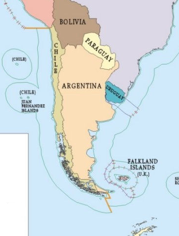
charts showing normal and straight baselines, the territorial sea, the contiguous zone, the exclusive economic zone and the continental shelf of Chile, peru-chile maritime border dispute pdf, Punta Lengua de Vaca a Isla Guafo, Punta Puga a Islas Diego Ramirez, Rada de Arica a Caleta Matanza, The Maritime Dispute Between Peru and Chile
View More charts showing normal and straight baselines, the territorial sea, the contiguous zone, the exclusive economic zone and the continental shelf of ChileCategory: claims
Recent developments regarding national legislation, maritime delimitation agreements and claims to national jurisdiction
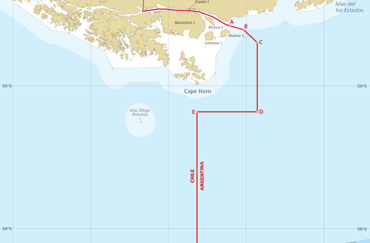
chart showing the maritime boundary between Argentina and Chile, with the list of geographical coordinates of points
chart showing the maritime boundary between Argentina and Chile, with the list of geographical coordinates of points, argentina, chile, exclusive economic zone, maritime boundary between Argentina and Chile, Maritime Claims
View More chart showing the maritime boundary between Argentina and Chile, with the list of geographical coordinates of pointsBrazil claims on the Baselines for measuring the breadth of the territorial sea and Outer limit of the Exclusive Economic Zone
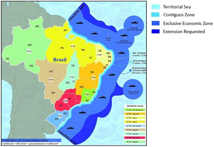
Brazil claims on the Baselines for measuring the breadth of the territorial sea and Outer limit of the Exclusive Economic Zone, Brazil, Brazilian continental shelf expansion: widening the outer edge, Brazilian EEZ expansion: widening the outer edge, Exclusive economic zone of Brazil, Map of the Brazilian coast, Maritime Claims, The Continental Shelf of Brazil
View More Brazil claims on the Baselines for measuring the breadth of the territorial sea and Outer limit of the Exclusive Economic ZoneBelgium claims for outer limit lines of the continental shelf and territorial sea
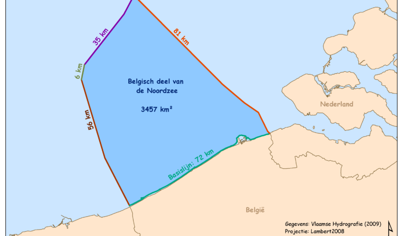
Belgium claims for outer limit lines of the continental shelf and territorial sea, Belgium, Belgium Maritime claims, continental shelf, Maritime Claims
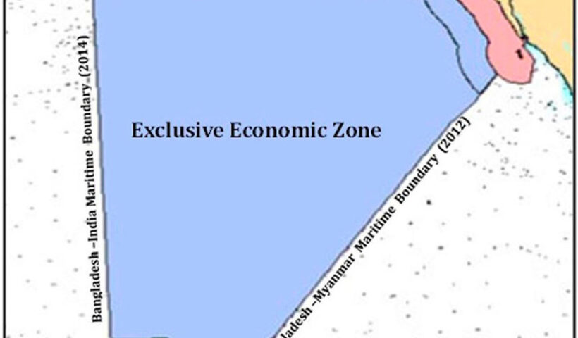
View More Belgium claims for outer limit lines of the continental shelf and territorial seaBangladesh claims for straight baselines in measuring the breadth of the territorial sea
Bangladesh claims for straight baselines in measuring the breadth of the territorial sea, bangladesh, bangladesh maritime boundary map, Bangladesh sea area map, Maritime Boundary of Bangladesh, Maritime Claims, The Bangladesh Maritime Zones
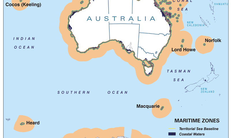
View More Bangladesh claims for straight baselines in measuring the breadth of the territorial seaAustralia territorial sea claims(baselines for measuring the breadth of the territorial sea)
Australia territorial sea claims(baselines for measuring the breadth of the territorial sea), Australia’s Maritime Zones/Boundaries Map, australian maritime boundaries shapefile, Australian territorial waters, Australian territorial waters map, How far do Australian territorial waters extend?, How far off the coast of Australia is international waters?, Maritime Claims, maritime exclusion zone australia, What is territorial sea baseline?
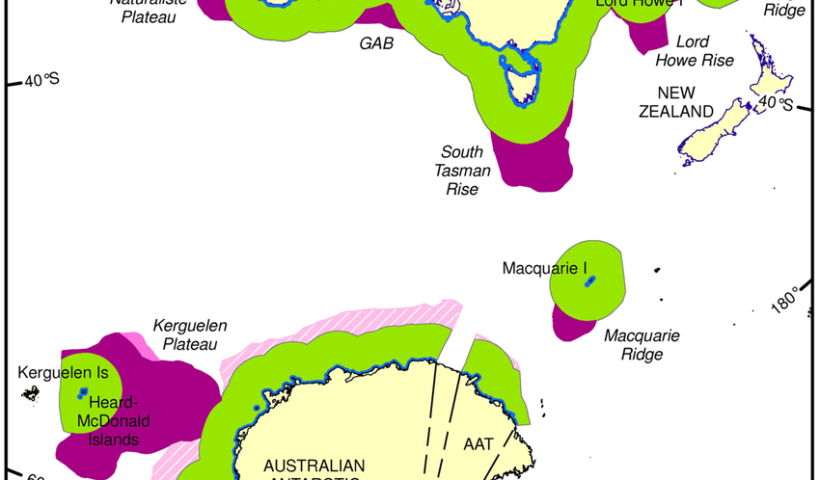
View More Australia territorial sea claims(baselines for measuring the breadth of the territorial sea)Australia claims on outer limits of its continental shelf
Australia claims on outer limits of its continental shelf, Australia, continental shelf, How far offshore is international waters Australia?, Maritime Claims, What is continental shelf in international law?, What is the Australian continental shelf?, Where is the continental shelf in Australia?
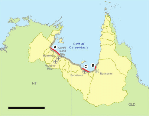
View More Australia claims on outer limits of its continental shelfouter limits of the territorial sea in the southern area of the Gulf of Carpentaria (Australia claims on territorial sea)
outer limits of the territorial sea in the southern area of the Gulf of Carpentaria (Australia claims on territorial sea), Australia, Australia claims on territorial sea, Gulf of Carpentaria, Port of Karumba
View More outer limits of the territorial sea in the southern area of the Gulf of Carpentaria (Australia claims on territorial sea)charts (straight baselines and outer limits of the EEZ) and lists of geographical coordinates (straight baselines)of Argentina
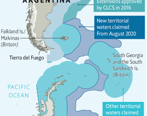
charts (straight baselines and outer limits of the EEZ) and lists of geographical coordinates (straight baselines)of Argentina, argentina, argentina coastline, Argentina continental shelf, argentina maritime claims, Argentine Sea, Argentine Sea map, De Faro Punta Mogotes a Faro Claromecó, De Faro Punta Norte a Faro San José, De Faro San Antonio a Faro Miramar, De Faro Segunda Barranca a Faro Punta Bajos, El Rincón, Estrecho de Magallanes – De Cabo Vírgenes a Bahía San Sebastián, Image of Argentine Sea map Argentine Sea map, Islas Malvinas, Islas Sandwich del Sur, Maritime Claims, Río de la Plata exterior
View More charts (straight baselines and outer limits of the EEZ) and lists of geographical coordinates (straight baselines)of Argentinageographical coordinates of points establishing the outer limits of its exclusive economic zone of Algeria
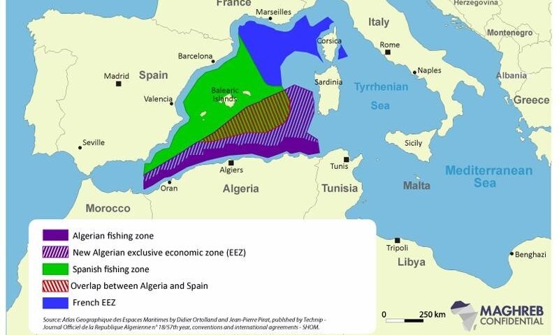
geographical coordinates of points establishing the outer limits of its exclusive economic zone of Algeria, Algeria, Algeria Maritime claims, Algeria’s extension of its EEZ (Exclusive Economic Zone), Algerian Exclusive Economic Zone (EEZ), Maritime Claims, outer limits of its exclusive economic zone algeria
View More geographical coordinates of points establishing the outer limits of its exclusive economic zone of Algeria
