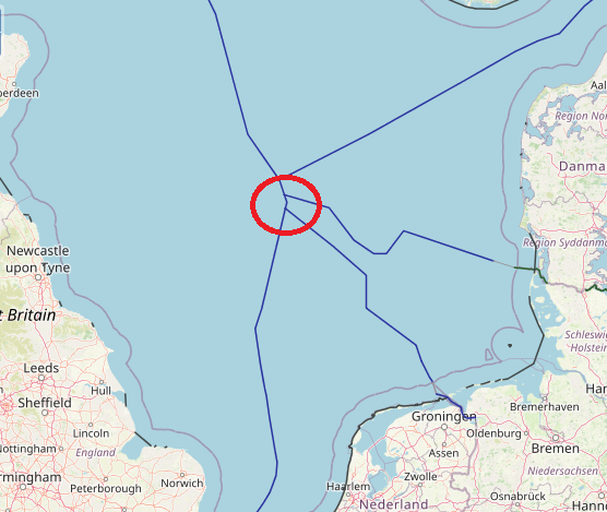
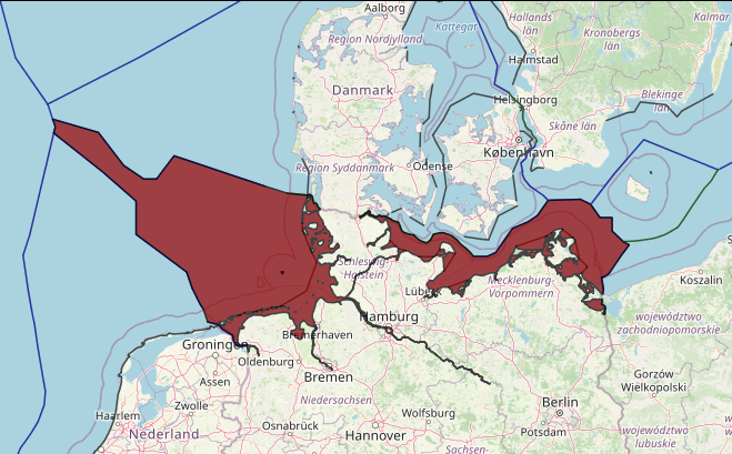
In the North Sea, there exists a comprehensive network of continental shelf boundaries – something that can be attributed to the positive and close relationships between the littoral states as well as their urgent desire to gain access to seabed resources. Chronologically, delimitation activity was at its most intense in the period 1965 to 1972. David Anderson distinguishes between two types of delimitation. Firstly, those delimitations which were based on the principle contained in Article 6 of the Convention on the Continental Shelf of 1958 and were largely concluded in the period 1965 to 1968 shortly after the Convention on the Continental Shelf came into force in June 1964. Anderson places the following agreements in this category: Norway and the UK (1965 and 1978), Denmark and Norway (1965 and 1979), Norway and Sweden (1968), Denmark and the UK (1966 and 1971), The Netherlands and the UK (1965 and 1971).
The second group identified consists of the multiple agreements that were either altered or inspired as a consequence of the North Sea Continental Shelf cases of 1969 and subsequent cases and are therefore based on the concept of equitable principles. The North Sea Continental Shelf cases helped to relieve Germany from the geographical disadvantage its generally concave coastline gave it when delimitations on the basis of equidistance were proposed. This group of delimitation agreements include those achieved between Germany and The Netherlands (1962, 1964, 1967 and 1971), Denmark and Germany (1965, 1967, 1969 and 1974), Denmark and The Netherlands (1966), Germany and the UK (1971), Belgium and the Netherlands (1996), and the abovementioned agreements between Belgium and France (1990) and between Belgium and the UK (1991).
It is also worth noting that the perceived economic potential of the area in dispute may prove a critical factor in both encouraging the parties to negotiate and, conversely, discouraging them from compromise. In this context Prescott cites
Britain and Germany’s experience in the 1880s in relation to long drawn out negotiations over a comparatively small coastal area on what is now the Cameroon- Nigeria boundary. Neither side would contemplate compromise over the disputed territory as it ‘might prove to be an Eldorado or a worthless swamp’
The North Sea region is bordered by a number of strong economies: France, Belgium, Netherlands, Germany, Denmark, Sweden, Norway (non-EU member but a member of the European Economic Area) and the United Kingdom (England and Scotland) (non-EU member), and is one of the most heavily used seas with extensive shipping, fishing, energy (hydrocarbon and offshore wind), aggregate extraction, defence, recreation and it also includes 2 of the world’s largest ports (Rotterdam and Hamburg).
The Blue Growth potential of the North Sea area was analysed in a 2014 report (“Blue Growth Scenarios and Drivers for Sustainable Growth” (Ecorys, et al., 2012) which estimated that the North Sea’s maritime (blue) economy represented at least €150 billion (or approximately 30% of the EU total) and employed at least 850,000 people. The following key sectors are considered the most important in the North Sea: offshore wind, offshore oil & gas, aquaculture, shipping, shipbuilding, cruise tourism and coastal protection.
The North Sea is situated on the continental shelf of north-west Europe. It forms part of the North East Atlantic region as defined by the North East Atlantic Regional Sea Convention, OSPAR. It opens into the Atlantic Ocean to the north and, via the English Channel to the south-west, into the Baltic Sea to the east and extends to Arctic Waters in the north.
The North Sea is relatively shallow, with an average depth of 90m and a maximum depth of 700m. The seabed is mainly composed of mud, sandy mud, sand and gravel with an important variety of marine landscapes, including fjords, estuaries, sandbanks, bays and intertidal mudflats. The North Sea is situated in temperate latitudes with a climate that is strongly influenced by the inflow of oceanic water from the Atlantic Ocean and by the large-scale westerly air circulation which frequently contains low pressure systems. Extreme weather conditions have a direct impact on hydrography, which is characterised by water exchange with surrounding ocean areas, and strong tides.
Biological systems in the North Sea are rich and complex with significant areas of importance for birds, fish and marine mammals. Approximately 230 species of fish are known to inhabit the area, with important spawning grounds for a number of commercial species and prey for birds and marine mammals. Some 10 million seabirds are present at most times of the year with extensive migration of protected species across the region. Marine mammals appear regularly over large parts of the North Sea including the long-finned pilot whale, harbour porpoise, common dolphin, white-sided dolphin, Risso’s dolphin, killer whale, grey seal, harbour seal, hooded seal (OSPAR, 2015).
A number of areas are highly important for nature conservation, including the Dogger Bank in the southern North Sea, which is protected under the EC Habitats and Birds Directive (with different approaches) by the countries which include this area within their EEZ (UK, Netherlands, Germany and Denmark). The whole of the North Sea has been declared a special area under Annex V of the MARPOL Convention (the International Convention for the Prevention of Pollution from Ships) which prohibits release and disposal of garbage and other domestic wastes from ships.
