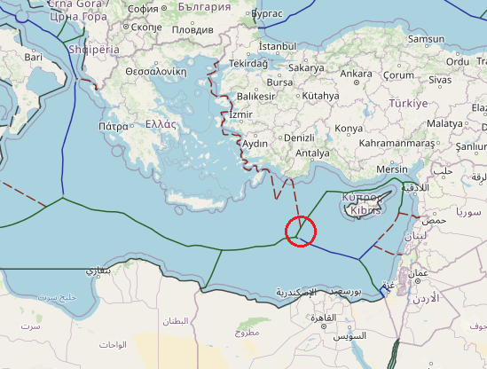
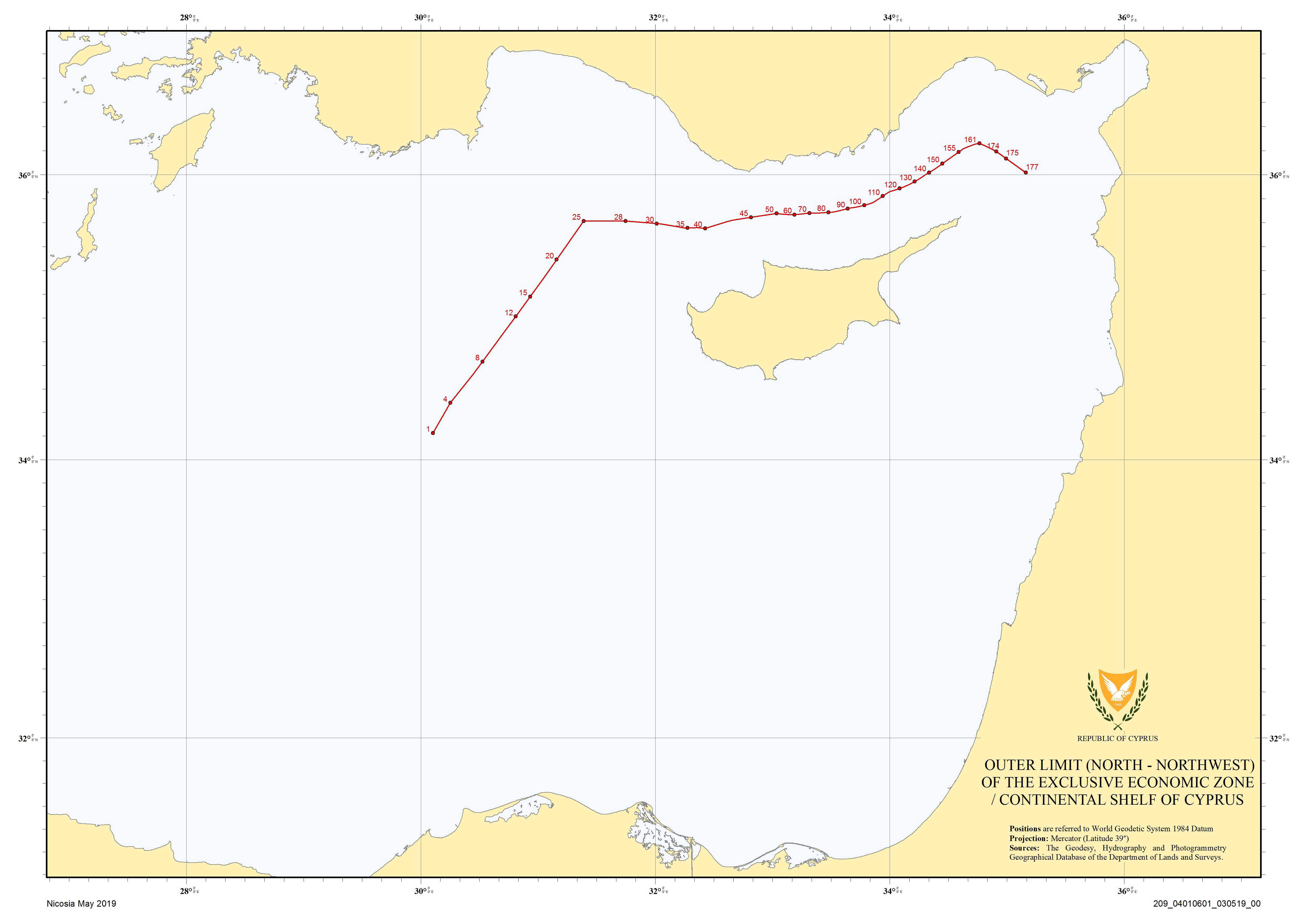
most of the eastern Mediterranean sea maritime borders based on the unilateral statements and Cyprus doesn’t except of this. The line of equidistance between Cyprus and the Greek island of Megisti extends for about 45 nm to the trijunction with Egypt near 33° 40’ N and 29° 54’ E. It is possible that Cyprus could argue that Greek claims from Megisti, which is a small, detached island, should be discounted. The definition of the equidistant area that attaches to Cyprus is completed by its potential boundary with Egypt. This line extends for about 165 nm, on a southeasterly course, from the trijunction with Greece to the trijunction with Israel. This line appears to be equitable.
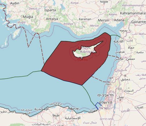
When looking at disputed maritime areas in the Mediterranean, Turkey is the shadow over all of the eastern Sea. Its role in the Cyprus–Northern Cyprus conflict as well as the full extent of maritime disputes with Greece will be discussed in greater detail below. This section is to delve into Turkey’s full set of unilateral maritime claims which were updated in 2019. The conflict between Cyprus and Northern Cyprus would not have reached its modern outcome without Turkish involvement. Disagreements between Turkish Cypriots and Greek Cypriots on the island of Cyprus have been ongoing since even before Ottoman control of the island, and the modern conflict began shortly after independence from the United Kingdom. Turkey moved to occupy northern Cyprus in 1974 and the Turkish Republic of Northern Cyprus declared independence in 1983. Today, Turkey is the only country who recognizes Northern Cyprus’s statehood.
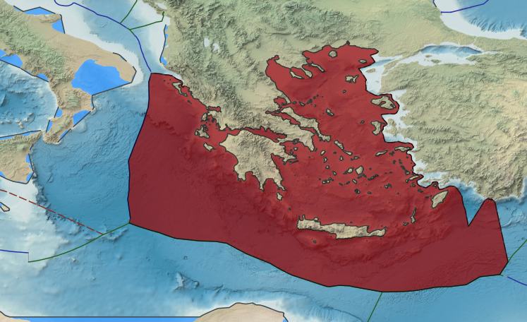
The strategic relevance of the Greek and Cypriot EEZs can be further perceived if noted that Greece and Cyprus stand at the crossroad of three continents and jointly share a common border with another ten countries, out of which with eight of them common sea borders also exist. This modification of the Mediterranean geography is certainly directly related to the application to issues of fisheries, circular economy renewable energy policies and offshore energy challenges. However, if we further consider the outlook shaped in the offshore production of hydrocarbons in Greece, Cyprus and Israel, briefly portrayed by the ex-Greek PM as having the potential to cover half of the needs in natural gas in Europe in the coming 30 years, we realize that it is no hyperbole to consider the Mediterranean as the Middle-East of the 21st century.
Greece has initiated its tender process for offshore oil and gas (hydrocarbons) exploration as of August 26, 2014 in 20 block areas in the Ionian Sea and Crete. The evaluation for Blocks 2 and 10 was finalized and the preferred bidders for Block 2 Total Greece as the operator, Edison International and the Hellenic Petroleum and for Block 10 the Hellenic Petroleum.
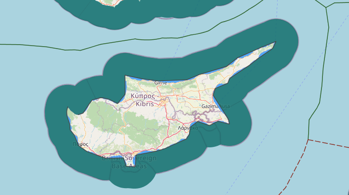


The island of Cyprus is now divided by a UN mandated and monitored buffer zone that snakes its way through hilly territory and divides the capital city (for both Cypruses) of Nicosia. The southern Greek Republic of Cyprus is an EU member and is recognized by the UN as the sole sovereign power of the island.
Related to the Cyprus dispute, the maritime picture off the coast of the island is quite complicated. The Republic of Cyprus has established maritime boundaries with Egypt, Israel, and Lebanon, in addition to the short UK boundaries already mentioned. Northern Cyprus agreed to a maritime boundary with Turkey, that the southern Republic of Cyprus disputes. Due to the nature of the dispute, the maritime boundaries between Cyprus and Northern Cyprus are also unresolved (and unlikely to become so in the foreseeable future).
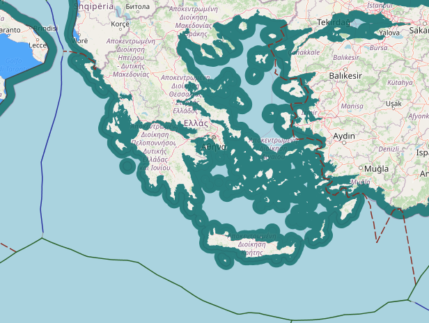
Turning to the maritime disputes between Turkey and neighboring Greece offers an even more complicated picture (at least delimitation wise) due to the multitude of Greek Islands that lay just off the Turkish coast. Relations between Turkey and Greece have been historically complicated and often quite problematic, negativity driven by both the conflict in Cyprus and unresolved maritime issues in the Aegean Sea. Oil was discovered in the continental shelf in 1973, adding [literal] fuel to the fire.
