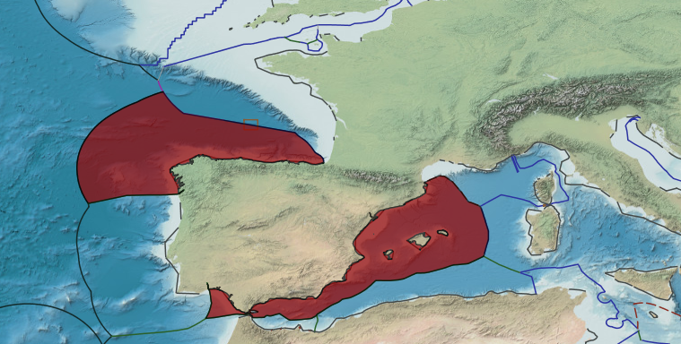
In 1974, Spain and Italy concluded a treaty delimiting the continental shelf on the basis of equidistance between Minorca Island (Spain) and Sardinia (Italy) in the Mediterranean Sea. The boundary is composed of geodetic lines connecting eight points, with a total length of approximately 137 M. The agreement contains provisions pertaining to the existence of possible hydrocarbon deposits extending across the boundary line. Although this treaty does not delimit the EEZ, the outer limits of Spain’s EEZ (points 37–41), as promulgated in its Royal Decree of 2013, align with this continental shelf boundary
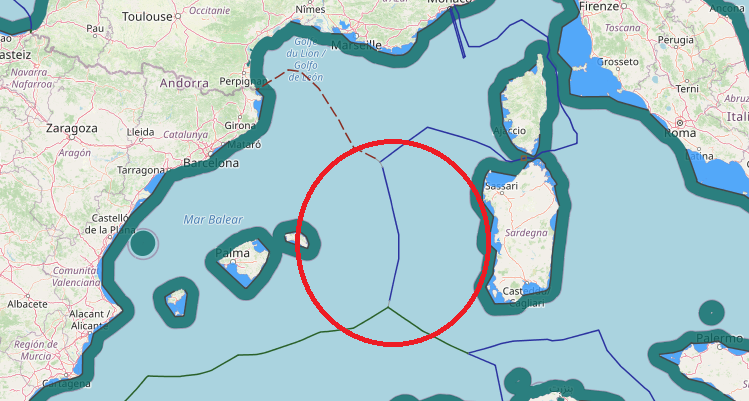
The continental shelf boundary between Italy and Spain in the western Mediterranean Sea was established through a bilateral agreement that was reached in 1974. The boundary was constructed using the equidistance methodology drawn between coastal basepoints on Italy’s Sardinia Island and Spain’s Menorca Island. The line consists of nine boundary segments connecting ten equidistance turning points, which were identified as points A–L. From the boundary’s origin in the north at Point A, it extends for 137 nautical miles and continues in a southerly direction until reaching its termination at Point L.