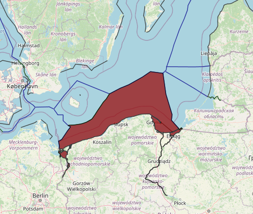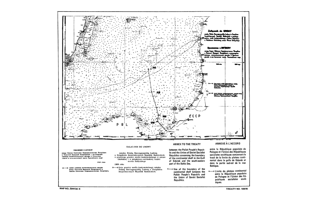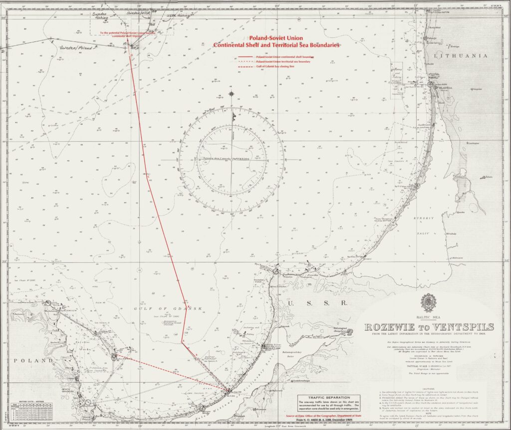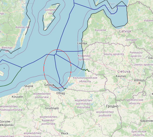
The Governments of Poland and the Soviet Union have ratified two agreements delimiting their respective spheres of maritime jurisdiction in the Baltic Sea. The territorial sea boundary was signed on March 18, 1958, and ratified on July 29, 1958, at which time the Agreement entered into force. The continental shelf boundary was signed on August 29, 1969, and ratified by Poland on December 29, 1969, and by the Soviet Union on May 13, 1970. It came into force May 13, 1970. Both Poland and the Soviet Union are parties to the 1958 Geneva Convention on the Continental Shelf.
The territorial sea boundary is a line perpendicular to the coast which extends seaward from the terminal point of the Poland-Soviet Union land boundary for a distance of 12 nautical miles (n.m.). The agreement specifies that the territorial sea boundary is applicable to the respective territorial sea claims of the two states, i.e., the Polish territorial sea boundary is 3 n.m. long and the Soviet Union’s 12 n.m. The seaward terminal of the territorial sea boundary also marks the initial point of the respective continental shelf boundaries.
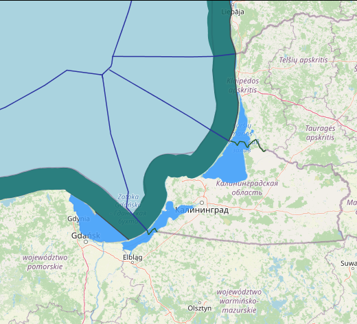
Gulf of Gdansk
An additional maritime boundary has been delimited in the boundary area: the straight baseline for the Polish sector of the Gulf of Gdansk. Decree No. 9 of the Dziennik Ustaw (Journal of Laws) Nr. 51 of 1956, Article 4, states that the Gulf of Gdansk is closed by a line connecting the Hel Promontory with the seaward point of the Polish-Soviet land boundary.
The Polish closing line is 29.6 n.m. long, more than Convention-approved length for a juridical bay. Enclosed within the gulf of Gdansk is the Bay of Puck which forms an arm of the larger Gulf. The limits of the Gulf delimited by the closing line meet the semi circularity.
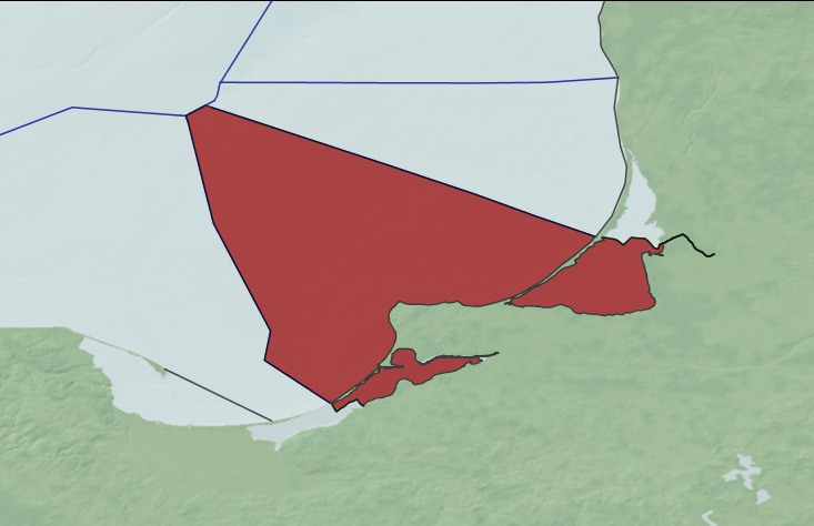
The continental shelf boundary between Poland and the Soviet Union extends for a distance of 77.5 n.m. with an average length of 19.4 n.m. for each segment of the boundary. The entire area covered by the Agreement lies on the continental shelf of the Baltic Sea. The average depth along the continental shelf boundary is about 50 fathoms.
The coordinate values in the continental shelf agreement must be reduced by 18 seconds to agree with U.S. Naval Oceanographic charts. Following are the coordinate values correct to the U.S. chart.
A 54°39’54” 19°18’36”
B 54°48’36” 19°20’24”
C 55°20’30” 19°03’30”
D 55°50’42” 18°55’54”
The CSB agreement explicitly states that the equidistance principle is used in determining the boundary. The five turning points on the boundary are all equidistant from Polish and Soviet territory.
The initial point of the CSB (Point X) is the terminal point of the territorial sea boundary of the Soviet Union. For the purpose of delimiting the TSB and CSB, the Gulf of Gdansk closing line was not used as the Polish baseline from which the boundaries were developed.
The seaward terminal of the CSB (Point D) ends the delimitation of the CSB, but the line will probably be extended to the Poland-Soviet Union-Sweden tripoint at such time as continental shelf boundaries are negotiated between the three parties.