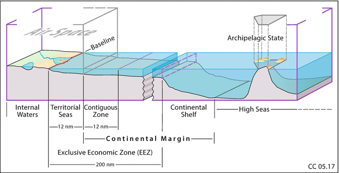
Under the LOSC, four types of baselines are at issue: normal baselines, straight baselines, closing lines across river mouths and bays, and archipelagic baselines.
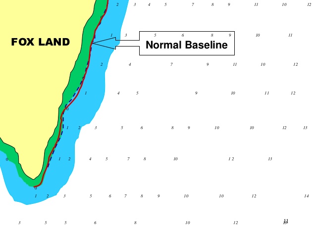
The normal baseline is the low-water line drawn along the coast. In this regard, Article 5 of the LOSC provides as follows:
Except where otherwise provided in this Convention, the normal baseline for measuring the breadth of the territorial sea is the low-water line along the coast as marked on large-scale charts officially recognized by the coastal State.
The phrase ‘except where otherwise provided in this Convention’ suggests that the baseline is in principle the low-water line. In relation to this, the ICJ, in the 1951 Anglo-Norwegian Fisheries case, stated: [F]or the purpose of measuring the breadth of the territorial sea, it is the low-water mark as opposed to the high-water mark, or the mean between the two tides, which has generally been adopted in the practice of States. This criterion is the most favourable to the coastal State and clearly shows the character of territorial waters as appurtenant to the land territory.
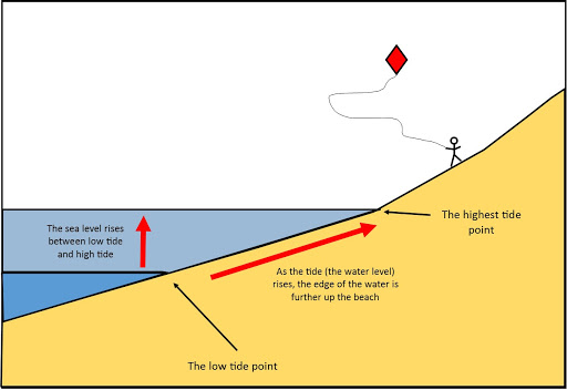
The low-water line is the intersection of the plane of low water with the shore. While States have discretion in choosing an appropriate low-water line, normally they will select the low-water line shown on existing charts. In this regard, the ILC stated that ‘there is no uniform standard by which States in practice determine this line’. This view seems to remain valid. The level of the low-water line relies on the tidal datum. Tidal datum has several definitions and the selection is left to the discretion of each State. Obviously the lower the low-water line selected, the further seaward the normal baseline will lie. However, the impact of a lower-tidal datum will be minimal, unless there is a significant tidal range.
Article 5 of the LOSC contains no further specification with regard to the identification of the low-water line and the scale of ‘large-scale charts’. It can therefore be presumed that States exercise some discretion in this matter. According to the UN Division for Ocean Affairs and the Law of the Sea (hereinafter UNDOALOS), the range of the scale of the chart
may lie between 1:50,000 to 1:200,000 where circumstances permit.
An emerging challenge for coastal States concerns changes in coastal configuration or loss of coastal areas resulting from rising sea levels. Under positive international law, the existing law of the normal baseline can be considered to apply when significant coastal change is caused by either territorial gain or territorial loss. It follows that the normal baseline is ambulatory and can move landward to reflect changes to the coast caused by sea-level rise and erosion. In reality, however, it would be unpractical to require coastal States to provide real-time notification of changing baselines. Accordingly, it seems reasonable to consider that the normal baseline is specified in an officially recognised, large-scale and reasonably up-to-date chart, and that coastal States have some limited discretion as to the timing of their chart updates.
The validity of the charted low-water line can be a matter for debate in international adjudication. In the Guyana/Suriname Arbitration, Guyana objected to Suriname’s base point S14, which Suriname had identified by relying on what Guyana claimed to be an inaccurate chart. While the Arbitral Tribunal did not accept Guyana’s challenge to the charted line, this instance seems to suggest that the accuracy of officially recognised charts may be challenged before an international tribunal; and that the officially recognised chart is presumed accurate, the burden of proof being on the party challenging that chart.
The LOSC contains no provision with regard to the normal baseline along polar coasts permanently covered by ice shelves. Nor is it possible to detect consistent State practice on this matter. As a possible solution, it has been submitted that the low-water line along the ice shelf contour could be the baseline. However, the ice foot may seasonally change. A question thus arises as to how it is possible to take into account seasonal variations in the ice shelf contour. Another possibility might be to use the average seasonal maximum or minimum edge of the ice shelf as a baseline. Yet it would seem that this method is untested in practice.
source: The International Law of the Sea, Yoshifumi Tanaka