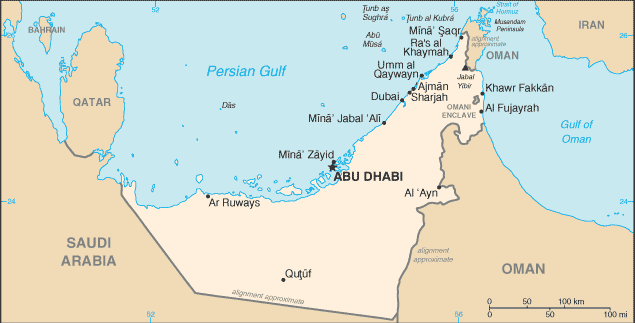
The coastal facade of the two federate states of the United Arab Emirates
in the Persian Gulf engaged in this arbitration does not show major
peculiarities except for the island of Abu Musa, a territory of the Emirate
of Sharjah having more than 800 inhabitants. This island is situated
approximately 35 nm offshore, in the middle of the Gulf. The coast of
the Federation extends 240 nm from Qatar to Oman. The coastline from
the boundary of Abu Dhabi and Dubai to the boundary of Sharjah and
Oman in the south extends 41 nm.
The Court of Arbitration was requested to delimitate both the land
border and the maritime boundary of the homogeneous continental shelf
of the two federate states. The case involved the analysis of complex
historical facts and conduct of the parties. With respect to the land
boundary in particular, delimitation was necessary to allocate the
formerly nomadic, borderless territory for the purpose of oil extraction.
While the land boundary is not of interest in the present context, the
arguments and decisions with regard to the maritime boundary are an
important contribution to the emerging case law on our subject.
Dubai and Sharjah requested the Court to decide the case in
accordance with international law. Neither of the parties were signatories
to the 1958 Shelf Conventions, and the 1949 British-sponsored
declarations stipulated that future delimitations be made in accordance
with the model of equitable principles. Sharjah primarily claimed a
boundary based on former conduct and historical title of a 312-degree
rhumb line (i.e. a line cutting the meridians at the same angle) from the
land boundary, in accordance with a British proposal from 1956. In fact,
that line had been a simplified equidistance line ignoring Abu Musa.
Subsidiarily, Sharjah claimed an equidistance line taking into account
special circumstances, in particular the amount of marine space
(territorial and shelf) allocated to the two states in federacy.
Given the position of, and its jurisdiction over, the island of Abu
Musa, Sharjah first claimed to give full effect to the island. This position
was later changed to half-effect when it was seen that a full-effect
boundary would cut into existing oil fields that were under Dubai’s
jurisdiction (Fateh Field). However, no effect should be given to the
outermost permanent harbour constructions, as this would benefit
Dubai. Dubai also claimed the application of equidistance, but without
giving any effect to the island. Dubai reasoned that Abu Musa was
too remote from the coastline and too close to the equidistance line
between the parties, and that giving effect to it would constitute an
encroachment on the natural prolongation of its land boundary.
Conversely, Dubai argued, full effect should be given to the harbour
constructions when establishing relevant base lines.
The Court of Arbitration established the land boundary based on
conduct and historical title at the extremity of the Al Mamzer peninsula.
It did not consider the proposal of 312-degree rhumb line, which
relied on a different terminus of the land boundary and therefore could
not be of relevance. The Court then proceeded to delimit the maritime
boundary in accordance with customary international law. In doing so,
the Court also heavily took into account the relevant provisions of the
1958 Conventions and the then-existing draft proposals of UNCLOS III
that relied upon the equitable principles approach. In accordance with
law and practice, the history of Article 8 of the 1958 Territorial Sea and
the Contiguous Zone, and Article 5 of the 1980 Draft Convention, the
Court affirmed the inclusion of the outermost permanent harbour
works of both parties, denying that this would lead to inequitable
results. Relying on the North Sea cases and the Anglo-French Channel
arbitration, the Court also found that equidistance should apply without
taking into account the island of Abu Musa. For that purpose, it
relied upon calculations of allocation of marine spaces. It argued that
giving half-effect to the island would result in a disproportionate and
exaggerated entitlement to marine space by Sharjah. The Court
established a boundary by equidistance beginning from the land
boundary until it intersects with the 12-mile territorial sea of that
island, and continuing to the unsettled boundary with Iran. As a result,
no continental shelf was allocated to the inhabited island of Abu Musa,
and Dubai was made the clear winner of the case.