Who discovered a polynya in the Cosmonaut Sea?
Comiso and Gordon (1987) first reported this polynya and named it the western Cosmonaut Sea Polynya (wCSP).
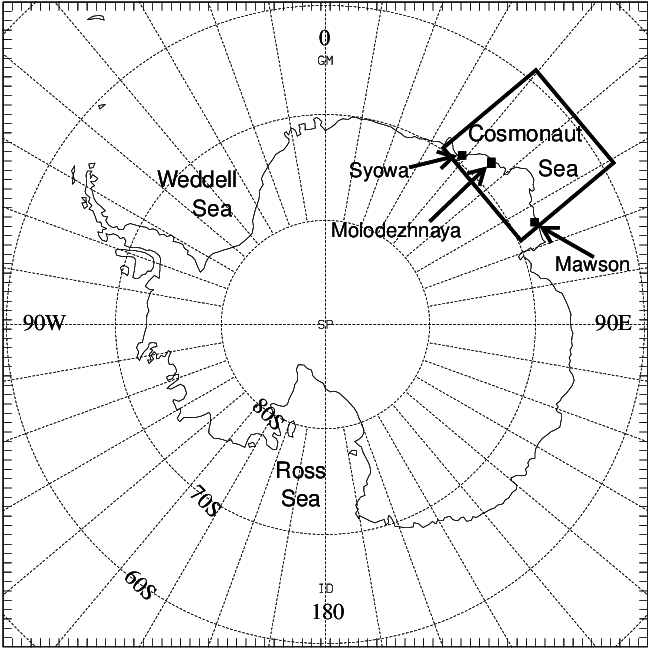
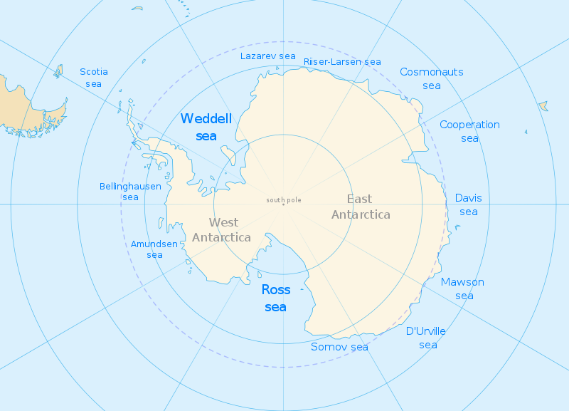
The Cosmonauts Sea (Russian: Море Космонавтов, More Kosmonavtov; sometimes misspelled Cosmonaut Sea) was a proposed sea name as part of the Southern Ocean, off the Prince Olav Coast and Enderby Land, Antarctica, between about 30°E and 50°E. It would have an area of 699,000 square kilometres (270,000 sq mi). It would be bordered by two other proposals from a 2002 International Hydrographic Organization (IHO) draft, a Cooperation Sea to the east, and to the west a Riiser-Larsen Sea.
The Cosmonauts Sea , which was named in 1962 by the Soviet Antarctic Expedition in honor of the world’s first cosmonauts and the beginning of crewed space exploration era. The name first appeared as a Russian proposal to the IHO in the IHO 2002 draft. This draft was never approved by the IHO (or any other organization), and the 1953 IHO document remains currently in force. Leading geographic authorities and atlases do not use the name, including the 2014 10th edition World Atlas from the United States’ National Geographic Society and the 2014 12th edition of the British Times Atlas of the World, though state-issued maps created by the Soviet Union and the Russian Federation do.
A prominent feature in the west Cosmonaut Sea is the reoccurrence of a sensible heat polynya — the western Cosmonaut Sea Polynya (wCSP), which normally exists in late austral autumn and early winter. The Southern Ocean Sate Estimate (SOSE) reanalysis product is employed to investigate the thermodynamic and dynamic processes controlling the formation and evolution of a real wCSP event in 2009, when the polynya properties revealed from satellite observations are reasonably simulated by SOSE. An oceanic heat budget analysis was conducted for the surface layer above the thermocline, and the results reveal that heat advection is the major term contributing to the surface heat content variation in this area. The precursor of wCSP — an embayment — was formed during cyclonic atmospheric circulations. The negative wind stress curl from a cyclone induced upwelling that brought the warm circumpolar deep water to the surface and presumably melted ice. Meanwhile, the location of the cyclone relative to the wCSP created weaker easterlies over the northern boundary of polynya and stronger easterlies over the southern boundary of polynya. This leads to difference in the meridional oceanic heat transports across the northern and southern boundaries, resulting in net positive meridional oceanic heat transport into the polynya. Both the vertical heat advection and the meridional heat advection contribute significantly to increased heat content in the surface layer of wCSP, causing sea-ice melt and formation of the embayment. The cyclonic wind field promotes convergence of sea ice over the northern area of the embayment and results in the polynya. The formation of wCSP is likely related to the strength and position of Southern Annular Mode on interannual scale, and may potentially affect the biological productivity by controlling the availability of light in the mixed layer.