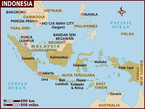
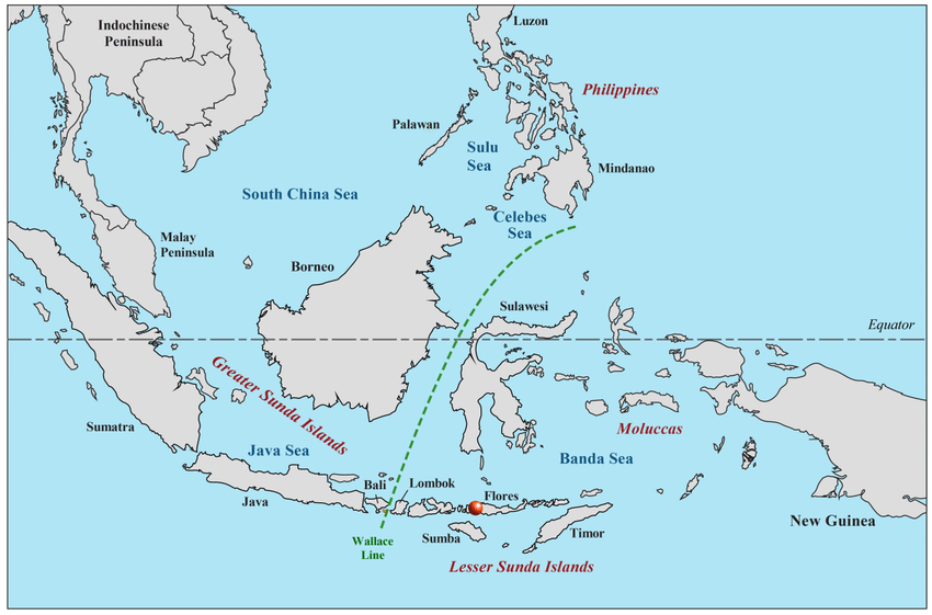
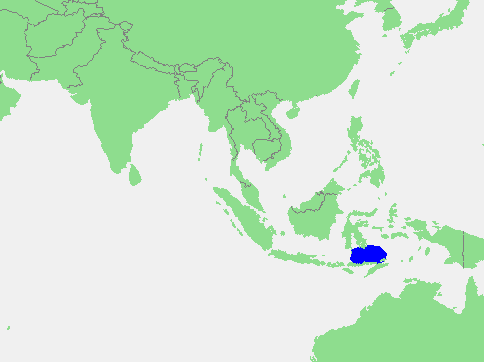
Flores Sea, Bahasa Indonesia Laut Flores, portion of the western South Pacific Ocean, bounded on the north by the island of Celebes (Sulawesi) and on the south by the Lesser Sunda Islands of Flores and Sumbawa. The Flores Sea covers 240,000 square kilometres (93,000 sq mi) of water in Indonesia. The sea is bounded on the north by the island of Celebes and on the south by Sunda Islands of Flores and Sumbawa.
The sea is 5,140 metres (16,860 feet) deep.[1] The International Hydrographic Organization (IHO) defines the Flores Sea as being one of the waters of the East Indian Archipelago. The IHO defines its limits as follows:
On the North. The South coast of Celebes [Sulawesi] from the West point of Laikang Bay (5°37′S 119°30′E) to Tanjong Lassa (120°28’E).
On the East. The Western limit of the Banda Sea between Flores and Celebes [a line from Flores’ Northern point (8°04′S 122°52′E) to Kalaotoa Island (7°24′S 121°52′E) and through the chain of islands lying between it and the South point of Pulo Salayar, through this island and across the Strait to Tanjong Lassa, Celebes (5°37′S 120°28′E)].
On the South. The North coasts of Flores, Komodo, Banta and a line to Tanjong Naroe the Northeast point of Soembawa, thence along its North coast to Tanjong Sarokaja (8°22′S 117°10′E).
On the West. A line from Tg Sarokaja to the Western Paternoster island (7°26′S 117°08′E) thence to the Northeastern Postiljon Island (6°33′S 118°49′E) and to the West point of Laikang Bay, Celebes.

What is Flores island famous for?
Tourism. The most famous tourist attraction in Flores is the 1,639-metre-high (5,377-foot) Kelimutu volcano, containing three colored lakes, located in the district of Ende close to the town of Moni, although there is also the Inierie volcano near Bajawa.
What country is Flores island?
Indonesia
Flores, one of the Lesser Sunda Islands in Nusa Tenggara Timur (East Nusa Tenggara) provinsi (province), Indonesia. The last major island in the chain, which extends eastward from Java, it is long and narrow, 5,500 square miles (14,250 square km) in area, and has numerous inlets and bays.
What is a fact about Flores?
“Flores” is Portuguese for “flower,” a name derived from the island’s colorful coral reefs. Over 450 kilometers long, Flores is one of the three largest islands in Nusa Tengarra along with Sumba and Timor. A mountain range runs from east to west across the island, roughly dividing it into north Flores and south Flores.
How big is the Flores Sea?
Do Komodo dragons live on Flores?
Flores is one of less than five islands in the world where Komodo dragons live in the wild.
Can you see Komodo dragons on Flores?
There are 5’700 Komodo Dragons that live in Komodo National Park. If you are in Flores, a visit to this park is a must. Embark in an adventure of a lifetime of seeing Komodo Dragons in their natural habitat.
Is Flores Island worth a visit?
Top Attractions in Flores
- Padar Island. 1,232. Islands. …
- Kalong (Flying Foxes) Island. 333. Islands. …
- Kelimutu Lake (Tri-Color Lake) 353. Bodies of Water. …
- Mount Kelimutu. 612. Volcanos. …
- Kanawa Island. 702. Islands. …
- Wae Rebo Village. 295. Historic Sites. …
- Bena Traditional Village. 412. …
- Mount Inerie Peak. Mountains.
Do people live on Flores Island?
Flores Island (Portuguese: Ilha das Flores; Portuguese pronunciation: [ˈfloɾɨʃ]) is an island of the Western Group (Grupo Ocidental) of the Azores. It has an area of 143 km2, a population of 3428 inhabitants, and, together with Corvo Island of the western archipelago, lies within the North American Plate.
Is Flores Indonesia safe?
We found the island to be very safe and felt very comfortable traveling.
How do I get to Flores?
By Air. The fastest and probably the most convenient way to travel to Flores is by air. There are daily flights from Denpasar, Bali and Jakarta, Java and weekly from Surabaya, Java. Several airlines serve the route offering economy and even business class.
How many volcanoes are there in Flores Island?
Fifteen active and ten dormant volcanoes form the spine of Flores. Some 1.8 million people live in the dramatic ravines between the peaks that rise from the mountain’s shoulders and fall away to the coastline.


