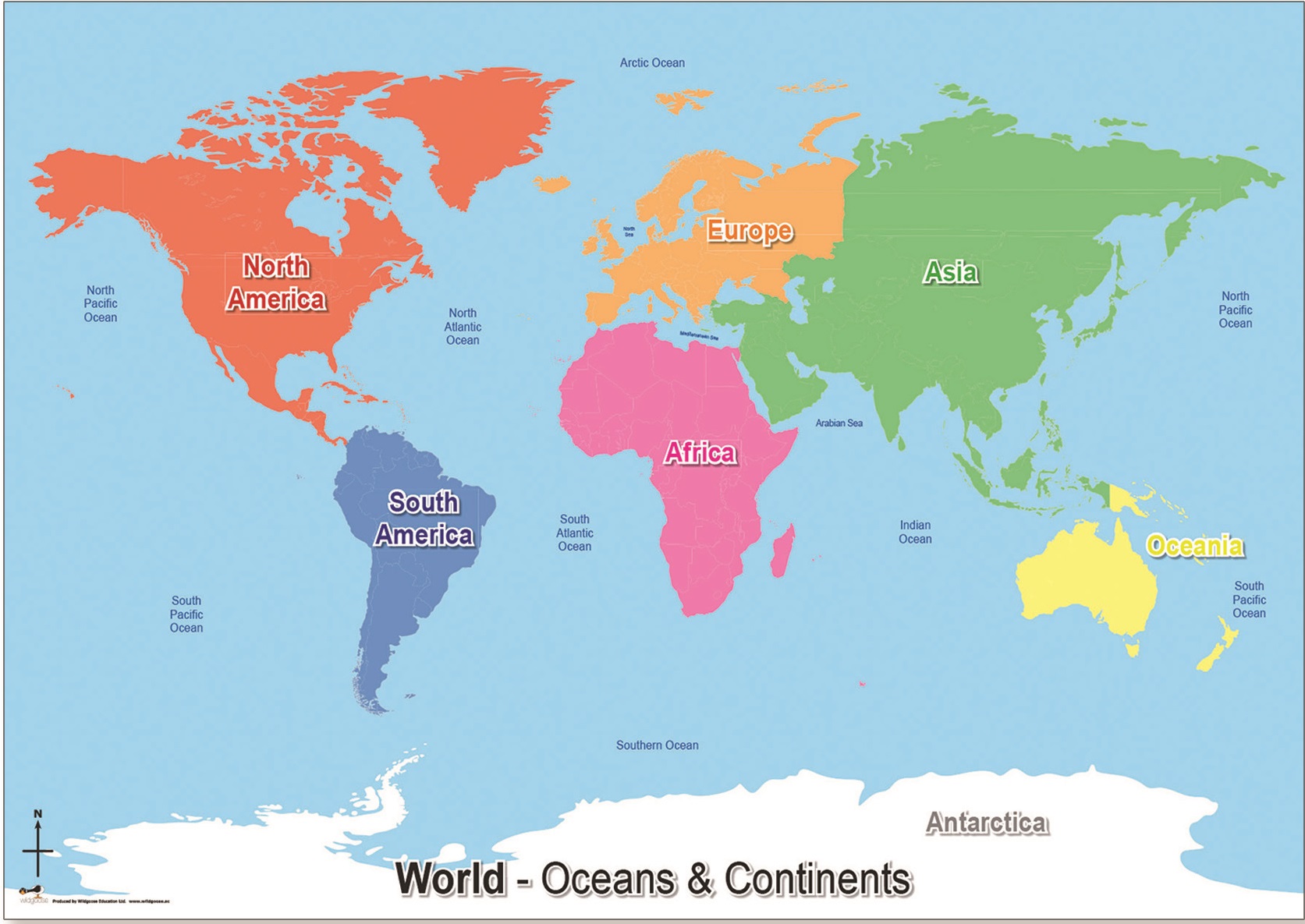
There is an old saying that “the Earth has six continents and seven seas.” In fact, that generalization is not too far off the mark. Earth has six continental landmasses:
Africa, South America, North America, Eurasia (Europe and Asia occupy a single large landmass), Australia,
and Antarctica. As for the seven seas, there are five great oceanic bodies of water and several smaller seas. The Pacific Ocean is the largest body of water. The Indian Ocean lies between Africa and Australia. The North Atlantic Ocean and the South Atlantic Ocean may be regarded as two discrete oceans that are dissimilar in a number of ways. Encircling Antarctica is the Southern Ocean. The sixth-largest
body of water, and the largest of the smaller seas, is the Arctic Ocean, which lies beneath and around the floating Arctic icecap.
The seventh body of water often identified with these oceans is the Mediterranean Sea, which lies between Europe and Africa and is connected to the interior sea of Eurasia, the Black Sea. The Mediterranean is not of oceanic dimensions, but unlike the Caribbean or the Arabian Sea, it also is not merely an extension of an ocean. The Mediterranean is very nearly landlocked and has only one narrow natural outlet through the Strait of Gibraltar, between Spain and Morocco.
In our study of weather and climate, the relative location, general dimensions, and topography of the landmasses are important because these influence the movement of moisture-carrying air so important to rainfall and snowfall patterns. The topography of the ocean floor will feature prominently in later units describing the largest of Earth-shaping forces. Readers therefore need a basic understanding of both continental and marine topography. The following two sections contain the required material.