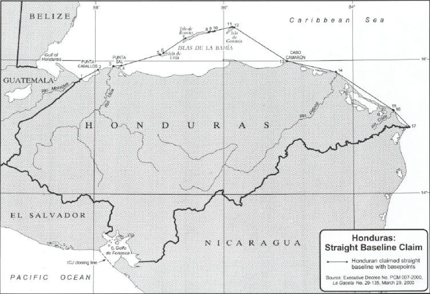
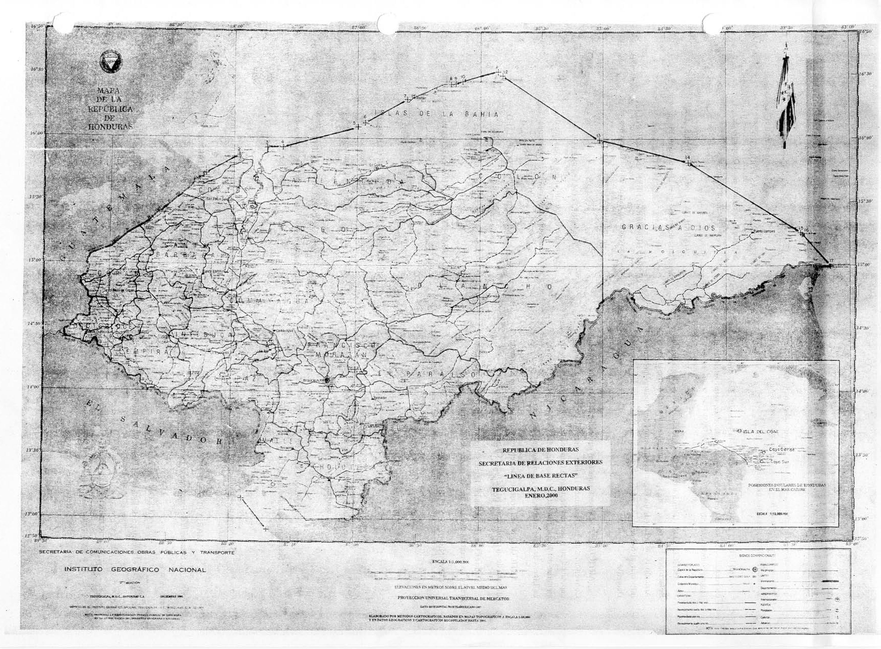
list of geographical coordinates of points for the drawing of straight baselines, with an illustrative map, as established by Executive Decree No. PCM 007-2000 of 21 March 2000

ANALYSIS OF HONDURAS STRAIGHT BASELINES
Executive Decree No. PCM 007-2000
Pacific Ocean: In Article 1 (B) Honduras claims a segment of the Gulf of Fonseca
closing line as its straight baseline from which to determine the breadth of its maritime
claims in the Pacific Ocean. This claim results from the ICJ’s 1992 ruling in the Land,
Island and Maritime Frontier Dispute between Honduras and El Salvador. The
interpretation and application of this decision require the agreement among El Salvador,
Honduras, and Nicaragua. No further analysis of this closing line will be made in this
paper.
Caribbean Sea: The following analysis of the Honduran claim made for its baselines
along its Caribbean coastline was made using National Imagery and Mapping Agency
(NIMA) charts. The claim is illustrated on the page-sized map included in this
analysis. Honduras has created 16 straight baseline segments along its Caribbean
coastline which range in length from 0.4 miles to 62.6 miles.
Segment 1-2 begins at the terminus of the Honduras-Guatemala international boundary
(“from the last marker of the land boundary…on the right bank of the mouth of the
Motagua River “) to the northern point of Punta Caballos. This stretch of Honduran
coastline is smooth with no fringing islands. A straight baseline segment is
inappropriate in this area where there are neither fringing islands nor a coastline which
is deeply indented and cut into. The territorial sea should be measured from the lowwater mark.
Between points 2 and 3 the baseline is the low-water mark of the coastline, a stretch of
approximately 13.5 miles.
Baseline segment 3-4, slightly more than 7 miles in length, connects a point near Punta
Ulua (just west of the Ulua River) to Punta Sal. The body of water enclosed by this line
fails to meet an article 10 bay closing line requirements and the straight baseline
geographic requirements are not met, as well.
Claimed baseline segment 4-5 connects the mainland coast at Punta Sal to the western
end of Isla de Utila, more than 36 miles to the northeast. There are no intervening
islands between Punta Sal and this island and the mainland coastline is quite smooth
and is not “deeply indented or cut into”. The waters enclosed by this line segment
would not be considered “sufficiently closely linked to the land domain to be subject to
the regime of internal waters.” Therefore, the appropriate baseline in this area would be
the low-water mark.
Between basepoints 5, at the western end of Isla de Utila, and 6, situated about 3.7
miles east along the north coast of the island, Honduras claims the low-water mark as
the baseline. Baseline segment 6-7 connects the north coast of Isla de Utila to a point
on the west coast of Isla de Roatan, just north of Punta Oeste.
The baseline continues eastward for about 24 miles along the low-water mark of Isla de
Roatán’s north coast to point 8, situated on the eastern end of the island. From here,
point 8 is connected to point 9 on Isla Morat by a straight baseline segment of less than
one mile. Segment 9-10 then connects Isla Morat to the central part of the north coast
of Isla Barbareta; the straight baseline system continues as segment 10-11 connects
this island to the north coast of Isla de Guanaja.
From point 11 the baseline continues along the northeast coast of Isla de Guanaja as
the low-water mark to point 12, situated at Black Rock Point on the eastern end of the
island. From this point, Honduras claims a straight baseline segment, almost 55 miles
in length, that extends to the southeast and point 13 at Cabo Camarón on the mainland.
This straight baseline segment clearly exceeds the provisions of the LOS Convention as
neither geographic criteria is met: there are no fringing islands nor is the mainland
deeply indented or cut into.
The question arises as to whether any valid straight baseline system can be drawn in
the vicinity of the three main islands of Isla de Utila, Isla de Roatán, and Isla de
Guanaja. The islands are within 24 miles of the mainland and less than 24 miles of
each other. However, there are parts of Isla de Roatán that are greater than 24 miles
from the mainland and from other islands to the south which creates a high seas pocket
if the 12-mile territorial sea were drawn from the island’s low-water mark. When testing
for the fringing islands criterion it is found that these islands mask about 61% of the
mainland in this immediate area.
The issue remains whether the waters enclosed by these baselines are “sufficiently
closely linked to the land domain to be subject to the regime of internal waters.” The
water depths are rather deep, in many areas exceeding 1400 meters, and there is a
pocket of high seas that would remain if the low-water line were used. Before making a
final determination on the validity of the straight baselines for this particular area, further
information would be required from Honduras on how the waters incorporated by these
baselines are closely linked to the land domain so as to give it the status of internal
waters. If straight baselines were to be drawn along these islands, the line segments
connecting the islands to the mainland would have to extend due south from the
respective ends of the eastern and western islands to the mainland.
From point 13, Honduras claims 4 straight baseline segments (13-14, 14-15, 15-16, and
16-17) that incorporate the remaining Caribbean-facing coastline to the mouth of the Rio
Coco and its international boundary terminus with Nicaragua. With the exception of
segment 15-16, which is a valid river closing line, these segments exceed the provisions
of the LOS Convention. The Honduran coastline along this stretch is quite smooth with
no deep indentations and there are no fringing islands. And, two of the baseline
segments, 13-14 and 14-15, are quite long being approximately 43 and 63 miles,
respectively, in length.
It should be noted that Article 8 (2) of the LOS Convention states,
Where the establishment of a straight baseline in accordance with the method
set forth in article 7 has the effect of enclosing as internal waters areas which
had not previously been considered as such, a right of innocent passage as
provided in this Convention shall exist in those waters.
Article 4 of the Decree states that the baselines of the other islands under Honduran
sovereignty, specifically Swan Island, Cayo Gorda, and Cayo Sur shall be the low-water
mark. The baselines entered into force on the date on which they were published in La
Gaceta: March 29, 2000.
Executive Decree No. 29,295
This Decree, which entered into force immediately upon its publication (August 28,
2000), appears to respond to concerns expressed to Honduras by neighboring States
regarding the application of the straight baselines. The Decree does not amend the
location of any of the baselines.
In the Preamble to this Decree Honduras implies that one reason for establishing the
straight baseline system was in relation to its potential boundaries with its neighbors, as
it states that the baselines “are simply one factor to be taken into account in any
negotiating process with neighboring States.” This reflects a similar statement made by
the Honduran Ministry of Foreign Affairs soon after Decree 007-2000 was published. In
that statement, Honduras said that “it is necessary to establish said baselines … in
order to enable Honduras to draft proposals for the negotiation of maritime boundaries
with neighboring States, both in the Caribbean Sea and in the Pacific Ocean”. While it
may be true that in the state practice of maritime boundary negotiations baselines may
be a consideration given by the States in determining the course of the boundary,
potential boundary negotiations should not be an influencing criterion for the
establishment of straight baselines. As noted earlier in this report, the LOS Convention
is clear in stating the geographical conditions which must be present (article 7 (1)) to
allow a State to establish straight baselines.
In Article 1 of the Decree Honduras says that under Decree No. PCM 007-2000 (the
one establishing the straight baseline points) it “does not…establish any unilateral
maritime claims, or any restriction to international maritime navigation….” This
assertion is questionable as the straight baselines determine the boundary between
internal waters and territorial sea and the differing legal status of those waters does
affect navigation rights. In addition, due to several of the excessive straight baselines
claimed by Honduras in that Decree, waters that otherwise would be high seas are now
being claimed as internal waters.
In Article 6 Honduras states that this Decree which establishes the straight baselines “is
hereby deferred, on an exceptional basis, for the reasonable period of time required for
consultations on this subject…” It is not totally clear what this assertion means, what
type of consultations are envisioned, and what would be the reasonable period of time.
But, more importantly, it does not address the nature of the baselines themselves in that
several of the segments exceed the provisions of the LOS Convention.
Honduran Views
In 2000 the Honduran Ministry of Foreign Relations issued Document Series No. 1,
“The United Nations Convention on the Law of the Sea, the Law on Maritime Spaces of
Honduras, and the Establishment of Baselines by the Government of Honduras.” This
document acknowledges that straight baselines must be determined in accordance with
the Convention and asserts that the straight baselines established by the Executive
Branch were established in accordance with the Law of the Sea Convention and
international law of the sea. However, the document does not explain how any of the
segments meet the geographical and other requirements established by international
law for straight baselines.