
International Bathymetric Chart of the Southern Ocean (IBCSO)
The objective of the IBCSO program is to gain better knowledge of the sea floor topography in the Southern Ocean. To achieve this, the IBCSO group collects and compiles bathymetric data from hydrographic offices, scientific institutions and data centres to create the first regional digital bathymetric model that covers all circum-Antarctic waters.
Download
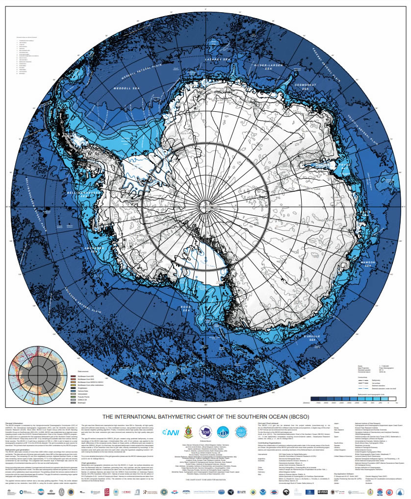
The printed version can be ordered via the US NOAA National Centers For Environmental Information NCEI web site.
It has a scale of 1:7 000 000 is 1 m x 1.2 m in size and is based on a polar stereographic projection with true scale at 65°S.
When using the chart please cite the following Reference: Arndt, J.E., H. W. Schenke, M. Jakobsson, F. Nitsche, G. Buys, B. Goleby, M. Rebesco, F. Bohoyo, J.K. Hong, J. Black, R. Greku, G. Udintsev, F. Barrios, W. Reynoso-Peralta, T. Morishita, R. Wigley, “The International Bathymetric Chart of the Southern Ocean (IBCSO) Version 1.0 – A new bathymetric compilation covering circum-Antarctic waters”, 2013, Geophysical Research Letters, Vol. 40, p. 3111-3117, doi: 10.1002/grl.50413