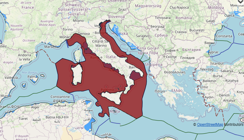
Italy maritime claims about baselines, internal waters, territorial waters, exclusive economic zone and continental shelf(between former Yugoslavia, Tunisia, Greece, Albania and in Mediterranean sea, Adriatic sea, Ionian sea, tyrrhenian sea and Sardinia)

various charts and geographical coordinates, as contained in:

– Presidential Decree No. 830 of 22 May 1969;
– Decree of the President of the Republic No. 816 of 26 April 1977;
– Law No. 347 of 3 June 1978;
– Law No. 348 of 3 June 1978;
– Law 107 of 2 March 1987 (published in Regular Supplement to the G.U. 70 of 25 March 1987);
– Law No. 59 of 11 February 1989;
– Law No. 147 of 12 April 1995 (published in Regular Supplement to the G.U. 99 of 29 April 1995);
– Law 290 of 23 May 1980 (published in Regular Supplement to the G.U. 181 of 3 July 1980);
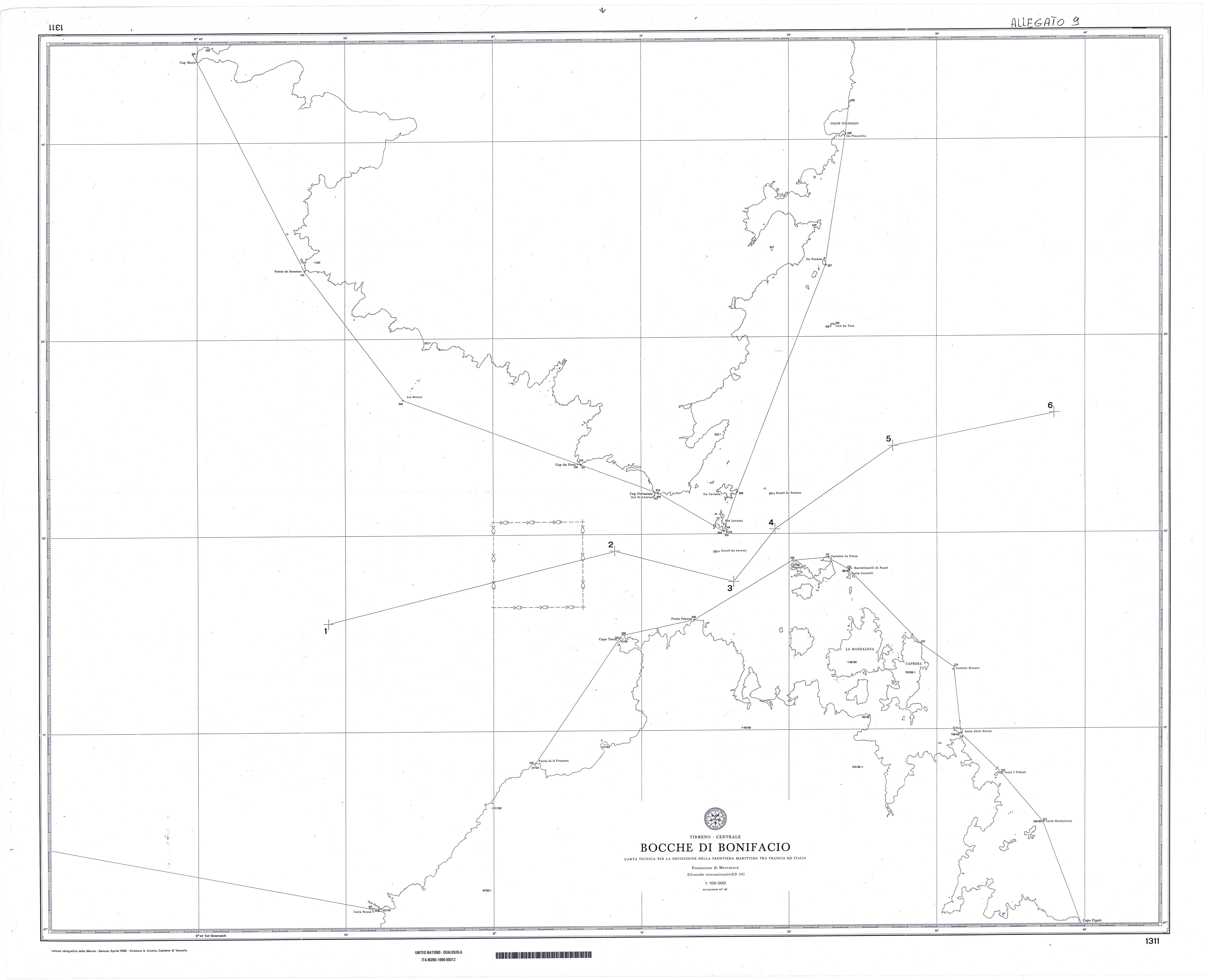
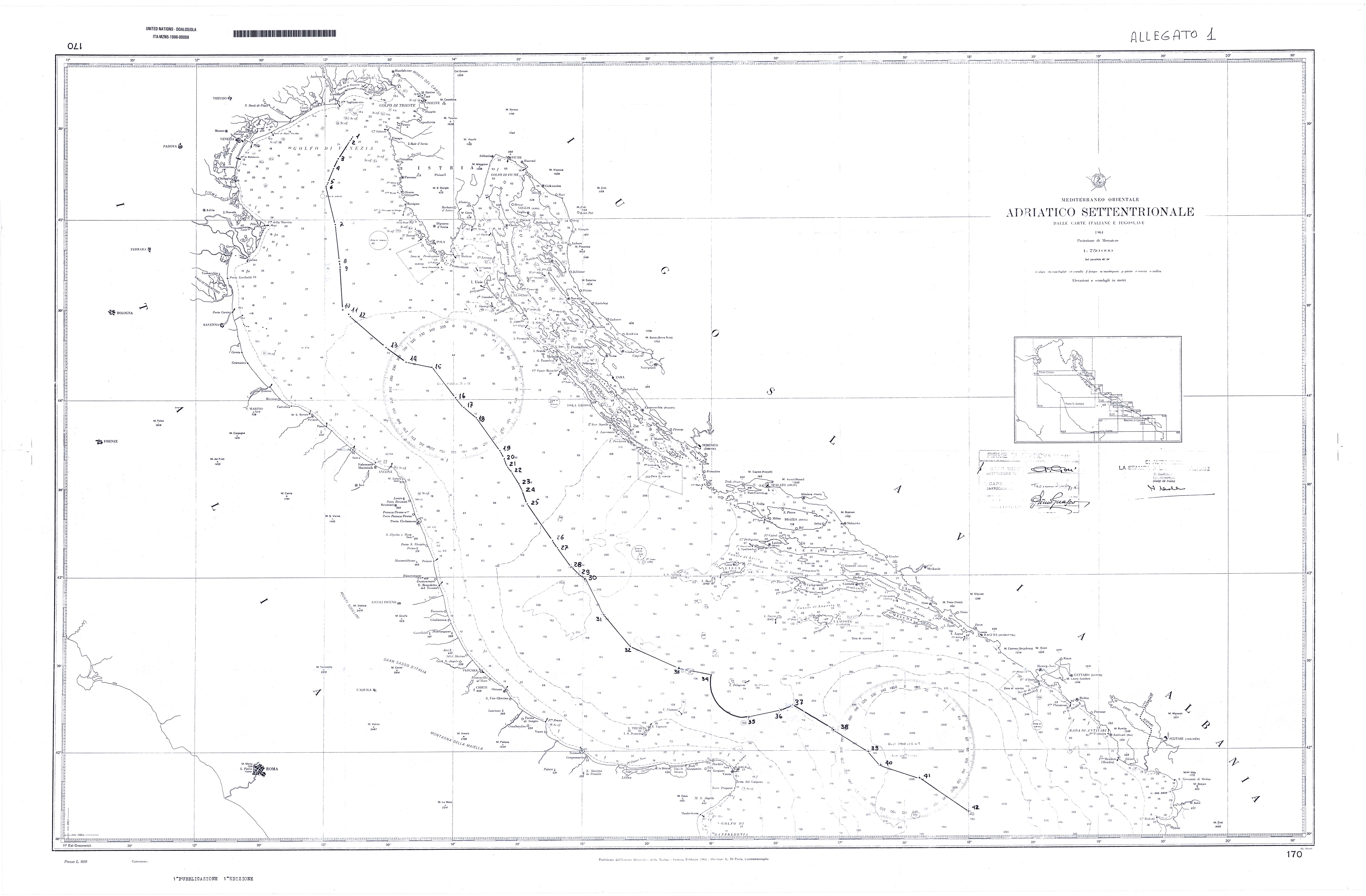
“Adriatico Settentrionale”, Scale 1:750,000
” Dal Golfo del Leone alle Isole Eolie”, Scale 1:1,000,000
“Canale di Sicilia”, Scale 1:750,000
” Dallo Stretto di Messina ai Dardanelli e Rodhos, Mare Ionio e Mare Egeo”, Scale 1:1,000,000
“Da Porto Corsini all’Isola Pago “, Scale 1:250,000
” Mari d’Italia”, Scale 1:1,700,000

Leave a Reply