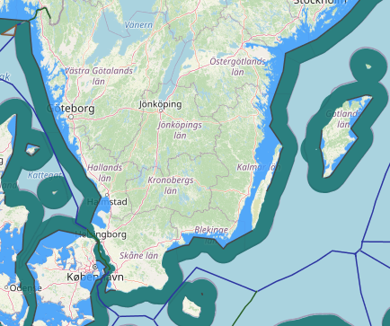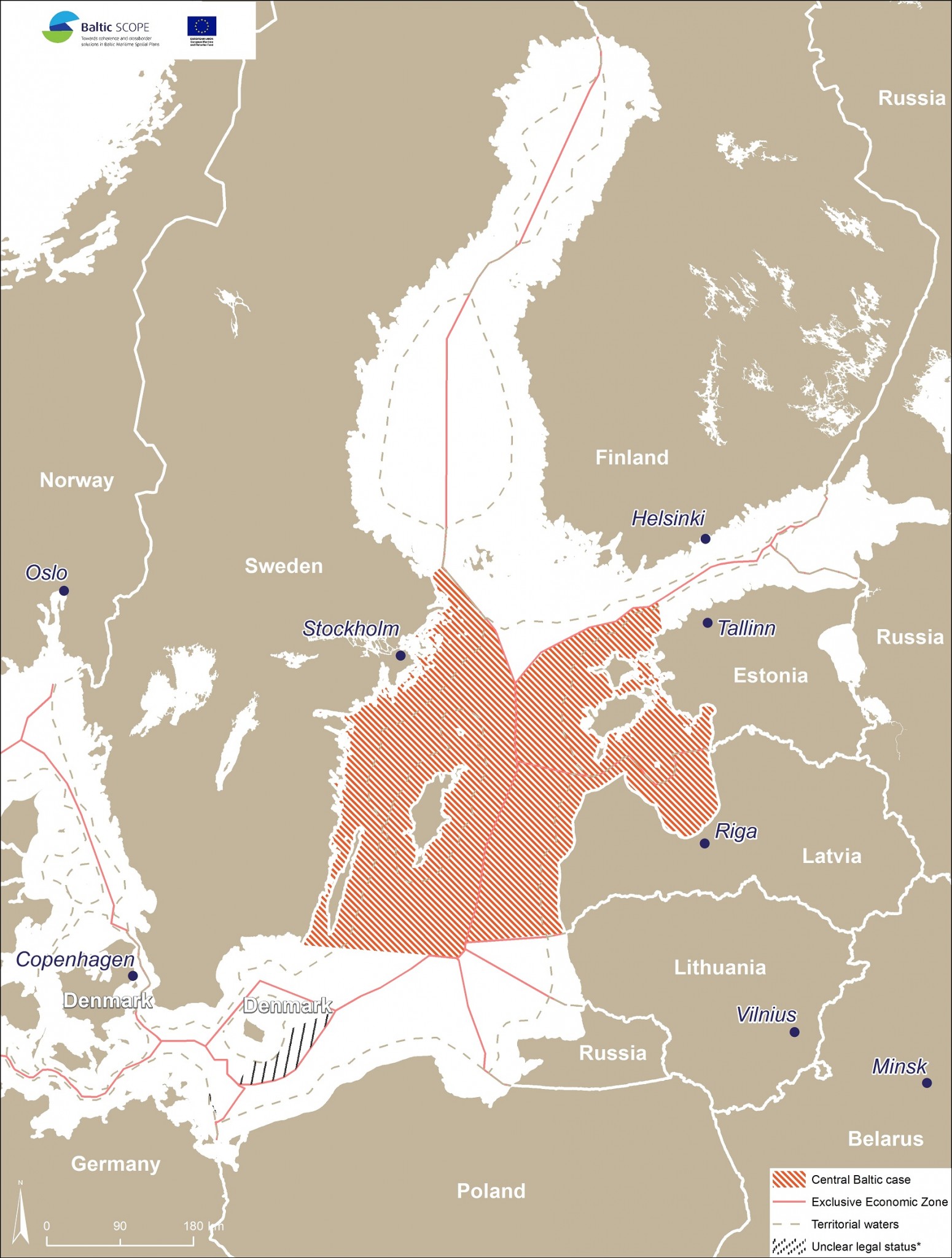
Through an Agreement of 2 November 1998 Estonia and Sweden delimited their entire maritime boundary, except for a short segment extending to the trijunction point with Finland.’ This maritime boundary had been previously delimited between Sweden and the Soviet Union in 1988. The 1998 Agreement between Estonia and Sweden adopts, with some minor technical adjustments, the boundary line established by Sweden and the Soviet Union. However, the 1998 Agreement does not make any reference to this fact. In this way the 1998 Agreement reflects the wish of Estonia not to be considered a successor state to a treaty concluded by the Soviet Union and at the same time reflects the agreement of the parties that the maritime boundary which was in place when Estonia regained its independence also forms the boundary between Estonia and Sweden.
This not only concerns the agreements concluded between Sweden and the Soviet Union in 1988, but also a number of delimitation agreements concluded between Estonia, Finland, Latvia and Sweden concluded in the 1990s. Finally, to understand fully the evolution of this maritime boundary, it is necessary to refer to bilateral arrangements between Estonia and Sweden with respect to fisheries.
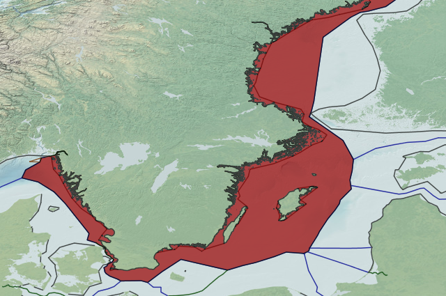
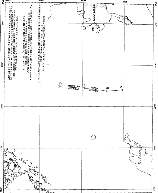
Sweden and the Soviet Union shared a maritime boundary in the central part of the Baltic Sea. The relevant coast of Sweden was mainly formed by the large island of Gotland and some smaller islands in its immediate vicinity and Gotska Sandon. This latter island, which measures some 3.6 square kilometers, lies 20 nautical miles to the north of Gotland, some 30 nautical miles from the Swedish mainland coast and some 80 nautical miles from Finland and Estonia. On the Soviet side the relevant coast was formed by the mainland coast to the south of the Gulf of Riga and the islands of Hiiumaa and Saaremaa to its north.
The one issue dominating the negotiations between Sweden and the Soviet Union on the delimitation of their maritime boundary was the weight to be accorded to Gotland. This island, which measures 3,200 square kilometers and has a population of about 60,000 (1999), is situated about 30 nautical miles from the Swedish mainland coast and about 80 nautical miles from the coast of the Baltic republics. Sweden claimed that Gotland and Gotska Sandon should be given full weight to establish a median line boundary, whereas the Soviet Union considered that the islands should be disregarded almost completely in this respect, only according Gotland a 12 nautical mile zone in areas where the
median line between the two mainland coasts was less than this distance from it.
The agreement the parties eventually reached in 1988 gave three-quarters of the area that was in dispute to Sweden and the remaining quarter to the Soviet Union. In addition, the parties gave each other access to fisheries resources of the part of the disputed area accorded to them by the delimitation agreement. The delimitation line agreed upon by Sweden and the Soviet Union joined the most northerly and most southerly point of the disputed area and related to the
contours of this area in a symmetrical manner. This implies that Gotland and Gotska Sandon were given the same weight throughout the delimitation line.
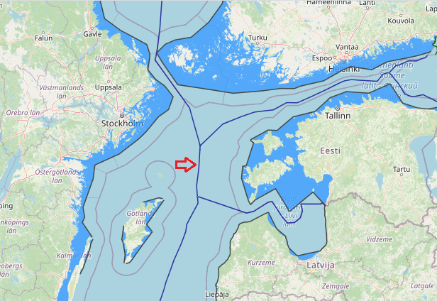
Estonia-Finland-Sweden tripoint agreement
This is only the third tripoint agreement concluded so far in the Baltic Sea.The relevant practice in the Baltic Sea so far indicates that parties in their bilateral agreements always leave the tripoint undetermined. These bilateral agreements
normally indicate that the tripoint will be determined by means of direct negotiations between all the parties concerned. This same practice moreover indicates that these direct negotiations between the three parties concerned normally take place soon after the entry into force of the last bilateral delimitation agreement concluded between the parties concerned, easily leading to the conclusion of a tripoint agreement soon afterwards. The tripoint between Poland, Sweden and the former USSR, for instance, was signed on the very day that the last bilateral agreement, i.e. the one between Poland and Sweden, entered into force. The present agreement between Estonia, Finland and Sweden, as well as the Estonia.. .Latvia.. .Sweden Agreement took somewhat longer. Nevertheless, both of them only required one meeting of experts and one meeting of diplomats to arrive at a solution.
Finally, it could be added that, like its predecessors, no chart was attached to the present tripoint agreement. The most important new feature introduced by this agreement in the Baltic Sea delimitation practice, is that the agreement has only been drafted in one single language, namely English. The parties, in other words, did no longer find it necessary to have an authentic version drafted in their own national languages. After a series of agreements concluded since the middle of the 1990 which added an English language version as a supplementary authentic text, and even granted the latter precedence, this is the very first agreement which takes this process one step further by doing away with the respective national language versions of the different participating states. Another novelty is that this is the first instance where the system used to determine the coordinates of the tripoint, i.e. WGS 84, corresponds with those used to determine the different terminal points in the tripoint area by the separate bilateral agreements. As a consequence no conversion will be necessary.
Agreement between the Government of the Kingdom of Sweden, the Government of the Republic of Estonia and the Government of the Republic of Finland on the common maritime boundary point in the Baltic Sea. Tallinn, 16 January 2001
Agreement between the Government of the Kingdom of Sweden, the Government of the Republic of Estonia and the Government of the Republic of Latvia on the common maritime boundary point in the Baltic Sea. Stockholm, 30 April 1997
Agreement between the Government of the Kingdom of Sweden and the Government of the Republic of Estonia on the delimitation of the maritime zones in the Baltic Sea. Stockholm, 2 November 1998