charts showing the outer limits of the territorial sea


Areas in the territorial sea
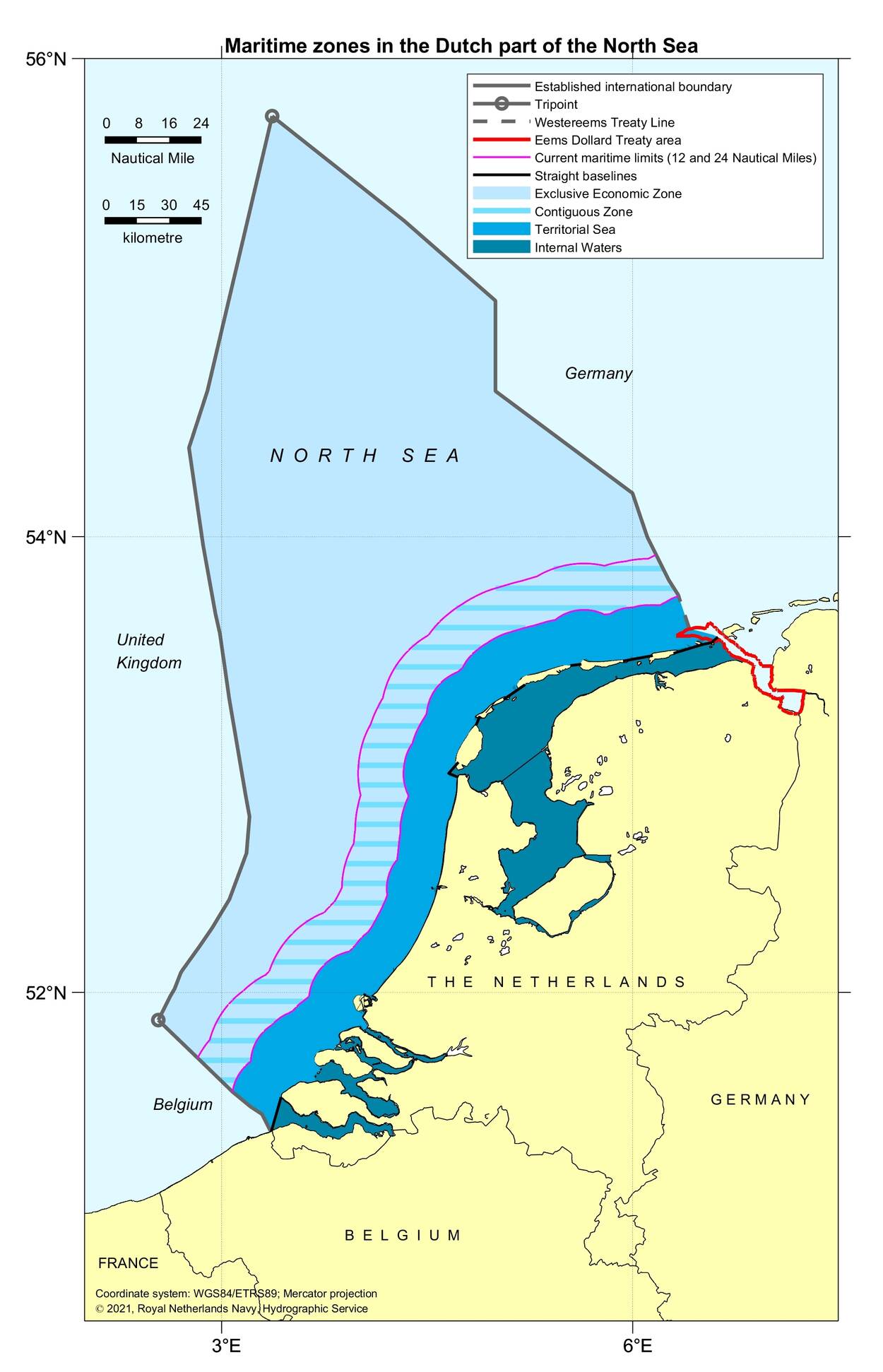
In addition to the maritime zones under UNCLOS, there are other maritime areas in the Netherlands territorial sea that depend on the baseline. They are the following:
- the zones of the European common fisheries policy.
Within these waters, EU Member States may enforce catch restrictions. The Netherlands allows Belgian, Danish and German ships to fish in the waters between 3 and 12 miles off the Dutch coast. French fishery vessels are allowed to fish between 6 and 12 miles off the coast. And British vessels are allowed to fish between Texel and the boundary with Germany. - the Particularly Sensitive Sea Area (PSSA) Wadden Sea.
In 2002, the International Maritime Organisation (IMO) designated the Wadden Sea as a PSSA sea. The outer limit of the Dutch part of this protected area is the 3-mile line. - the Coastal Waters according to the European Water Framework Directive.
The Water Framework Directive applies a zone of 1 mile (1.852 metre) off the coast. This zone represents the limit of the basins of the Ems, Rhine, Meuse and Scheldt rivers.

Boundary treaties with Belgium, Germany and the United Kingdom
The maritime boundaries of the Netherlands in the North Sea are laid down in treaties with Belgium, Germany and the United Kingdom.
Maritime boundary with Belgium
The maritime boundary with Belgium is laid down in 2 treaties: one for the territorial sea and one for the Continental Shelf.
Maritime boundary with Germany
The maritime boundary with Germany for the Continental Shelf is laid down in 2 treaties: one for the Continental Shelf near the coast, and one for further offshore.
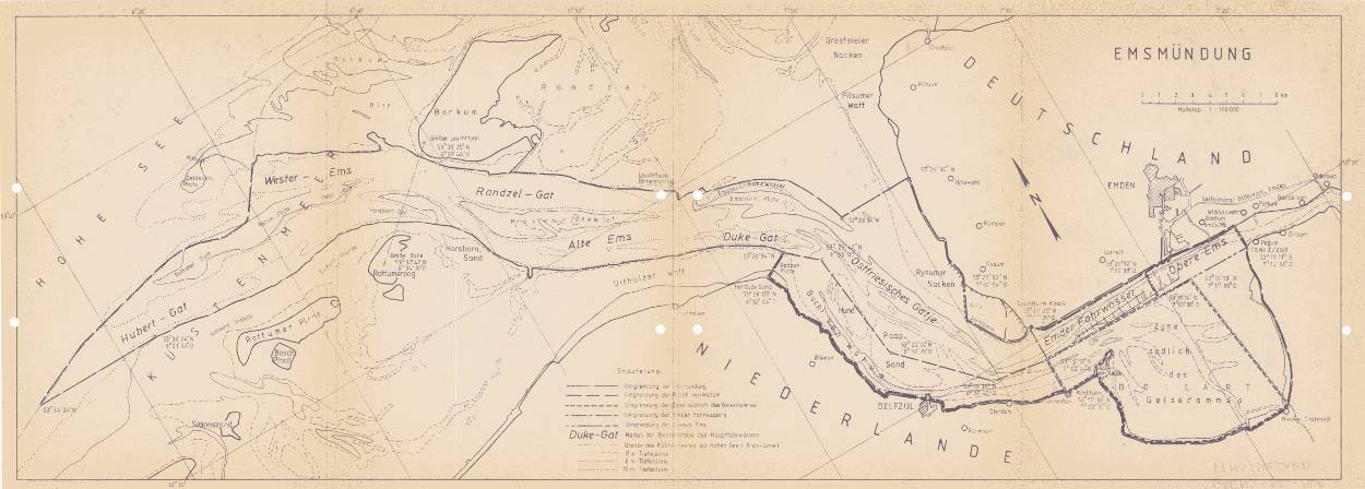
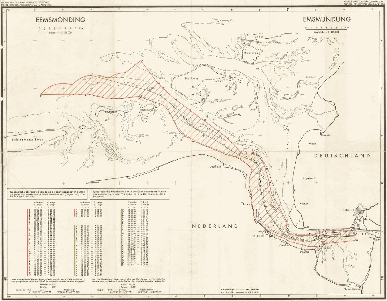
The Netherlands and Germany have not yet agreed on the boundary of the territorial sea near the Ems estuary. Yet, there is a treaty with agreements on cooperation: the Ems-Dollard Treaty. A supplementary agreement has been added to this treaty. It only deals with the exploration and exploitation of oil and gas. The borders of the treaty and the Supplementary Agreement do not match.
Figures: Relevant claims and treaties in the Eems-Dollard estuary; annex to the Eems-Dollard Treaty; annex to the Supplementary Agreement.