charts (outer limits of the continental shelf and the exclusive economic zone) and confirmation (deposit) of lists of geographical coordinates (straight baselines), as contained in:
– Royal Decree of 12 July 1935, relating to the Baselines for the Norwegian Fishery Zone as regards that part of Norway which is situated to the north of 66°28’8 N Latitude;
– Royal Decree of 18 July 1952 relating to the Baseline for the Norwegian Fishery Zone as regards that part of Norway which is situated to the south of 66°28’8 N Latitude;
– Crown Prince Regent’s Decree of 30 June 1955; and
– Royal Decree of 25 September 1970 concerning the Delimitation of the Territorial Waters of Parts of Svalbard.

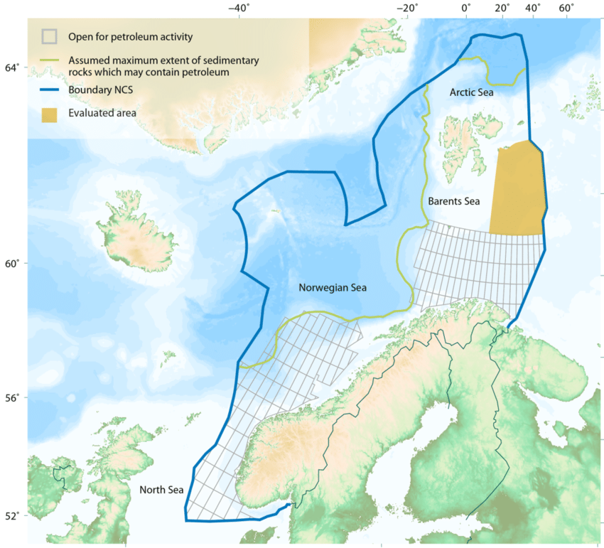
Norwegian Baselines, Maritime Boundaries and the UN Convention on the Law of the Sea
Norway has established by legislation a 12-nautical mile (M) territorial sea, 24-M contiguous zone, and a 200-M economic zone. Norwegian law also contains provisions relating to the continental shelf of Norway, which extends beyond 200 M from the territorial sea baselines. Through its domestic regulations, Norway claims straight baselines (from which its maritime zones are measured) along its mainland coast and also the coasts of Svalbard and Jan Mayen. Norway has concluded maritime boundary agreements with five neighboring States: Denmark, Iceland, Russia, Sweden, and the United Kingdom. Selected maritime laws, declarations, and enactments of Norway.