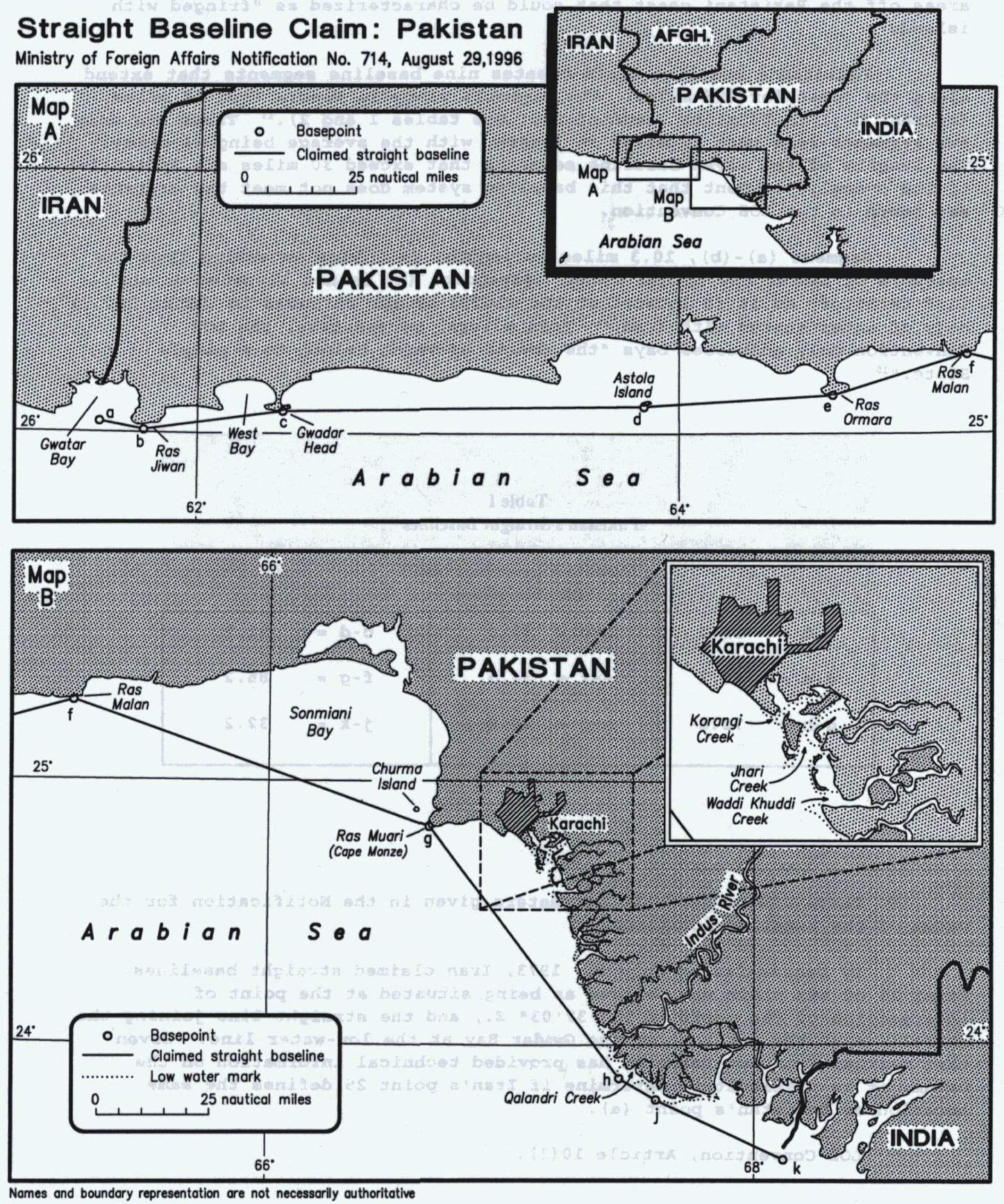
the list of geographical coordinates of points for the drawing of the straight baselines, established by Notification of 29 August 1996, with an illustrative map.
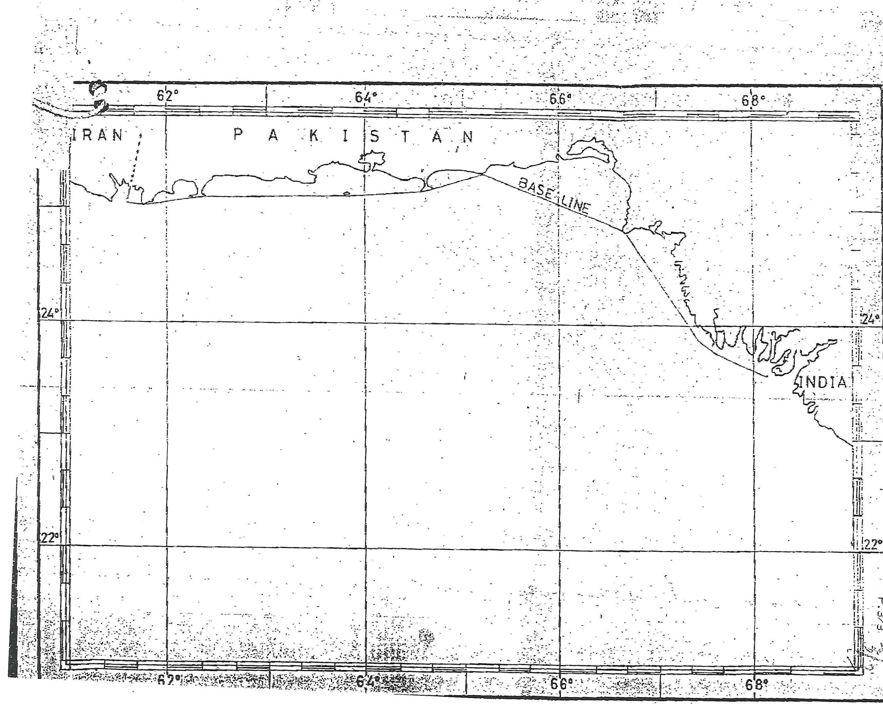
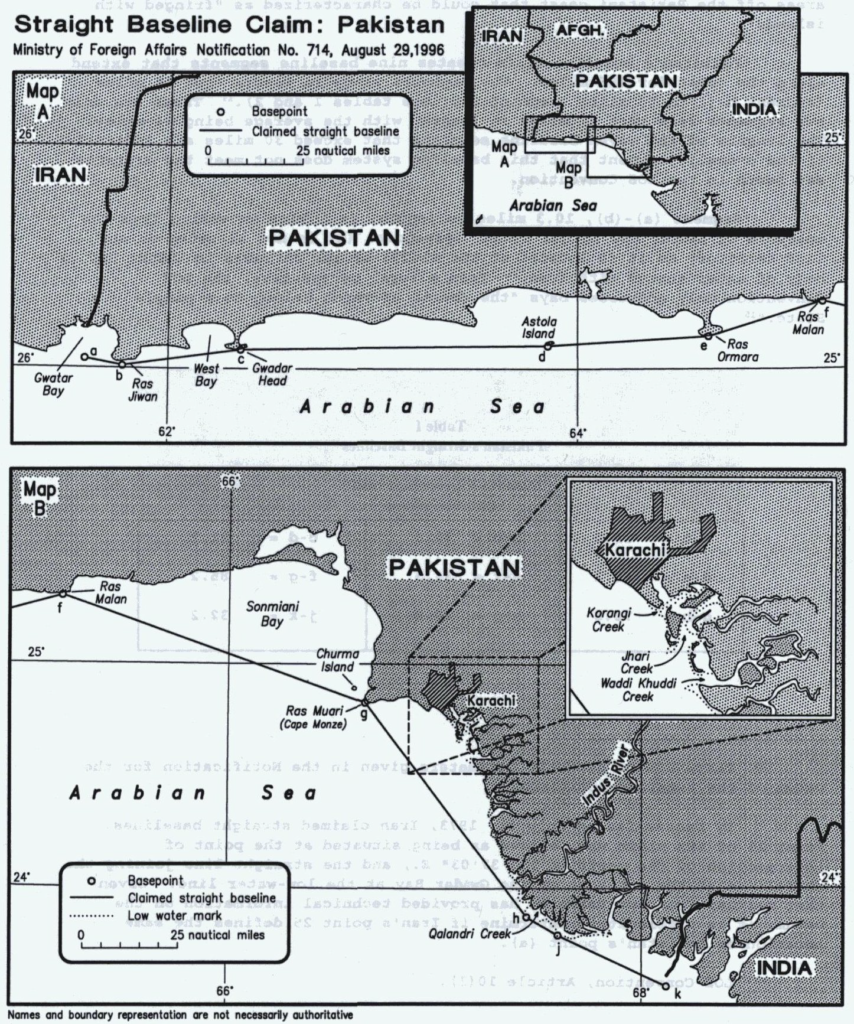
The Government of Pakistan published a ministry of Foreign Affairs Notification in the August 29, 1996, The Gazette of Pakistan which included a listing of geographic coordinates defining the straight baselines for Pakistan. From these straight baselines Pakistan will measure the breadth of its territorial sea, contiguous zone, exclusive economic zone, and continental shelf. These baselines are claimed by authorization given in the 1976 Pakistan law on Territorial Waters and Maritime Zones Act. Paragraphs 2(3) and (4) of this 1976 law state:
(3) The baseline from which such limit (territorial waters) shall be measured and the waters on the landward side of which shall form part of the internal waters of Pakistan shall be specified by the Federal Government by notification in the official Gazette.
(4) Where a single island, rock or a composite group thereof constituting a part of the territory of Pakistan is situated off the main coast, the baseline referred to in such-section (3) shall be drawn along the outer seaward limits of such island, rock, or composite group.
The August 1996 publication represents the first claim made by Pakistan for straight baselines. In addition, on September 9, 1996, the Pakistan Foreign Ministry published a statement in Islamabad on the same subject (see Annex for the text of this statement). The August 29 Notification states: