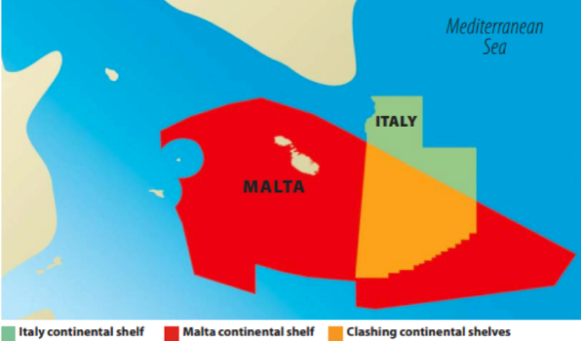
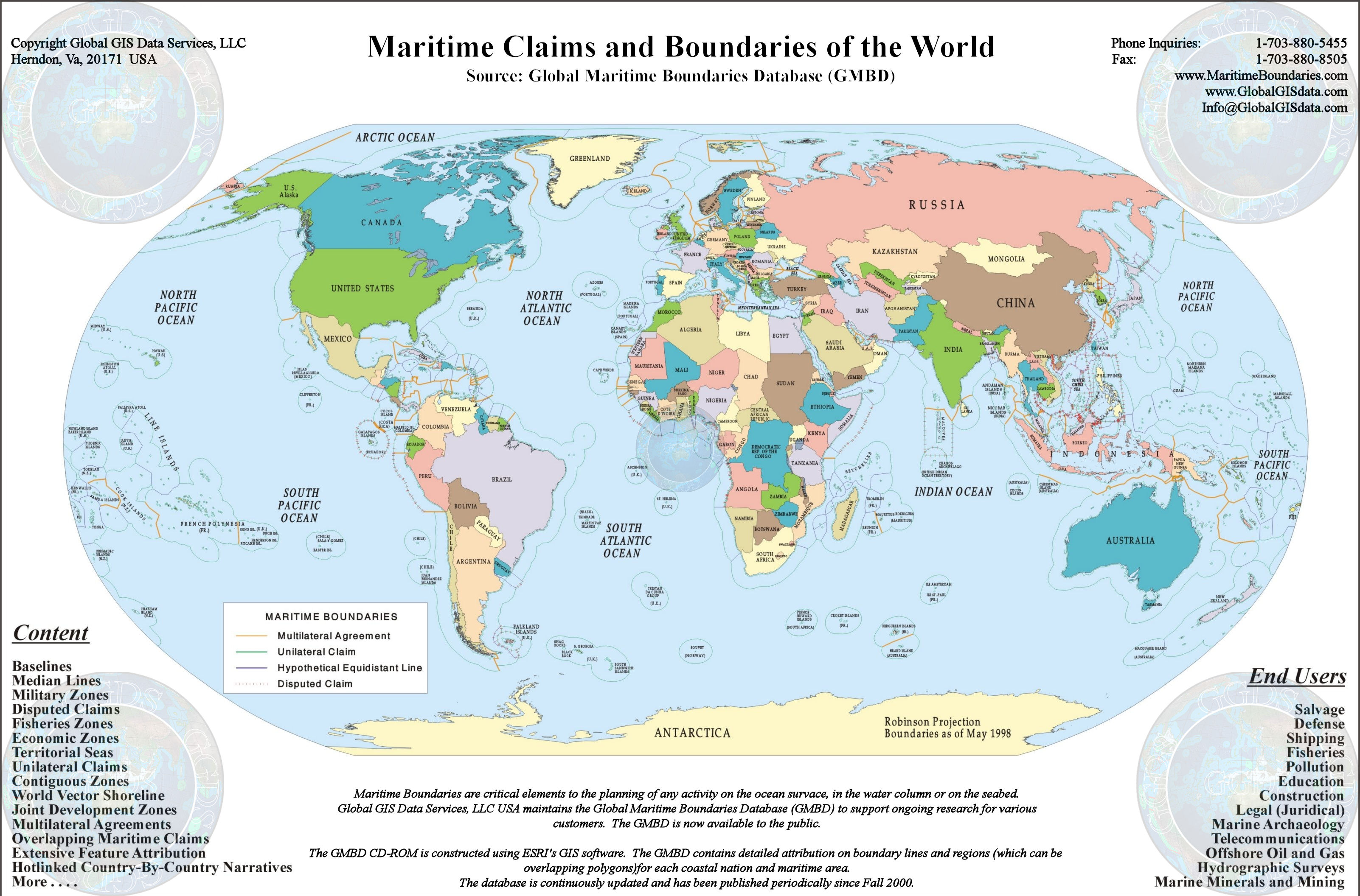
INFORMAL AGREEMENT BETWEEN ITALY, MALTA ON MORATORIUM OFFSHORE SICILY A new chapter has opened in the relations between Italy and Malta: Rome and Valletta agreed “informally” to suspend oil drilling in the Southeastern area of Sicily where the respective claims are overlapped.
The political commitment given by the two Countries allows to glimpse prospects for resolving their long standing dispute on the delimitation of the continental shelf (CS) as well as expresses the always excellent level of their bilateral relations. The agreement must be however followed by the formal delimitation of the maritime boundary. Moreover there is a third party concerned to be considered: Libya, whose continental shelf borders the hypothetical limits of both Italy and Malta’s CS.
Month: December 2021
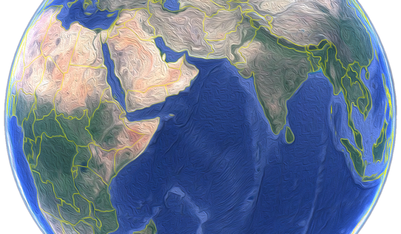
THE INDIAN OCEAN
THE THIRD LARGEST of the world’s oceans, the Indian Ocean covers 28 million sq miles (73 million sq km) and contains some 5,000 islands, many of them surrounded by coral reefs. This ocean is unique because, unlike the Atlantic and Pacific, it has no outlet to the north. It contains both the saltiest sea (the Red Sea), and the warmest sea (the Persian Gulf) on Earth. It is bounded by Asia to the north, Africa to the west and Australia to the east. To the south it is bounded by the Southern Ocean or Antarctica, depending on the definition in use. Along its core, the Indian Ocean has some large marginal or regional seas such as the Arabian Sea, the Laccadive Sea, the Somali Sea, Bay of Bengal, and the Andaman Sea. The Indian Ocean is at risk from pollution, especially from oil tankers leaving the Persian Gulf. Monsoon rains and tropical storms can bring disastrous flooding to its northern coasts.
View More THE INDIAN OCEANPersian Gulf
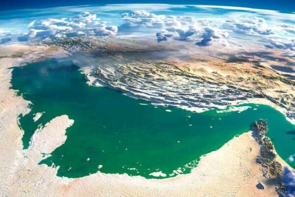
The Persian Gulf is an arm of the Arabian Sea between the mountainous coast of southwestern Iran and the rather flat coast of Arabian Peninsula. The gulf is approximately 1000 km long and 200 to 300 km wide, with an area of about 250,000 km². The inland sea is connected to the Gulf of Oman in the east by the Strait of Hormuz.
View More Persian GulfSouth-East Asia
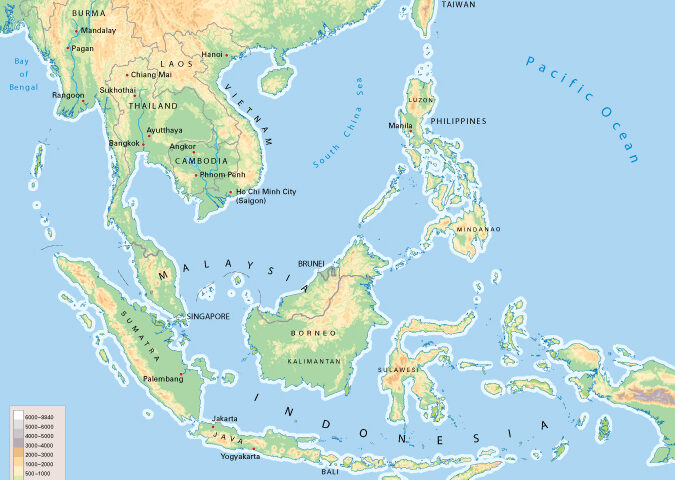
Southeast Asia is a vast subregion of Asia, roughly described as geographically situated east of the Indian subcontinent, south of China, and northwest of Australia. The region is bounded by the Bay of Bengal in the west, the Indian Ocean in the south, the South China Sea in the center, and the Philippine Sea and the Pacific Ocean in the east.
View More South-East AsiaDevelopment of the Studies on Maritime Delimitation
Since 1945, in particular, many studies have been written in the field of maritime delimitation. Most of them have focused on the case law. In fact, as is shown in the bibliography, there are many articles relating to international judgments in this field. Since it has been argued that the law of maritime delimitation has developed through international jurisprudence, it was only natural that writers turned to the analysis of case law in this field.
View More Development of the Studies on Maritime DelimitationImportance of Maritime Delimitation in International Law of the Sea
MARITIME SPACES IN international law of the sea are, in essence, defined in relation to the coastal State jurisdiction over each maritime space. Thus, coastal State jurisdiction is the primary criterion in characterising maritime spaces. The ambit of coastal State jurisdiction is in principle defined spatially, based on distance from the coast. According to the 1982 UN Convention on the Law of the Sea, the territorial sea in which a coastal State exercises territorial sovereignty shall not exceed 12 nautical miles measured from the relevant baseline (Article 3). The contiguous zone over which a limited jurisdiction is exercised by the coastal State may not extend beyond 24 nautical miles from that line (Article 33). The Exclusive Economic Zone (EEZ), where the coastal State may exercise sovereign rights regarding the exploration and exploitation of natural resources, shall not extend beyond 200 nautical miles (Article 57). The same is in principle true for continental shelves of less than 200 nautical miles (Article 76(1)). It would seem safe to say that these rules have now become customary law. Hence, the definition of the spatial extent of coastal State jurisdiction is at the heart of the international law of the sea.
View More Importance of Maritime Delimitation in International Law of the Sea
