Analyzing Navigational Regimes: Bosporus and Dardanelles

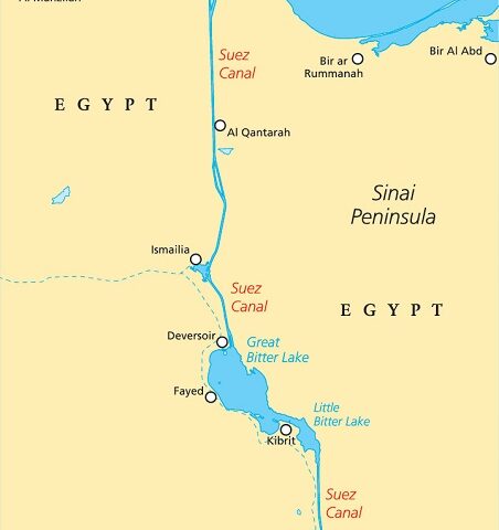
Navigational regimes are crucial for ensuring the safe and efficient movement of vessels through international waterways. These regimes consist of a set of rules and regulations that govern navigation, safety, and access to specific areas. The Bosporus and Dardanelles Straits, located in Turkey, are two prominent examples of navigational regimes that have significant geopolitical and economic implications. This article will analyze the navigational regimes of the Bosporus and Dardanelles, exploring their historical background, the role of international maritime law, environmental concerns, impact on trade and global economy, security challenges, technological advancements, collaborative efforts, and a case study of successful implementation.

View More Analyzing Navigational Regimes: Bosporus and Dardanelles

Analyzing Legal Implications of Landlocked Water Bodies: A Study on the Law of the Seas

Landlocked water bodies, such as lakes and seas, play a crucial role in the global geopolitical landscape. These bodies of water, surrounded entirely by land, present unique legal challenges and implications that must be carefully analyzed. Understanding the legal aspects of landlocked water bodies is vital for ensuring the preservation of ecosystems, resolving disputes, and promoting international cooperation. This article aims to provide a comprehensive analysis of the law of the seas as it pertains to landlocked water bodies, examining their historical context, defining characteristics, legal implications, and future perspectives.

View More Analyzing Legal Implications of Landlocked Water Bodies: A Study on the Law of the Seas

Security and Legal Challenges in the Baltic Sea: An Analytical Perspective

Security and Legal Challenges in the Baltic Sea: An Analytical Perspective The Baltic Sea region faces a myriad of security and legal challenges. This article provides an analytical examination of the complex issues at play, shedding light on the implications for regional stability and cooperation. From territorial disputes to environmental concerns, this analysis delves into the intricate web of geopolitical dynamics shaping the Baltic Sea’s security landscape. With a professional and objective tone, it aims to deepen our understanding of the region’s security challenges and foster informed discourse on potential solutions.

View More Security and Legal Challenges in the Baltic Sea: An Analytical Perspective

The Impact of Global Warming on Marine Ecosystems

The Devastating Effects of Global Warming on Marine Ecosystems: A Critical Analysis

View More The Impact of Global Warming on Marine Ecosystems

Impacts of Global Warming on Marine Boundaries: An Analytical Overview

Impacts of Global Warming on Marine Boundaries: An Analytical Overview

View More Impacts of Global Warming on Marine Boundaries: An Analytical Overview

The Impact of Global Warming on Maritime Legal System

The Evolving Maritime Legal Framework Amidst Global Warming

View More The Impact of Global Warming on Maritime Legal System

The Legal Framework of European Surrounding Seas: An Analytical Perspective

Title: The Legal Framework of European Surrounding Seas: An Analytical Perspective Excerpt: The legal framework governing the European surrounding seas embodies a complex network of regulations, treaties, and frameworks. This article provides an analytical perspective, delving into the intricacies of the legal framework, its effectiveness, and potential areas for improvement. By critically examining the current system, we aim to shed light on the challenges and opportunities that lie ahead for European maritime governance.

View More The Legal Framework of European Surrounding Seas: An Analytical Perspective

NATO and International Legal Regime in Open Seas: An Analytical Perspective

NATO and International Legal Regime in Open Seas: An Analytical Perspective The global order relies on the stability and security of the open seas, where international law plays a pivotal role. NATO, as a key actor in safeguarding maritime security, must navigate the complexities of this legal regime. Examining the organization’s approach from an analytical standpoint unveils insights into its effectiveness, challenges, and potential for greater cooperation. Understanding NATO’s role within the international legal framework is crucial for ensuring the preservation of maritime order and the promotion of shared interests among nations.

View More NATO and International Legal Regime in Open Seas: An Analytical Perspective

Analyzing the US Military Presence in the Black Sea

Analyzing the US Military Presence in the Black Sea: Enhancing Regional Security or Provoking Instability?

View More Analyzing the US Military Presence in the Black Sea

Analyzing the US Military’s Presence in the Gulf of Aden

Analyzing the US Military’s Presence in the Gulf of Aden: A Strategic Perspective

View More Analyzing the US Military’s Presence in the Gulf of Aden

Legal Challenges in Madagascar’s Maritime Domain: An Analytical Perspective

Title: Legal Challenges in Madagascar’s Maritime Domain: An Analytical Perspective Excerpt: Madagascar’s maritime domain presents a complex web of legal challenges, demanding nuanced analysis for effective resolution. As a country rich in marine resources and vulnerable to various maritime threats, Madagascar faces critical issues pertaining to territorial claims, illegal fishing, maritime security, and environmental protection. This article aims to provide a professional and analytical perspective on the legal complexities surrounding Madagascar’s maritime domain, highlighting the need for comprehensive strategies to safeguard its marine ecosystems and promote sustainable development.

View More Legal Challenges in Madagascar’s Maritime Domain: An Analytical Perspective

The Legal System of Antarctica: Understanding the Polar South’s Governance

The Legal System of Antarctica: Understanding the Polar South’s Governance Antarctica, the earth’s southernmost continent, is governed by a unique legal system. This article aims to shed light on the legal framework that regulates activities in this remote and pristine region. From the Antarctic Treaty System to environmental protection laws, we explore the governance mechanisms that ensure the preservation of this polar wilderness.

View More The Legal System of Antarctica: Understanding the Polar South’s Governance

Oceanic Odyssey: Navigating the Ever-Evolving Global Maritime Canvas

Oceanic Odyssey: Sailing the Seas of Evolution

View More Oceanic Odyssey: Navigating the Ever-Evolving Global Maritime Canvas

Channeling Success: Overcoming Maritime Challenges in France and Britain

Navigating the Storm: Conquering Maritime Hurdles in France and Britain

View More Channeling Success: Overcoming Maritime Challenges in France and Britain

Exploring the Majestic Seas of Argentina: A Comprehensive Insight

Exploring Argentina’s Seas: A Comprehensive Insight

View More Exploring the Majestic Seas of Argentina: A Comprehensive Insight

Exploring the Significance of Hudson Bay: An Analytical Perspective

Exploring Hudson Bay: A Comprehensive Analysis

View More Exploring the Significance of Hudson Bay: An Analytical Perspective

Approaches to delimitation of maritime boundaries

The establishment of continental shelf zones and exclusive economic zones
(EEZs) considerably increased the number and length of the maritime
boundaries between coastal states. A 1983 survey identified some 376
international maritime boundaries between 137 coastal states around the
globe. In 1988, the US Department of State gave a figure of 412 demarcations
required. Eventually, additional boundaries arose due to the advent
of new states and the breaking-up of the Soviet Union. Yet another
generation of boundaries will result from climate change and accessibility
to resources in the Arctic waters.

View More Approaches to delimitation of maritime boundaries

Registration of ships in shipping, maritime law and law of the sea

Registration means the entering of a matter in the public records. Registration
is generally—but not always—not only a precondition for, but also the test of, a
vessel’s nationality. This is the public law function of registration, as opposed to its
private law function.

View More Registration of ships in shipping, maritime law and law of the sea

Earth’s Broken Shell

The division of the world into land and sea seems so
natural and timeless that it is hard to imagine it any other
way. Yet the very existence of continents and oceans is unique to
planet Earth, and their behaviour is even more remarkable.
Early in the 20th century, a German meteorologist named
Alfred Wegener noted the extraordinary way coastlines of
continents seemed to match across the oceans, like the separated
pieces of a vast jigsaw. He suggested that this was because the
continents were once joined together and the oceans between
them opened up as they split apart and drifted around the
world over many millions of years.

View More Earth’s Broken Shell

LAW OF THE SEA (summary)

The law of the sea is a body of public international
law governing the geographic jurisdictions of coastal
States and the rights and duties among States in the
use and conservation of the ocean environment and its
natural resources. The law of the sea is commonly
associated with an international treaty, the Convention
on the Law of the Sea (UNCLOS), negotiated
under the auspices of the United Nations, which was
signed in 1982 by 117 States and entered into force in
At present 133 States have signed and ratified
UNCLOS;

View More LAW OF THE SEA (summary)

About suez Canal Invasion

The canal is operated and maintained by the state-owned Suez Canal Authority (SCA) of Egypt. The Suez Canal is a man-made waterway connecting the Mediterranean Sea to the Indian Ocean via the Red Sea. It enables a more direct route for shipping between Europe and Asia, effectively allowing for passage from the North Atlantic to the Indian Ocean without having to circumnavigate the African continent. In 1854, Ferdinand de Lesseps, the former French consul to Cairo, secured an agreement with the Ottoman governor of Egypt to build a canal 100 miles across the Isthmus of Suez. The Suez Canal is a human-made waterway that cuts north-south across the Isthmus of Suez in Egypt. The Suez Canal connects the Mediterranean Sea to the Red Sea, making it the shortest maritime route to Asia from Europe. Since its completion in 1869, it has become one of the world’s most heavily used shipping lanes.

View More About suez Canal Invasion

What Makes a Continent a Continent?

According to a 2017 paper published in the Geological Society of America’s journal, GSA Today, “The ‘Glossary of Geology’ defines a continent as ‘one of the Earth’s major landmasses, including both dry land and continental shelves.’ It is generally agreed that continents have all the following attributes: (1) high elevation relative to regions floored by oceanic crust; (2) a broad range of siliceous igneous, metamorphic and sedimentary rocks; (3) thicker crust and lower seismic velocity structure than oceanic crustal regions; and (4) well-defined limits around a large enough area to be considered a continent rather than a microcontinent or continental fragment… To our knowledge, the last point — how ‘major’ a piece of continental crust has to be to be called a continent — is almost never discussed.”

View More What Makes a Continent a Continent?

Piracy Map of the world(2019-2020-2021-2022)

The Piracy & Armed Robbery Map below follows the definition of Piracy as laid down in Article 101 of the 1982 United Nations Convention on the Law of the Sea (UNCLOS) and Armed Robbery as laid down in Resolution A.1025 (26) adopted on 2 December 2009 at the 26th Assembly Session of the International Maritime Organisation (IMO). This maps shows all the piracy and armed robbery incidents reported to the IMB (International Maritime Bureau) Piracy Reporting Centre during 2019- 2022.

View More Piracy Map of the world(2019-2020-2021-2022)

What does the law of the sea do?

The law of the sea is a body of customs, treaties, and international agreements by which governments maintain order, productivity, and peaceful relations on the sea. Generally speaking, the law of the sea stipulates that maritime countries essentially control their territorial waters from the shore out to a distance of 12 miles (19.3 km), the “12-mile limit.” Within this zone, all laws of that country apply: the country can build, extract natural resources, and either encourage

View More What does the law of the sea do?

Development of the Studies on Maritime Delimitation

Since 1945, in particular, many studies have been written in the field of maritime delimitation. Most of them have focused on the case law. In fact, as is shown in the bibliography, there are many articles relating to international judgments in this field. Since it has been argued that the law of maritime delimitation has developed through international jurisprudence, it was only natural that writers turned to the analysis of case law in this field.

View More Development of the Studies on Maritime Delimitation

Importance of Maritime Delimitation in International Law of the Sea

MARITIME SPACES IN international law of the sea are, in essence, defined in relation to the coastal State jurisdiction over each maritime space. Thus, coastal State jurisdiction is the primary criterion in characterising maritime spaces. The ambit of coastal State jurisdiction is in principle defined spatially, based on distance from the coast. According to the 1982 UN Convention on the Law of the Sea, the territorial sea in which a coastal State exercises territorial sovereignty shall not exceed 12 nautical miles measured from the relevant baseline (Article 3). The contiguous zone over which a limited jurisdiction is exercised by the coastal State may not extend beyond 24 nautical miles from that line (Article 33). The Exclusive Economic Zone (EEZ), where the coastal State may exercise sovereign rights regarding the exploration and exploitation of natural resources, shall not extend beyond 200 nautical miles (Article 57). The same is in principle true for continental shelves of less than 200 nautical miles (Article 76(1)). It would seem safe to say that these rules have now become customary law. Hence, the definition of the spatial extent of coastal State jurisdiction is at the heart of the international law of the sea.

View More Importance of Maritime Delimitation in International Law of the Sea

what is the meaning of Flag State in law of the sea

Flag State jurisdiction is the prototype maritime jurisdiction. The flag, as the most potent symbol of State power, demonstrates urbi et orbi the existence of a direct link to the State concerned and, for generations, reflected the power of that State to the world. It is the strength of symbolism that creates the importance attached to the jurisdictional basis employed, that of nationality, and the genuine link between the two. The power connection, however, does not work both ways: as the ship remains a private actor, acts and omissions attached to its presence and operation in the marine environment are not automatically attributable to the State and thus do not necessarily trigger the mechanism of State responsibility; rather the State maintains a general droit de regard on what remains essentially a private enterprise. I will address each problem in turn.

View More what is the meaning of Flag State in law of the sea

the meaning of Lakes and its variants

Surface water usually flows toward the sea, but sometimes it is held back by a depression or dam and forms a lake. Although most lakes are filled with freshwater, others have high salinity due to a high evaporation rate and accumulation of dissolved mineral salts.

View More the meaning of Lakes and its variants

what is the meaning of Littorals in geography and law of the sea?

A littoral is a coastal zone between the low-tide line and the high-tide line. This landscape is constantly changing due to the continuous action of the sea, rivers, and wind, and it may take a variety of forms depending on the geological nature of the coast. also we can say the littoral zone or nearshore is the part of a sea, lake, or river that is close to the shore.

View More what is the meaning of Littorals in geography and law of the sea?

what is the meaning of the continents in geography and law

The seven continents that make up the world’s land mass are, from largest to smallest: Asia, Africa, North America, South America, Antarctica, Europe, and Australia. Only 29 percent of the Earth’s surface is land. The percentage area of each continent is shown here.

View More what is the meaning of the continents in geography and law

Denmark(Faroe Islands)–United Kingdom maritime boundary and Special Area

In May 1999 Denmark and the United Kingdom concluded an agreement (1999 Agreement) concerning their overlapping claims to fisheries zones and continental shelf in North Atlantic waters located between the Faroe Islands and Scotland. The 1999 Agreement designates continental shelf and fisheries zone boundaries in addition to a ‘Special Area’ of water column that remains subject to the overlapping jurisdictional claims both States.

View More Denmark(Faroe Islands)–United Kingdom maritime boundary and Special Area

Colombia–Jamaica maritime boundary and the Joint Regime Area

In 1993 Colombia and Jamaica concluded a treaty (1993 Treaty) concerning their overlapping claims to a continental shelf and EEZ in the Caribbean Sea. Article 1 of the 1993 Treaty establishes a maritime boundary between the two States. Immediately to the west of the boundary, the 1993 Treaty also establishes a ‘Joint Regime Area’ in which, ‘pending the determination of the jurisdictional limits of each Party …, the Parties agree to establish … a zone of joint management, control, exploration and exploitation of living and non-living resources’. Article 3(1), sub-paragraphs (b) and (c) of the 1993 Treaty exclude two circular areas of 12 nautical miles radius from the Joint Regime Area. One circular area surrounds the cays of the Seranilla Bank and the other surrounds the cays of Bajo Nuevo. Both of these groups of features are claimed by Colombia – a claim that has been disputed on various occasions by Honduras, Jamaica, Nicaragua and the United States.

View More Colombia–Jamaica maritime boundary and the Joint Regime Area

Canada–United States overlapping claims in North Atlantic and surrounding Machias Seal Island and North Rock

In 1979 the Canada and the United States agreed to empower a Chamber of the ICJ to designate a single seabed and water-column boundary in the Gulf of Maine. The Chamber’s 1984 Judgment establishes a segmented boundary that commences at an offshore point mutually agreed by both States (Point A) and terminates at the point of intersection with the United States’ 200 nautical mile limit. McDorman notes that, prior to the conclusion of the 1979 agreement, Canadian and US negotiators had proposed several options concerning provisional joint management of overlapping claims in the Gulf of Maine. These proposals did not gain traction because delimitation issues proved difficult to set aside. In particular, the location of competing boundary claims influenced political views concerning the fair division of fisheries and potential hydrocarbon resources.

View More Canada–United States overlapping claims in North Atlantic and surrounding Machias Seal Island and North Rock

The Development of the Case Law of Maritime Delimitation: From Equity to Normativity

In parallel with the codification process in the 1958 Geneva Conventions and the 1982 UNCLOS, the law of maritime delimitation was subject to a progressive development through litigation and arbitration. Both processes were at the same time independent and interrelated. The scope of this part is to provide a broad historical background of the evolution of the case law of maritime delimitation in order to better analyze in the following section the conditions, under which the Equidistance/Relevant Circumstances principle had emerged and developed.

View More The Development of the Case Law of Maritime Delimitation: From Equity to Normativity

Codification of Maritime Delimitation

The first attempt at codification of the customary law of maritime delimitation started with the 1930 Hague Conference under the auspices of the League of Nations. The Hague Conference failed to reach its purpose and the following World War II period was not an appropriate period to deal with issues of maritime delimitation. In the aftermath of World War II, the creation of the United Nations Organization (UN) and the multiple individual claims of States over maritime spaces, such as the Truman Proclamation and the Santiago Declaration raised the need of re-starting the process of codification of the law of maritime delimitation. The adoption of the 1958 Geneva Conventions which followed was a successful initiative, at least to some extent.

View More Codification of Maritime Delimitation