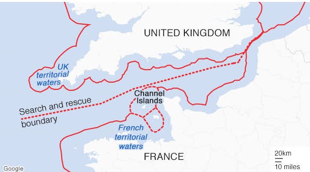
The delimitation of the continental shelf in the English Channel and its
western approaches in the Atlantic area posed problems during negotiations
preceding this landmark arbitration for two reasons. Firstly, the
English Channel Islands, under British sovereignty for purposes of foreign
relations, consist of an archipelagic formation of four main groups
with the principle islands of Alderney, Guernsey, Jersey, Sark, Herm and
Jethon. The islands are situated off the coast of France, the closest, the
island of Ecrehos, being only 6.6 miles from the continent. Geologically,
the islands are both linked to the English mainland by a basic continuity
of the shelf, and also separated from it by a the trough of Hurd Deep, a
trench of some 100 metres running a few miles north of the islands in
south-westerly direction for some 80 miles. Secondly, in the western part
(or the western approaches or Atlantic area), both states show atypical
coastal configurations in the sense that they are neither in a clearly
opposite nor in a clearly adjacent constellation. Moreover, both parties
have islands: the Scilly Isles off the Cornish coast and the island of Ushant
(Quessant) off the Brest peninsula. As possible base points, both groups
of islands could strongly influence the direction of the western boundary
extending into the Atlantic Ocean.

