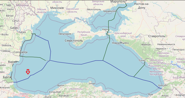
The two respective States agreed on 4 December 1997 to delimit the boundary in the mouth area of the Mutlidere/Rezovska River and the maritime areas in the Black Sea. The agreement concerning the delimitation of the maritime areas between the two adjacent States is based on a simplified equidistance line to produce an equitable and just delimitation. This maritime border was developed as an all-purpose boundary dividing the overlapping exclusive economic zone (EEZ) and continental shelf entitlements of the Parties.
View More Maritime boundaries between Turkey and BulgariaMonth: May 2021
maritime boundaries between Turkey and Syria
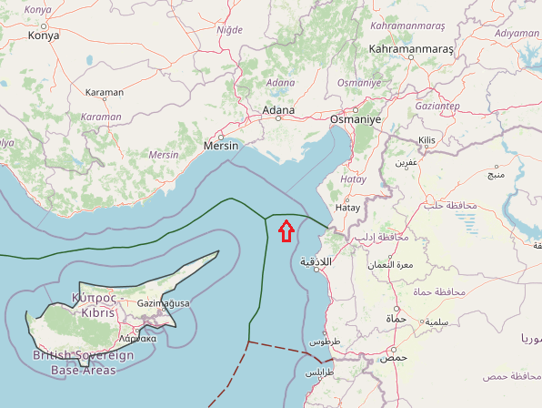
The land boundary between Syria and Turkey reaches the coast in Qasab Bay. The equidistant line is forced northwestwards to Syria’s advantage by Ras el- Basit, a limestone headland. When Turkey’s Ras el-Khanzir comes into range the line of equidistance is directed due west until the trijunction with Cyprus is reached. This trijunction is near 36° 02’ N and 35° 10’ E and the Turco-Syrian boundary extends for about 40 nm. This line appears to be equitable but it will require the question of Hatay Province to be resolved.
View More maritime boundaries between Turkey and Syriamaritime boundaries between Turkey and Cyprus
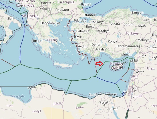
In accordance with international law (both UNCLOS and customary), the delimitation of the continental shelf or the EEZ between States with opposite or adjacent coasts shall be effected by agreement on the basis of international law in order to achieve an equitable result. Cyprus has repeatedly called upon Turkey to enter into negotiations for the delimitation of their maritime zones, in accordance with international law. This invitation to Turkey was, in fact, repeated in a letter addressed to the UN Secretary-General, on 12th December 2018. Turkey dismissed any efforts for a peaceful negotiation, and has resorted to actions that jeopardize and hamper the reaching of a final agreement, in violation of Articles 74(3) and 83(3) UNCLOS, which reflect customary principles such as good faith, self-restraint and peaceful settlement of disputes
View More maritime boundaries between Turkey and Cyprusmaritime boundaries between Greece and Cyprus
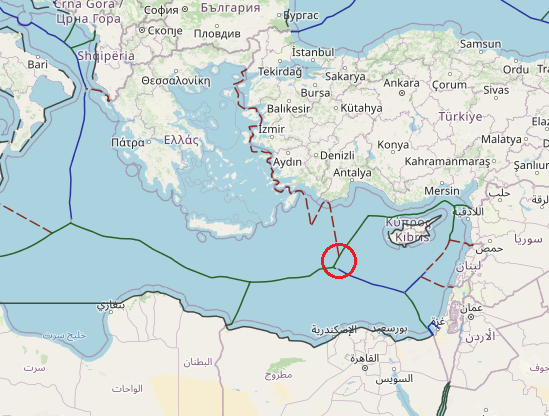
The strategic relevance of the Greek and Cypriot EEZs can be further perceived if noted that Greece and Cyprus stand at the crossroad of three continents and jointly share a common border with another ten countries, out of which with eight of them common sea borders also exist. This modification of the Mediterranean geography is certainly directly related to the application to issues of fisheries, circular economy renewable energy policies and offshore energy challenges. However, if we further consider the outlook shaped in the offshore production of hydrocarbons in Greece, Cyprus and Israel, briefly portrayed by the ex-Greek PM as having the potential to cover half of the needs in natural gas in Europe in the coming 30 years, we realize that it is no hyperbole to consider the Mediterranean as the Middle-East of the 21st century.
View More maritime boundaries between Greece and Cyprusmaritime boundaries between Greece and Egypt
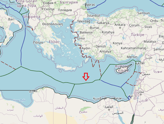
On August 6, 2020, Greece and Egypt signed an Exclusive Economic Zone (EEZ) agreement in Cairo delimiting their maritime boundaries in the Eastern Mediterranean. This recent move came after Turkey had temporarily suspended the activities of its seismic research vessel Oruç Reis as a de-escalatory gesture to open up space for diplomatic negotiations with Greece as part of Germany’s mediation efforts. As such, Athens’s recent move undermined these efforts and once more bore witness to Greece’s intransigence.
View More maritime boundaries between Greece and Egyptmaritime boundaries between Greece and Turkey
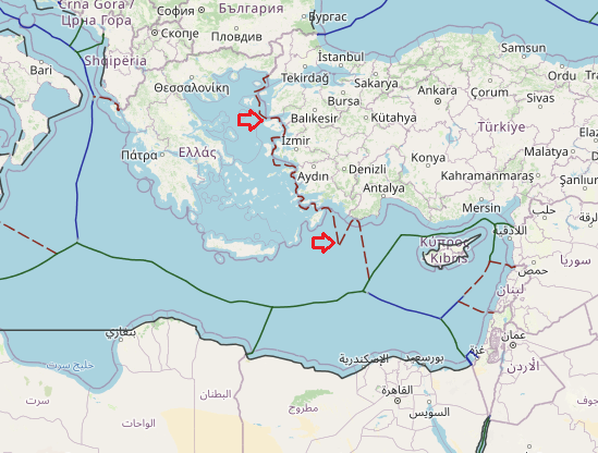
Turkey and Greece has Unsettled median lines between their own maritime borders. In 2018, Former Foreign Minister Nikos Kotzias said Greece is ready to extend its territorial waters from 6 to 12 nautical miles. In the first stage, he said, Greece will expand its sovereignty towards the west from the Diapontia Islands, a cluster of small islands in the Ionian Sea, to Antikythera, an island lying between the Peloponnese and Crete. But the plan is to also do the same in the Aegean.
View More maritime boundaries between Greece and TurkeyMaritime boundaries between Greece and Libya
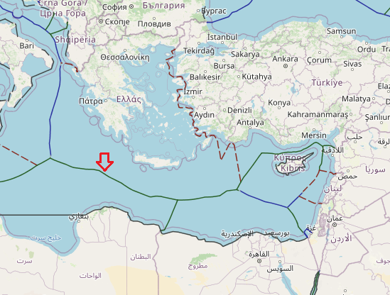
Till now Greece and Libya hasn’t achieve to any agreement about maritime boundaries and all the maritime border between them based on their unilateral statements. some disputed situation raise from this point that Greece and turkey has many challenge about their maritime zone. for example Greece take EEZ for own island in eastern Mediterranean sea, but turkey has opposite idea. for this reason they have unsettled issue on the Mediterranean zone.
View More Maritime boundaries between Greece and Libyamaritime boundaries between Russia and Estonia
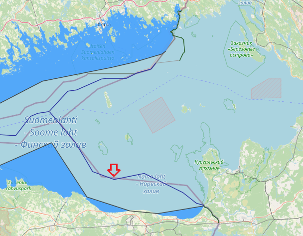
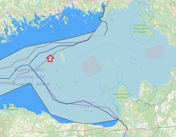
In 2014, Estonia and the Russian Federation signed their land and maritime boundary agreements that are currently awaiting ratification. It is established that the agreed…
View More maritime boundaries between Russia and Estoniamaritime boundaries between Finland and Russia
between Russia and Finland, the boundary is on the shore of Gulf of Finland, in which there is a maritime boundary between the respective territorial waters, terminating in a narrow strip of international waters between Finnish and Estonian territorial waters. In 2014, Estonia and the Russian Federation signed their land and maritime boundary agreements that are currently awaiting ratification. This study reconstructs the maritime boundary delimitation between the two States. In particular, the role of islands and pre-existing agreements for the delimitation of the territorial sea boundary in the south-eastern part of the Gulf of Finland are critically examined. It is established that the agreed maritime boundary line is a median line which was influenced by the use of the special circumstances method in the delimitation process. in relation to the first part of the Finland-USSR maritime boundary, military, strategic and related navigational considerations have had a powerful influence on the course of maritime boundaries and it had not based on equidistance method alone.
View More maritime boundaries between Finland and Russiamaritime boundaries between Finland and Estonia
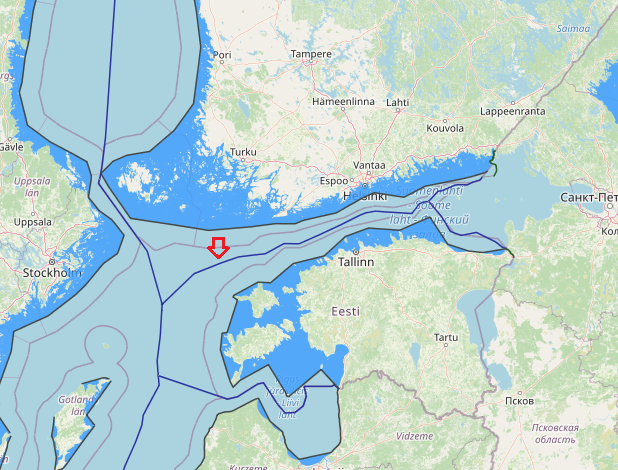
Agreement between the Republic of Estonia and the Republic of Finland on the Boundary of the Maritime Zones in the Gulf of Finland and the Northern Baltic Sea was signed in 18 October 1996. In principle, the main aim of the negotiations was not to try to establish a maritime boundary in areas· where no such boundary existed before. In fact, only a very minor part of this agreement could fit such a description. What the Estonia-Finland Agreement did rather was to provide an answer to the much more subtle question about the ·exact legal value to be attributed under international law to the previously concluded maritime boundary agreements, in casu by the former Soviet Union.
View More maritime boundaries between Finland and Estoniamaritime boundaries between Sweden and Estonia
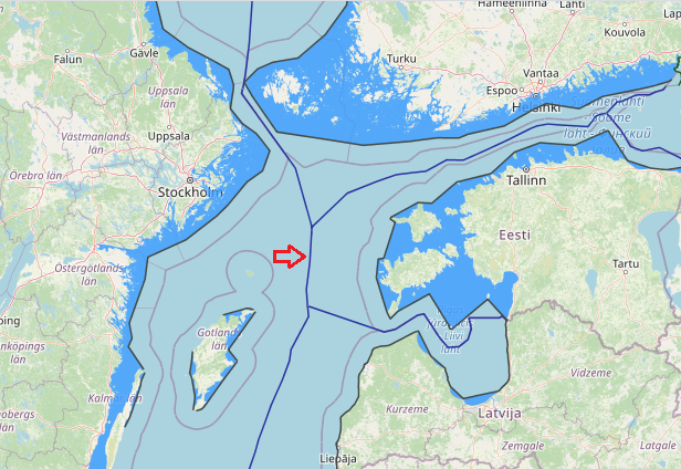
Through an Agreement of 2 November 1998 Estonia and Sweden delimited their entire maritime boundary, except for a short segment extending to the trijunction point with Finland.’ This maritime boundary had been previously delimited between Sweden and the Soviet Union in 1988. The 1998 Agreement between Estonia and Sweden adopts, with some minor technical adjustments, the boundary line established by Sweden and the Soviet Union. However, the 1998 Agreement does not make any reference to this fact. In this way the 1998 Agreement reflects the wish of Estonia not to be considered a successor state to a treaty concluded by the Soviet Union and at the same time reflects the agreement of the parties that the maritime boundary which was in place when Estonia regained its independence also forms the boundary between Estonia and Sweden.
View More maritime boundaries between Sweden and Estoniamaritime boundaries between Latvia and Estonia
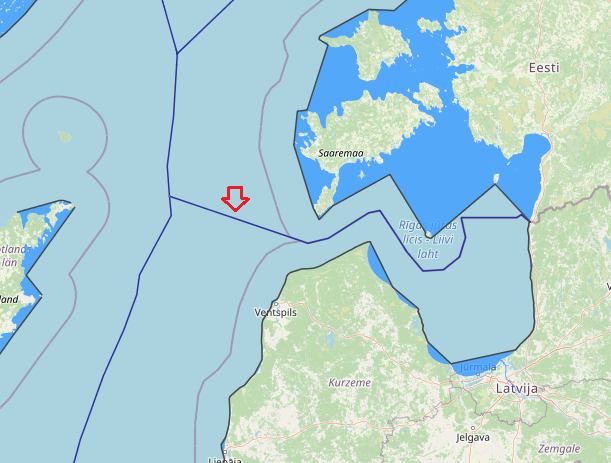
On 12 July 1996, Estonia and Latvia also concluded a treaty on the maritime delimitation in Gulf of Riga, the Strait of Irbe and the Baltic Sea. The delimitation line was influenced by the specific geographical configuration of the costs and historical considerations. The existence of a historic boundary between Estonia and Latvia which was established during the 1920’s was also taken into account.
View More maritime boundaries between Latvia and Estoniamaritime boundaries between Latvia and Sweden
Latvia and Sweden maritime boundaries based on Agreement on the delimitation of the continental shelf and of the Swedish fishery zone and the Soviet economic zone in the Baltic Sea, which it is make the border line by median-equidistance line method. also, agreement between the Government of the Republic of Estonia, the Government of the Republic of Latvia and the Government of the Kingdom of Sweden related to the Common Maritime Boundary Point in the Baltic Sea, 30 April 1997. This agreement entered into force on 20 February 1998.
View More maritime boundaries between Latvia and Swedenmaritime boundaries between Latvia and Lithuania
All of Baltic maritime agreements, except the one between Latvia and Lithuania, have moreover entered into force by now. the Latvia-Lithuania Agreement is first of all an overall maritime boundary agreement, including the territorial sea, exclusive economic zone as well as the continental shelf. Secondly, it added English to the languages of the parties as an authentic text of the agreement. The latter is a rather new development in the Baltic Sea, which started to manifest itself after the dissolution of the former Soviet Union with respect to delimitation agreements directly related to this particular phenomenon. Up to the middle of the 1990s maritime delimitation agreements in this region had always been drafted in the respective languages of the parties only, these texts being equally authentic. Not one single exception to this rule existed. Since the middle of the 1990s this is already the fourth agreement which added English as a supplementary authentic text. What all of them, moreover, have in common is that in case problems of interpretation arise among the different authentic languages, the English language text shall prevail. No difficulty therefore arose when reproducing the English text in Annex 2.
View More maritime boundaries between Latvia and Lithuaniamaritime boundaries between Sweden and Lithuania
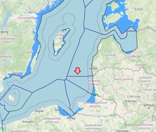
The Agreement between the Government of Lithuania and the Government of Sweden concerning Delimitation of the Maritime Boundary of the Exclusive Economic Zone and the Continental Shelf in the Baltic Sea was initialed at the meeting of delegations of Lithuania and Sweden on 23 December 2014 in Vilnius. The countries plan to sign the agreement in 2014. The Lithuanian-Swedish maritime boundary, which has a length of about 15 kilometers, is being delimited for the first time in history. The agreement establishes a single maritime boundary, dividing the continental shelf and exclusive economic zones (EEZ) between the parties. The boundary extends for a distance of about 8 nautical miles (M) and consists of four turning points, of which one is also a definitive terminal point. The northern terminal point, on the other hand, stops just short of the hypothetical tripoint that will have to be settled by means of direct negotiations between all the parties concerned, including Latvia.
View More maritime boundaries between Sweden and Lithuaniamaritime boundaries between Russia(Kaliningrad) and Lithuania
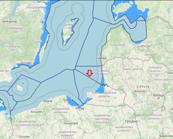
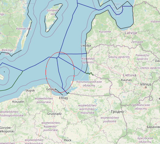
Lithuania-Russia maritime boundary in fact consists of two separate reports: one relating to the delimitation of the exclusive economic zone and the continental shelf, and one relating to the territorial sea. Treaty between the Republic of Lithuania and the Russian Federation on the Delimitation of the Exclusive Economic Zone and the Continental Shelf in the Baltic Sea, 24 October 1997.This treaty has not yet entered into force.
View More maritime boundaries between Russia(Kaliningrad) and Lithuaniaexclusive economic zone(EEZ) map of the world
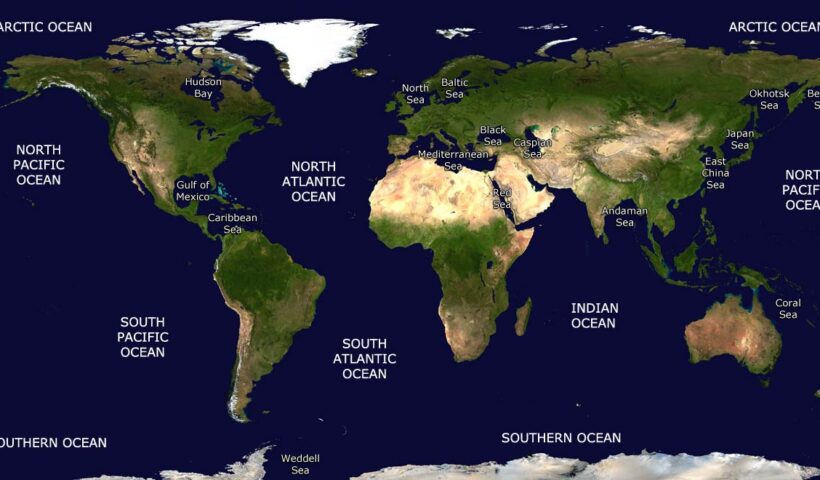
Extending beyond this point and reaching up to 200 nautical miles (370.4 km) from a country’s coast lies its Exclusive Economic Zone. Within this region, a country owns the natural resources at the seafloor but has no say on what happens at the surface. Any ships in an Exclusive Economic Zone are essentially in international waters. This map of the week features the Exclusive Economic Zones of EU Countries for which a regulatory text exists in UN’s Convention on the Law of the Sea1. Note that such a text does not exist for the EEZ of some EU countries (e.g. UK, Italy, and Greece) and these are currently not shown on the map.
View More exclusive economic zone(EEZ) map of the worldBorder of seas and oceans in the earth(sea and oceans boundaries)
This dataset represents the boundaries of the major oceans and seas of the world. The source for the boundaries is the publication ‘Limits of Oceans & Seas, Special Publication No. 23’ published by the IHO in 1953. The dataset was composed by the Flanders Marine Data and Information Centre.
View More Border of seas and oceans in the earth(sea and oceans boundaries)maritime boundaries between Russia(Kaliningrad) and Poland
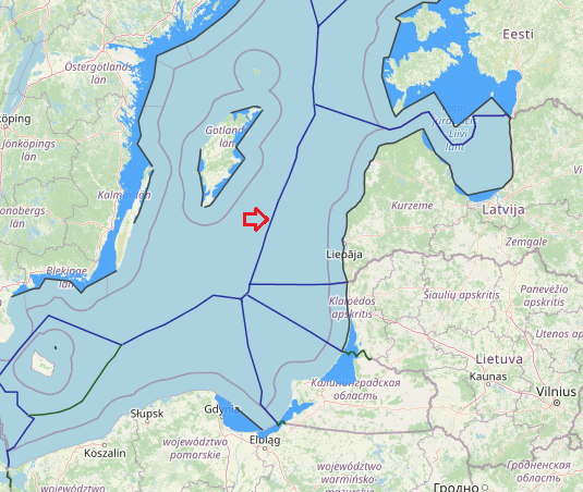
The continental shelf boundary between Poland and the Soviet Union extends for a distance of 77.5 n.m. with an average length of 19.4 n.m. for each segment of the boundary. The entire area covered by the Agreement lies on the continental shelf of the Baltic Sea. The average depth along the CSB is about 50 fathoms.
View More maritime boundaries between Russia(Kaliningrad) and PolandMaritime boundaries between Poland and Sweden
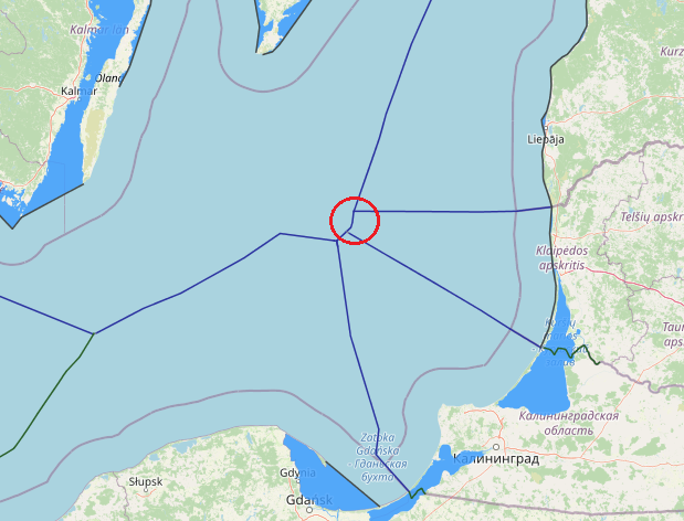
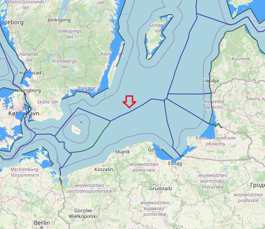
An median line-equidistance-based maritime boundary between Sweden and Poland would extend generally from a Denmark-Poland-Sweden tripoint to Russia-Poland-Sweden. The agreement between the Government of the Kingdom of Sweden, the Government of the Polish People’s Republic and the Government of the USSR concerning the Common Delimitation Point of their Maritime Boundaries in the Baltic Sea several key tripoints in the Baltic have been finalised through agreements between Poland, Sweden and the USSR (1989), Estonia, Latvia and Sweden (1997) and Estonia, Finland and Sweden (2001). The tripoint between Poland, Sweden and the former USSR, was signed on the very day that the last bilateral agreement, i.e. the one between Poland and Sweden, entered into force.
View More Maritime boundaries between Poland and SwedenMaritime boundaries between Finland and Sweden
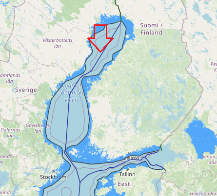
The Finland-Sweden continental shelf agreement is plotted on the attached DMA/HC charts 44030 and 44180. The official Finnish nautical charts cited in Article 6 of the Agreement were used to compute the distances between the boundary points and Finnish straight baselines. Official Swedish charts Nos. 41, 42, 51, 53, and 71 (1:200,000) were used to measure distances to the Swedish baselines.
The shelf boundary extends for a distance of approximately 419.76 nautical miles and has 17 turning or terminal points. The boundary runs the entire length of the Gulf of Bothnia, through the narrow Aland Sea, and into the northernmost part of Baltic Sea.
Maritime boundaries between Norway and Russia
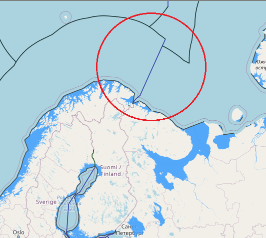
Norway and Russia have delimited their maritime jurisdiction in the maritime areas north of their land boundary. Norway and the former Soviet Union concluded a maritime boundary agreement in 1957 delimiting the territorial sea and continental shelf within Varangerfjorden, a fjord lying seaward of the Norway-Soviet land boundary. The 1957 agreement was superseded by a 2007 agreement between Norway and Russia that delimited the territorial sea, continental shelf, and EEZ in the Varangerfjorden area. This boundary extends from the terminus of the land boundary to an area just seaward of the mouth of Varangerfjorden and is composed of geodetic lines connecting six points, with a total length of approximately 39 M. The agreement contains provisions pertaining to the existence of possible hydrocarbon deposits extending across the boundary line.
Norway and Russia concluded a maritime boundary agreement in 2010 delimiting the EEZ and continental shelf of the two countries in the Barents Sea and Arctic Ocean. The boundary is composed of geodetic lines connecting eight points, with a total length of approximately 907 M. The boundary begins at the terminus of the Varangerfjorden boundary (in the south) agreed in 2007 and terminates in the Arctic Ocean at the point where the last boundary segment (between boundary points 7 and 8) intersects with a line connecting the continental shelf limits of both countries “as established in accordance with Article 76 and Annex II of the Convention.” The 2010 boundary separates the maritime zones generated by the mainland coasts of both countries and also by Svalbard (to the west) and Russia’s Franz Josef Land and Novaya Zemlya (to the east).
Maritime boundaries between Norway and Sweden
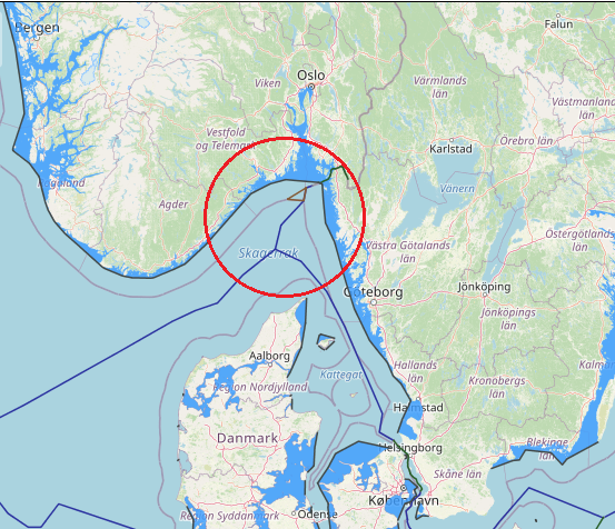
The territorial sea boundary between Norway and Sweden also has a long history having been delimited through an arbitral award of 23 October 1909 following earlier agreements in 1661, 1897 and 1904. By virtue of a compromise signed on March 14, 1908, Norway and Sweden decided to submit to arbitration the question of the maritime boundary between the two countries, insofar as it was not settled by the Resolution royal of March 15, 1904 . The Tribunal constituted for the purposes of this arbitration was called upon to decide whether the frontier line had been fixed either entirely or in part by the Treaty of 1661, and if not, to fix this line taking into account the circumstances of fact and principles of international law. It was composed as follows: Mr. JA Loeff, from the Netherlands; MFVN Beichmann, from Norway, and MK Hj. L. Hammarskjôld, from Sweden. Alone, the latter was a member of the Permanent Court of Arbitration in The Hague. The Tribunal sat from August 28 to October 18, 1909, and meanwhile visited the disputed area. He rendered his award dated October 23, 1909. By this award, the Tribunal determined the maritime boundary between Norway and Sweden, in application of the principles in force in the two countries at the time of the conclusion of the original delimitation treaty. and in view of several long-standing factual circumstances. Settlement of the question of the maritime boundary between Norway and Sweden – Competence of the Tribunal determined by the interpretation of the Compromis – Maritime territory as essential appurtenance of land territory a fundamental principle of International Law – Median line – Thalweg – Historic title. Sweden established an EEZ in 1993 which in the North Sea follows the previously agreed continental shelf boundary with Norway.
View More Maritime boundaries between Norway and Swedenmaritime boundaries between Portugal and morocco
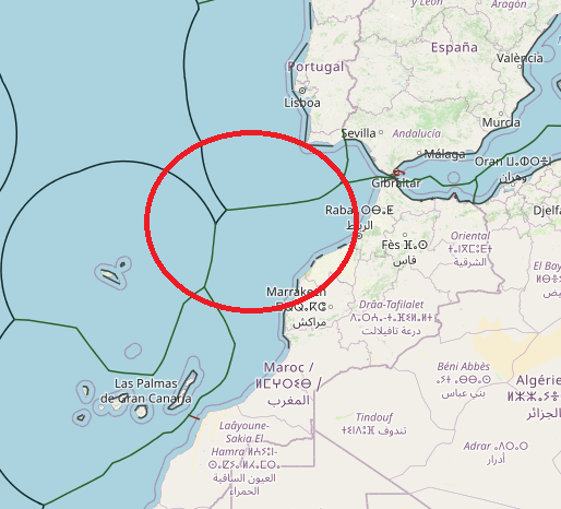
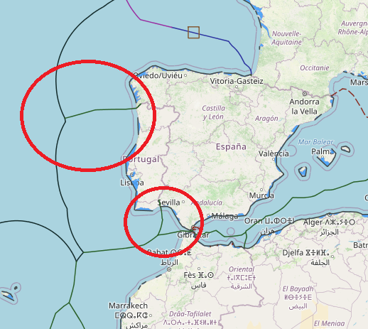
morocco and Portugal doesn’t achieve to any agreement about maritime borders or boundaries yet. all their delimitation based on national legislation which is in connection to median line-equidistance system. their most subjects in maritime boundaries related to exclusive economic zone and continental shelf area. According to several Spanish media outlets, Morocco does not have the right to delimit its maritime borders without authorization from both Spanish and Portuguese authorities.
View More maritime boundaries between Portugal and moroccomaritime boundaries between Spain and morocco
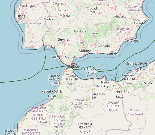
The pending maritime delimitations between Spain and Morocco are highly complex and noteworthy due to the existence of diverse factors, namely the particularity that the delimitations shall be conducted in two different seas: the Alboran Sea and the Atlantic Ocean. Moreover, various sovereignty issues must be addressed, such as the Spanish enclaves in North Africa, which are claimed by Morocco generating maritime entitlements, and the Western Sahara dispute and Morocco’s intention to include the Western Sahara maritime areas under its jurisdiction. In terms of the latter issue, this article studies the fisheries agreements concluded between the European Union and Morocco and the recent decisions given by the Court of Justice of the European Union, declaring those agreements prohibited under international law in respect of Western Sahara waters. Other significant matters analyzed are the views of both countries, the existence of several overlapping maritime claims with third States and the negotiations that have been carried out thus far to reach an agreement delimiting the maritime boundaries. On this subject, it is crucial to determine whether a tacit agreement exists – on the basis of the hydrocarbon activities licensed by Spain and Morocco – establishing the maritime boundary between the Canary Islands and Morocco’s Atlantic coast.
View More maritime boundaries between Spain and moroccomaritime boundaries between Spain and Portugal
In 1976, Spain and Portugal concluded two treaties delimiting the territorial sea, contiguous zone, and continental shelf between the two States in the Atlantic Ocean. However, these treaties have not entered into force. The two countries have additional unresolved maritime boundaries, including with respect to the Canary Islands (Spain) and the Madeira Islands (Portugal). Spain’s Royal Decree of 1977 establishes a straight baseline system for its mainland coast that consists of 84 points and 75 segments. it seems that “Portugal is now opposed to ratification and favors the equidistant line for both boundaries”
View More maritime boundaries between Spain and Portugalmaritime boundaries between Denmark and Poland
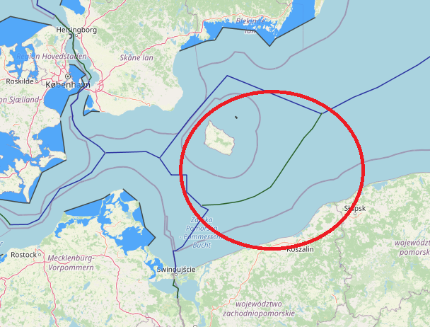
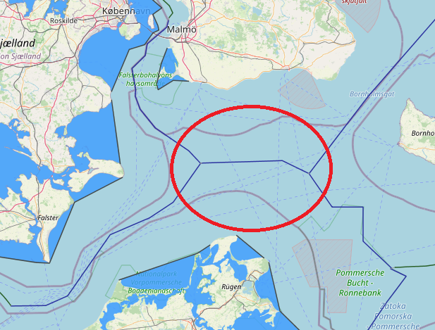
An equidistance-based maritime boundary between Denmark (Bornholm) and Poland would extend generally eastwards then northeast for approximately 70 nm to a Denmark-Poland-Sweden tripoint in the vicinity of the western terminus
of the Poland-Sweden continental shelf and fishing zones boundary of 1989. Article 2 of the 1989 treaty defines the western end of the boundary, Point A, as being located at 55° 21,640’ N, 16° 32,000’ E. West of Point A it is stated that the boundary ‘shall extend as far as the points on which agreement is reached with any third State concerned’. Thus, the western tripoint with Germany appears to be somewhat better defined than that with Sweden, though neither should present the parties with particular difficulties as equidistance is accepted as the basis for the Denmark (Bornholm)-Poland delimitation.
maritime boundaries between Denmark and Sweden
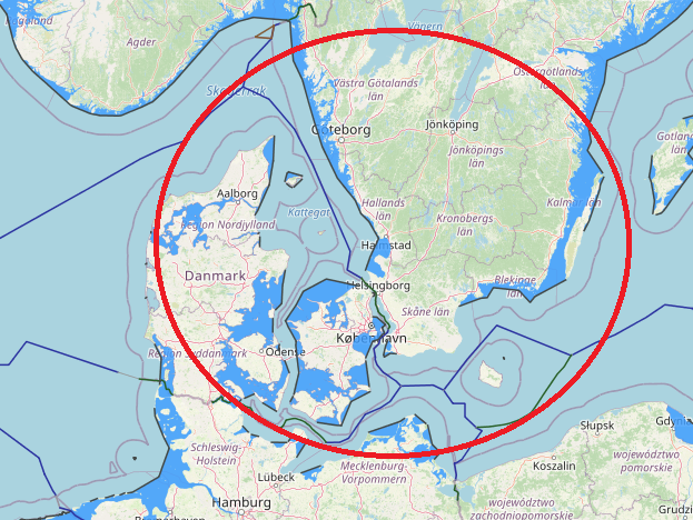
Denmark and Sweden maritime boundaries(in territorial sea and continental shelf) based on equidistance-median line system. on 30 January 1932, Denmark and Sweden concluded a territorial sea boundary stretching 63nm through the Oresund. The territorial waters (12 nautical miles) of Denmark form a border with Sweden along the Øresund, extending to 115 km.
View More maritime boundaries between Denmark and Swedenmaritime boundaries between Denmark and Norway
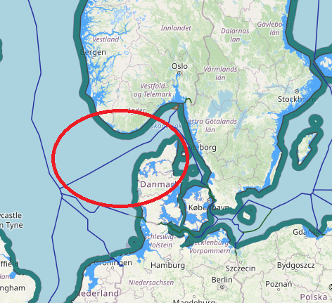
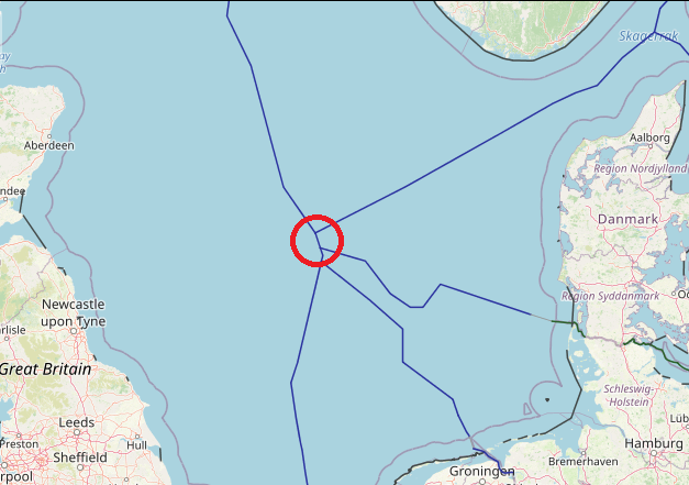
the common principle for delimitation of maritime boundaries between Norway and Denmark based on median and equidistance line. they have many faced place against together which many of them solved via agreements and one of them solved by ICJ decision. The border between the Danish and Norwegian EEZ runs along the Skagerrak, between Faroer and Norway in the North Sea and between Greenland and Norwegian Svalbard in the Arctic. in below see their agreements and ICJ judgement in Jan Mayen and green land case.
View More maritime boundaries between Denmark and Norwaymaritime boundaries between Denmark and Great Britain
In 1963 Denmark was the first mainland state to surround an overseas archipelago, the Faroe Islands, with a set of straight baselines. The archipelago has…
View More maritime boundaries between Denmark and Great Britainmaritime boundaries between Germany and Poland
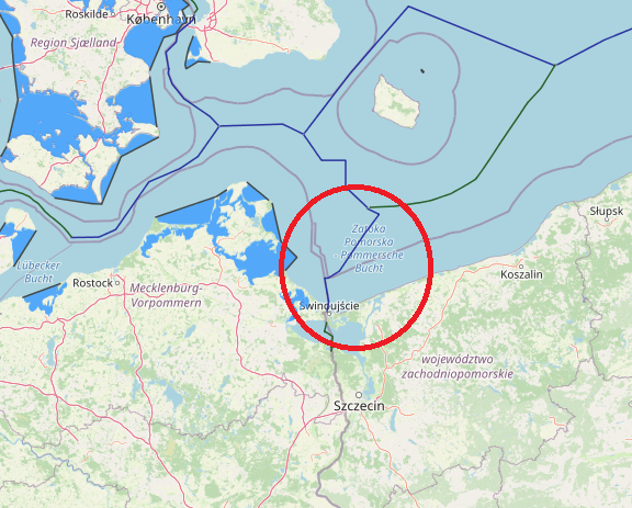
The Agreement between the German Democratic Republic and Poland signed in 1989 provides for a single maritime boundary for both the continental shelf and the fishing zone which is different from the boundary established for the continental shelf under the previous Agreement of 1968.
View More maritime boundaries between Germany and Polandmaritime boundaries between Germany and Sweden
maritime boundaries between Germany and Sweden
View More maritime boundaries between Germany and Swedenmaritime boundaries between Germany and Denmark
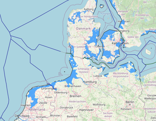
The Kingdom of Denmark has existed with its current territory since 1920. The only land border of Denmark (proper) is that with Germany, with a…
View More maritime boundaries between Germany and Denmarkmaritime boundaries between Germany and Great Britain
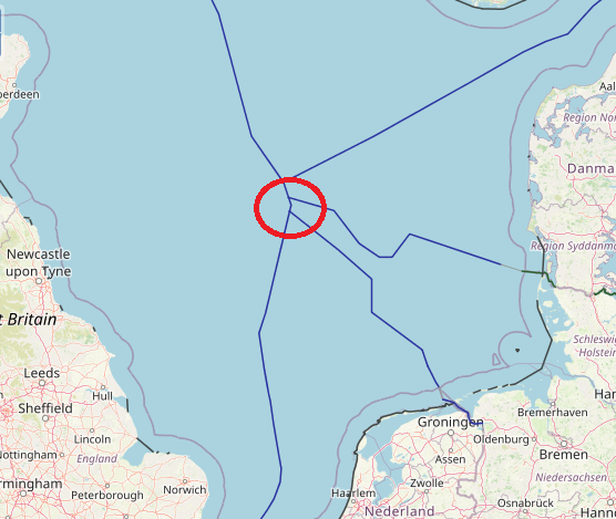
In the North Sea, there exists a comprehensive network of continental shelf boundaries – something that can be attributed to the positive and close relationships…
View More maritime boundaries between Germany and Great Britainmaritime boundaries between Netherlands and Germany
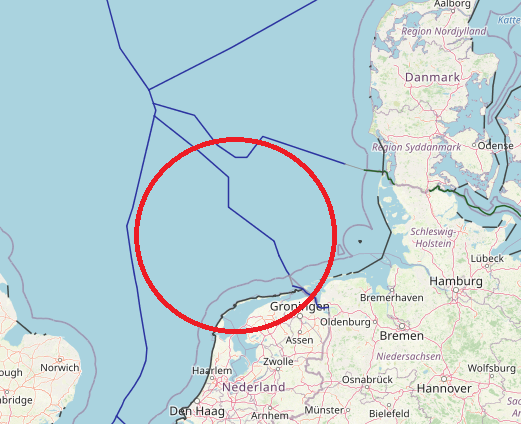
The maritime boundary with Germany for the Continental Shelf is laid down in 2 treaties: one for the Continental Shelf near the coast, and one…
View More maritime boundaries between Netherlands and Germanymaritime boundaries between Great Britain and Netherlands
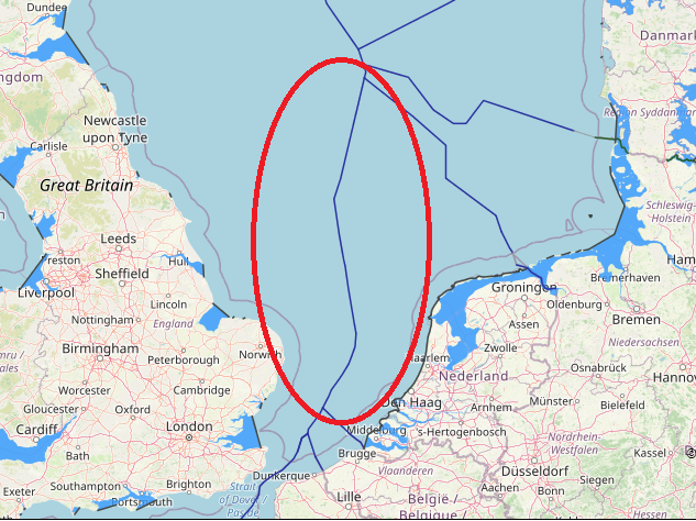
maritime boundaries between Great Britain and Netherlands, Great Britain, Great Britain continental shelf map, Great Britain exclusive economic zone map, Great Britain internal and territorial waters map, Great Britain maritime claims, netherlands, Netherlands boundaries in the North Sea, Netherlands continental shelf map, Netherlands EEZ map, Netherlands exclusive economic zone map, Netherlands internal waters map, Netherlands maritime boundaries, Netherlands maritime claims\, Netherlands straight baseline, Netherlands territorial sea map, Netherlands territorial waters map, UK, UK continental shelf map, UK EEZ map, UK exclusive economic zone map, UK internal waters map, UK maritime boundaries, UK maritime claims, UK territorial waters map
View More maritime boundaries between Great Britain and Netherlandsmaritime boundaries between Belgium and Netherlands
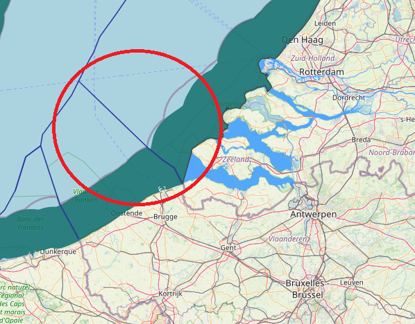
maritime boundaries between Belgium and Netherlands, The Agreement of 1996 between Belgium and the Netherlands delimiting the continental shelf provided that “If one of the Contracting Parties decides to establish an exclusive economic zone, the coordinates, as indicated in Article 1, shall be used for its lateral delimitation.” In the absence of such a provision or a subsequent agreement, it cannot be assumed that a boundary agreed for the continental shelf necessarily applies equally to an EEZ if one has been proclaimed.
View More maritime boundaries between Belgium and Netherlandsmaritime boundaries between Belgium and Great Britain
maritime boundaries between Belgium and Great Britain,
View More maritime boundaries between Belgium and Great Britainmaritime boundaries between France and Belgium
Belgium faces the sea for about 4.5% of its total boundaries. Its outlet to the southern North Sea, as a result, only measures 66.5 km.…
View More maritime boundaries between France and Belgiummaritime boundaries between France and U.K(Great Britain and northern Ireland)
The border between the countries of France and the United Kingdom in Europe is a border that stretches along the Channel, the North Sea, the…
View More maritime boundaries between France and U.K(Great Britain and northern Ireland)
