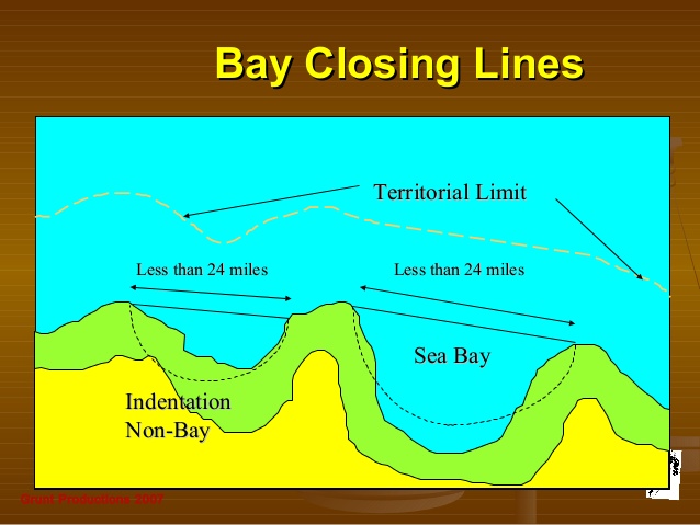
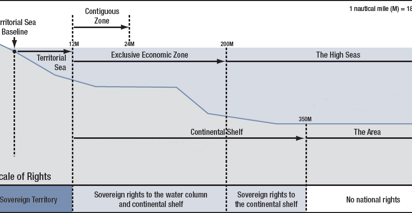
Extending beyond this point and reaching up to 200 nautical miles (370.4 km) from a country’s coast lies its Exclusive Economic Zone. Within this region, a country owns the natural resources at the seafloor but has no say on what happens at the surface. Any ships in an Exclusive Economic Zone are essentially in international waters. This map of the week features the Exclusive Economic Zones of EU Countries for which a regulatory text exists in UN’s Convention on the Law of the Sea1. Note that such a text does not exist for the EEZ of some EU countries (e.g. UK, Italy, and Greece) and these are currently not shown on the map.
View More exclusive economic zone(EEZ) map of the worldexclusive economic zone(EEZ) map of the world
IILSS 23rd May 2021 No Comments At what distance will you find exclusive economic zone?EEZexclusive economic zoneexclusive economic zone distanceexclusive economic zone exampleexclusive economic zone(EEZ)Exclusive Economic Zones of the Worldhigh resolution world maphigh resolution world map blankhigh-resolution world map satelliteHow far out to sea does a country own?importance of exclusive economic zoneIs EEZ an international water?VisibleEarth High Resolution MapWhat is the EEZ?Where is the exclusive economic zone?Which country has the largest EEZ?Which country has the smallest EEZ?World Map HD ImageWorld Map HD Pictureworld map high resolution download