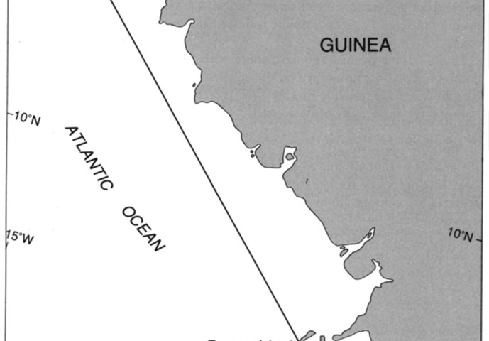
An egregious breach was committed by Guinea in its Decree of 1964 which purported to establish a single straight baseline of 120 n.m. enclosing its entire coastline (see Fig. 5.14). The Guinean coastline is somewhat indented in localities, but it certainly does not pass muster under any interpretation of the “deeply indented and cut into” language of Article 4 (LOSC Article 7). To view Sene Island in the north and Tamara Island in the south as together constituting an island fringe is also to misapprehend that requirement as it is used in the Convention. The islands have no spatial relationship to one another nor are they within 12 n.m. of the coast. Having failed to meet either geographical test under Article 4(1) (LOSC Article 7(1)), it hardly mattered that the baseline followed the general direction of the coast.
STATE CLAIMS IN VIOLATION OF ARTICLE 4 (LOSC ARTICLE 7), Guinea case, Guinea, Guinea-Bissau, Guinean coastline, maritime boundary, north and Tamara Island, straight baseline

