The law of the sea is a body of public international
law governing the geographic jurisdictions of coastal
States and the rights and duties among States in the
use and conservation of the ocean environment and its
natural resources. The law of the sea is commonly
associated with an international treaty, the Convention
on the Law of the Sea (UNCLOS), negotiated
under the auspices of the United Nations, which was
signed in 1982 by 117 States and entered into force in
At present 133 States have signed and ratified
UNCLOS;
Month: June 2022
what is the meaning of TSUNAMI?
Tsunami is a Japanese word that is made of two
characters: tsu and nami. The character tsu means
harbor, while the character nami means wave.
Therefore, the original word tsunami describes large
wave oscillations inside a harbor during a ‘tsunami’
event. In the past, tsunami is often referred to as
‘tidal wave’, which is a misnomer. Tides, featuring
the rising and falling of water level in the ocean in a
daily, monthly, and yearly cycle, are caused by
gravitational influences of the moon, sun, and planets.
Tsunamis are not generated by this kind of
gravitational forces and are unrelated to the tides,
although the tidal level does influence a tsunami
striking a coastal area.
ABOUT ANTARCTIC FISHES
The Southern Ocean ichthyofauna is relatively sparse
and unusual in composition, consisting of 213
species belonging to only 18 families
About the Baltic Sea
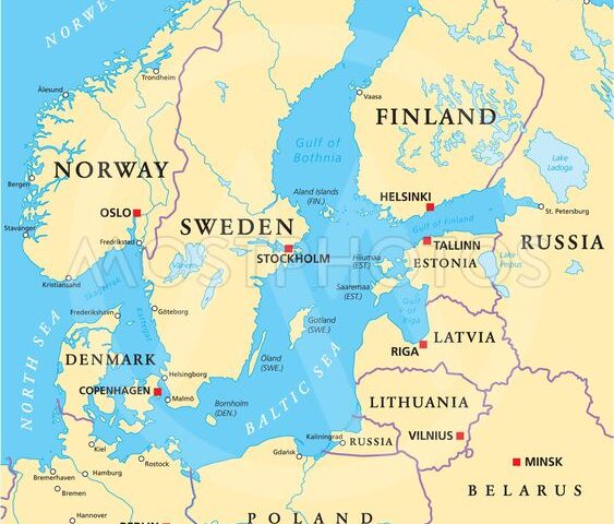
Etymology. The first to name it the Baltic Sea (“Mare Balticum”) was 11th century German chronicler Adam of Bremen. The origin of the name is speculative. He may have based it on the mythical North European island Baltia, mentioned by Xenophon. The Baltic Sea is surrounded by nine countries: Denmark, Germany, Poland, Lithuania, Latvia, Estonia, Russia, Finland and Sweden. As long as people have lived here, the Baltic Sea has served as an avenue to connect the bordering countries and as a source of human livelihood. The largest expanse of brackish water in the world, the semienclosed and relatively shallow Baltic Sea is of great interest to scientists, while to historians it represents the economic core of the Hanseatic League, the great medieval trading group of northern European ports.
View More About the Baltic SeaAbout the North Sea
Few of the world’s seas have come under such environmental pressure as the Baltic and North seas. Both seas are surrounded by cities, ports, and industry and some of the most intensively farmed land in the world. The North Sea has long been important as one of Europe’s most productive fisheries. It also serves as a prominent shipping zone among European countries and between Europe and the Middle East.
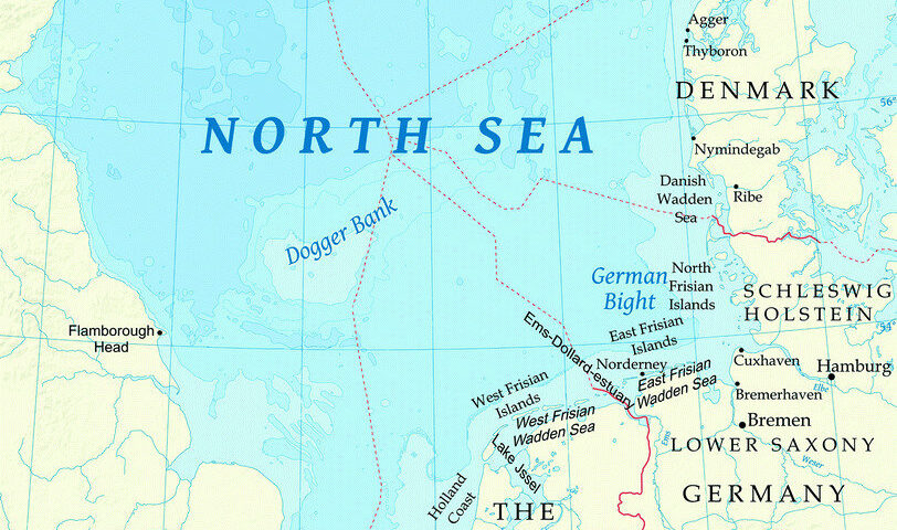
The North Sea (historically also known as the German Ocean) is a part of the Atlantic Ocean, located between Norway and Denmark in the east, Scotland and England in the west, and Germany, the Netherlands, Belgium and France in the south. The North Sea is bounded by the coastlines of England, Scotland, Norway, Sweden, Denmark, Germany, the Netherlands, Belgium and France, and by imaginary lines delimiting the western approaches to the Channel (5°W), the northern Atlantic between Scotland and Norway (62°N, 5°W), and the Baltic in the Danish Straits.
About suez Canal Invasion
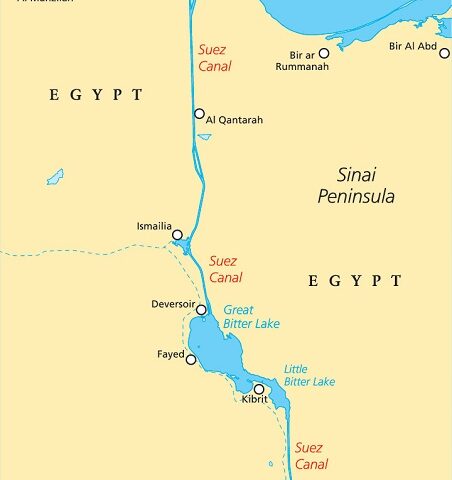
The canal is operated and maintained by the state-owned Suez Canal Authority (SCA) of Egypt. The Suez Canal is a man-made waterway connecting the Mediterranean Sea to the Indian Ocean via the Red Sea. It enables a more direct route for shipping between Europe and Asia, effectively allowing for passage from the North Atlantic to the Indian Ocean without having to circumnavigate the African continent. In 1854, Ferdinand de Lesseps, the former French consul to Cairo, secured an agreement with the Ottoman governor of Egypt to build a canal 100 miles across the Isthmus of Suez. The Suez Canal is a human-made waterway that cuts north-south across the Isthmus of Suez in Egypt. The Suez Canal connects the Mediterranean Sea to the Red Sea, making it the shortest maritime route to Asia from Europe. Since its completion in 1869, it has become one of the world’s most heavily used shipping lanes.
View More About suez Canal InvasionAbout the Mediterranean
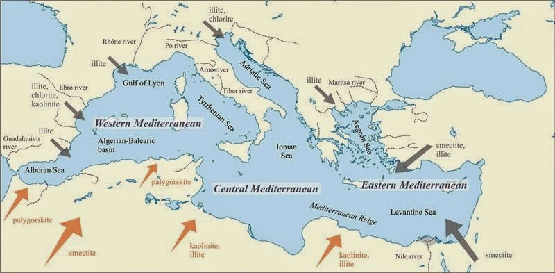
Geologists once thought that the Mediterranean was a tiny remnant of the Tethys Sea, the great ocean that once separated the world’s northern and southern continents. In fact, the Black Sea is the only remnant of the Tethys in Europe. The Mediterranean has a far briefer but more complex history. Essentially, the Mediterranean is a deep basin between the converging tectonic plates of Europe, Anatolia, and Africa, and the eastern, central, and western Mediterranean have different geological histories, which is why today, the east is earthquake prone, the centre is dotted with active volcanoes, and the west is relatively quiet.
View More About the MediterraneanThe Seas of Europe
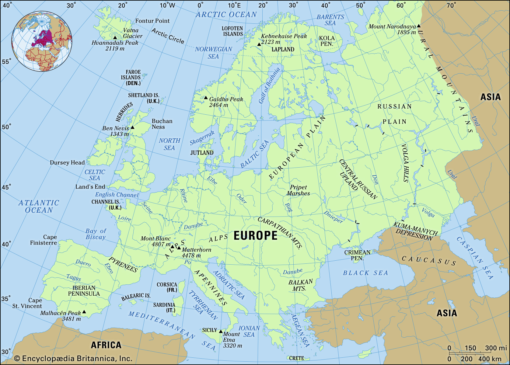
Europe is surrounded by seas, none of them large or very deep, but they are hugely rich ecologically and culturally. The continent is bound by the Atlantic, the Arctic Ocean, the Black Sea and the Mediterranean. The Baltic is entirely within Europe. Each of these is subdivided into smaller seas and straits.
View More The Seas of EuropeThe Midnight Zone at the oceans
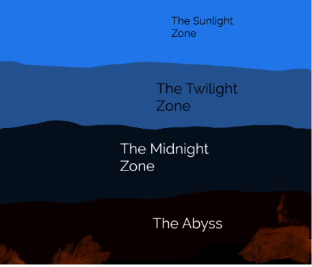
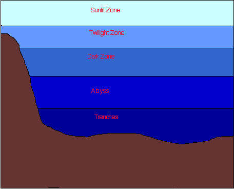
The Midnight Zone is the part of the ocean where more than 75 percent of all the ocean’s water lies. It starts at 3,281 feet below the surface and goes all the way to a depth of 13,124 feet (1,000–4,000 meters). That’s almost 3 miles!
View More The Midnight Zone at the oceanswhat is the meaning of Thermocline?
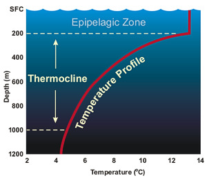
The thermocline is a layer of water in the twilight zone of the ocean where the water temperature drops really quickly. The sun’s light and warmth keep the sunlight zone pretty warm, and the wind and waves mix that warmth to a certain depth, around 330 feet (100 meters). But below the sunlight zone the water temperature starts dropping quickly. The temperature difference from the top of the thermocline to the bottom can be as great as almost 60 degrees Fahrenheit (about 20 degrees Celsius). Below about 1,000 feet (300 meters), the ocean temperatures stay pretty much the same.
View More what is the meaning of Thermocline?what is below the Surface of the ocean?
Oceanographers usually divide ocean waters into separate layers, called zones, from the surface all the way to the seafloor. Zones are based on the amount of sunlight that can penetrate the water’s layers and have appropriate names: the sunlight zone, the twilight zone, and the midnight zone. We know most about the upper layers of the ocean, because that’s where humans are most able to explore. Those layers are also where most sea life can be found.
View More what is below the Surface of the ocean?Why Ocean is salty?
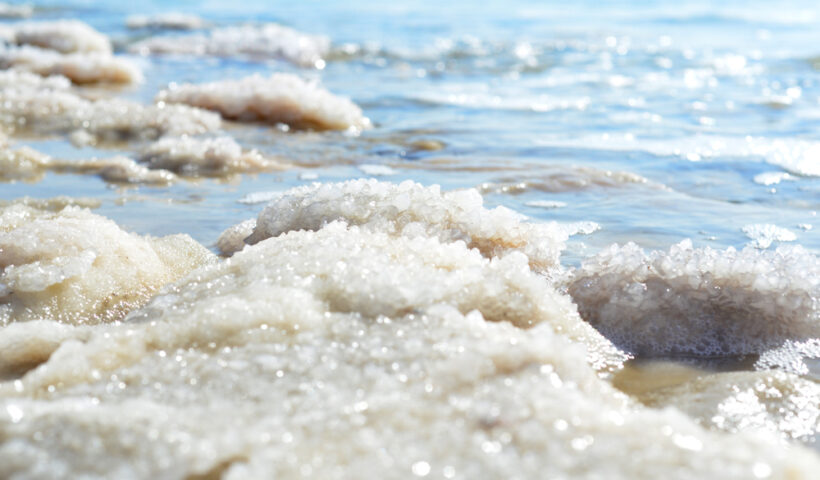
If you’ve ever swum in the ocean, you’ve probably tasted a mouthful of seawater. It’s pretty salty. In fact, it’s 220 times more salty than freshwater. Th t’s a lot of salt! And scientists have wondered for a long time why the oceans contain so much salt. After all, freshwater pours into the oceans from rivers all over the world 365 days each year, and millions of gallons of water fall on the oceans as rain all the time. But that’s actually part of the reason why the sea got so salty in the first place, and stays salty now.
View More Why Ocean is salty?About the Arctic Ocean
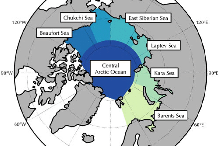
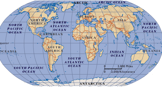
The Arctic Ocean is the smallest and shallowest ocean in the world. It is also almost completely landlocked— surrounded by North America, Europe, and northern Asia.
View More About the Arctic OceanAbout the Southern Ocean
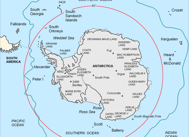
The Southern Ocean surrounds the continent of Antarctica. Th e Southern Ocean wasn’t an “official” ocean until 2000. Until then, it was usually called the Antarctic Ocean, and was considered a polar region of the other three major oceans. But scientists realized that the winds that blow around the continent of Antarctica are so strong that the surface currents of the Southern Ocean qualify it as its own ocean. Th e Southern Ocean’s official boundaries are all the waters that lie south of 60 degrees south latitude.
View More About the Southern OceanAbout the Indian Ocean
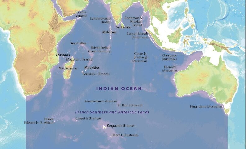
The Indian Ocean is located mostly in the Southern Hemisphere, between Africa, southern Asia, Australia, and Antarctica. It’s the third-largest ocean, and holds about 20 percent of the world’s ocean waters. The Indian ocean is named after India because: India holds a central location which is at the head of the Indian Ocean. India in ancient times was an important location in the Indian Ocean which connected Europe with countries of Southeast Asia.
View More About the Indian OceanAbout the Atlantic Ocean
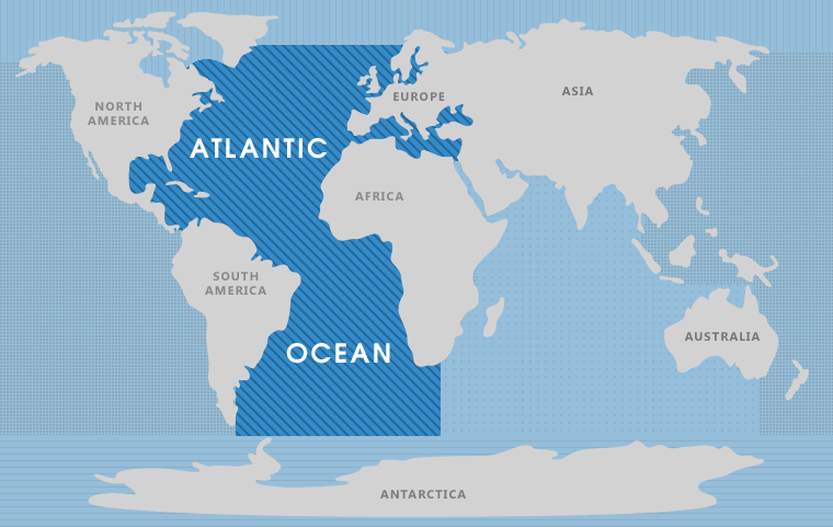
The Atlantic Ocean is the second-largest ocean in the world, about half the size of the Pacific. It is shaped like an “S” and separates Europe and Africa from North and South America.
Th e Atlantic Ocean is home to the world’s longest mountain range, called the Mid-Atlantic Ridge, which stretches 10,000 miles (16,000 kilometers) under the ocean from Iceland all the way to the southern tip of Africa.
About the Pacific Ocean
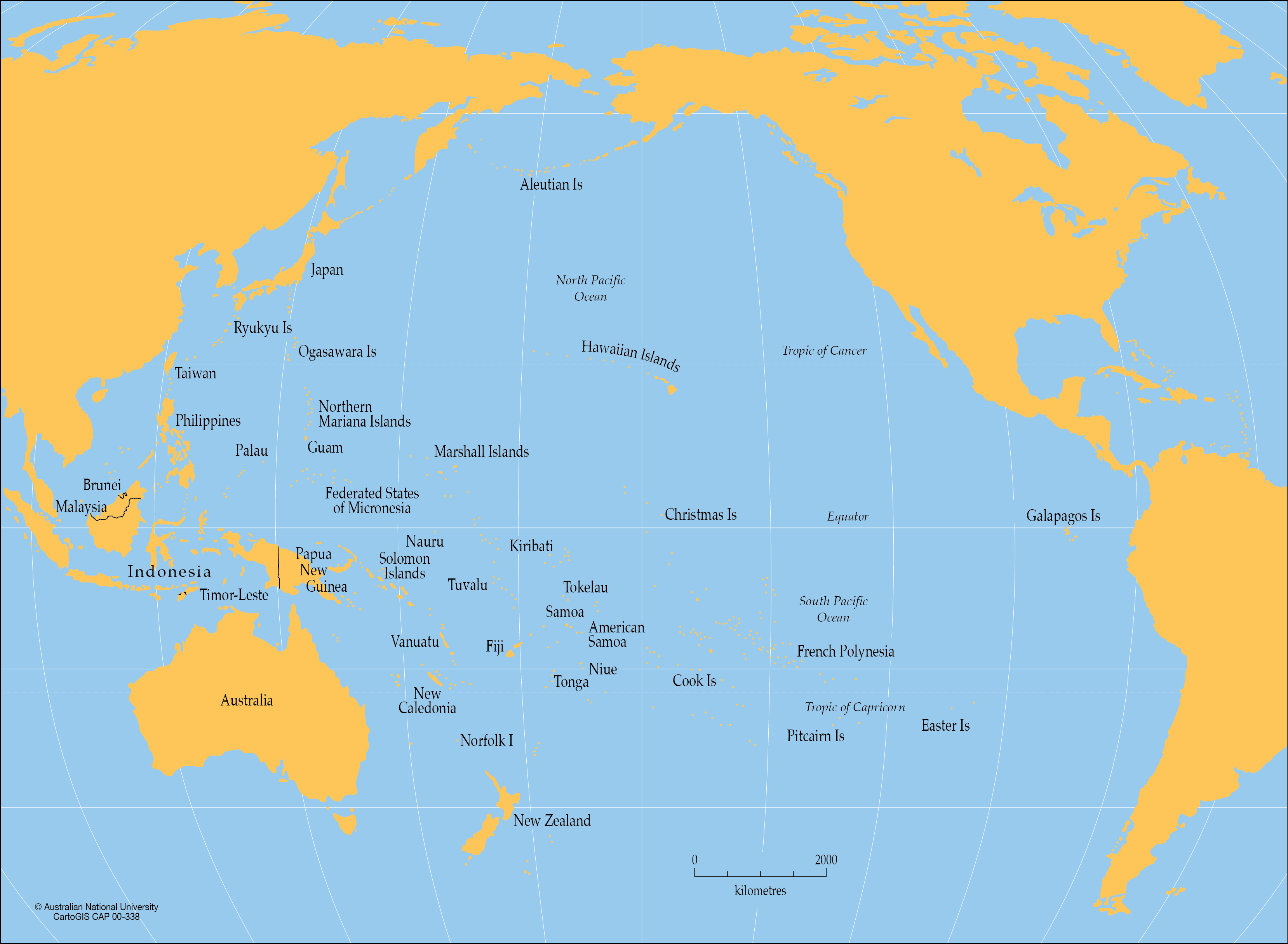
The Pacific Ocean is the largest ocean in the world. It covers more than a third of the entire planet, and reaches from the far north of the Northern Hemisphere to the far south of the Southern Hemisphere. Th e Pacific Ocean is so big that all the continents and almost all of the other oceans could fit into it.
View More About the Pacific OceanWhat Is the Ocean?
Our planet is covered in water. The oceans cover more than two-thirds of the earth’s surface and contain almost all of the living space on the planet. That’s because the living space of the oceans is both on and below the surface. Miles below the surface.
View More What Is the Ocean?What Makes a Continent a Continent?
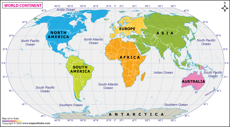
According to a 2017 paper published in the Geological Society of America’s journal, GSA Today, “The ‘Glossary of Geology’ defines a continent as ‘one of the Earth’s major landmasses, including both dry land and continental shelves.’ It is generally agreed that continents have all the following attributes: (1) high elevation relative to regions floored by oceanic crust; (2) a broad range of siliceous igneous, metamorphic and sedimentary rocks; (3) thicker crust and lower seismic velocity structure than oceanic crustal regions; and (4) well-defined limits around a large enough area to be considered a continent rather than a microcontinent or continental fragment… To our knowledge, the last point — how ‘major’ a piece of continental crust has to be to be called a continent — is almost never discussed.”
View More What Makes a Continent a Continent?SEATTLE Port info
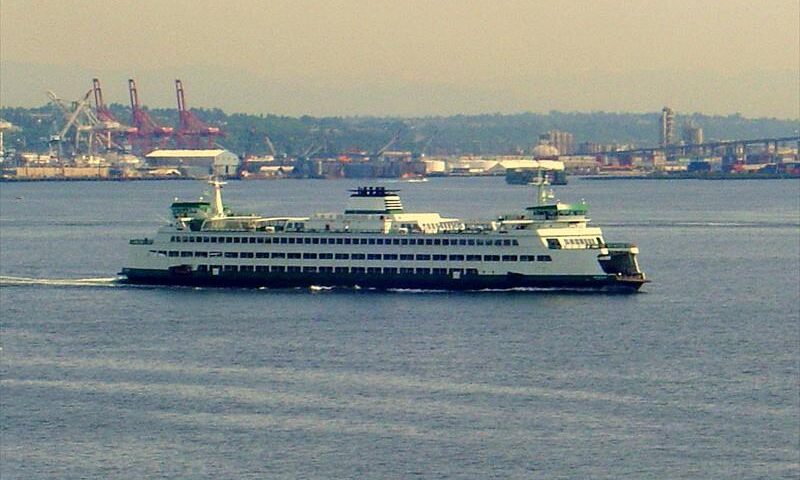
SEATTLE is located at US West Coast, US West Coast in USA at coordinates N 47° 37′ 16.30″ – W 122° 21′ 51.65″. The official UN/Locode of this port is USSEA.
View More SEATTLE Port infoHAMBURG Port info
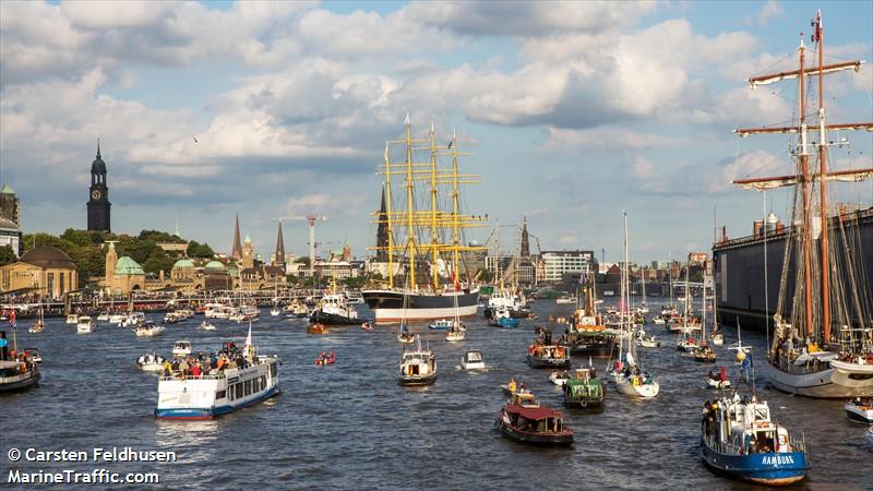
HAMBURG is located at UK Coast & Atlantic, Elbe River in Germany at coordinates N 53° 30′ 25.19″ – E 009° 57′ 42.83″. The official UN/Locode of this port is DEHAM. It is also known as DEHBU.
View More HAMBURG Port infoFORT LAUDERDALE Port info
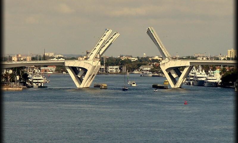
FORT LAUDERDALE is located at US East Coast, US East Coast in USA at coordinates N 26° 10′ 32.26″ – W 080° 08′ 17.07″. The official UN/Locode of this port is USFLL. It is also known as FT LAUDERDALE,LAUDERDALE,FTLAUDERDALE.
View More FORT LAUDERDALE Port infoISTANBUL Canal info
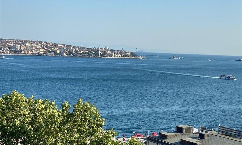
ISTANBUL is located at Black Sea, Marmara Sea in Turkey at coordinates N 41° 05′ 38.62″ – E 029° 02′ 08.75″. The official UN/Locode of this port is TRIST. It is also known as BOSPORUS,BOSPHORUS,TURKEY.
View More ISTANBUL Canal infoGUANGZHOU Port info
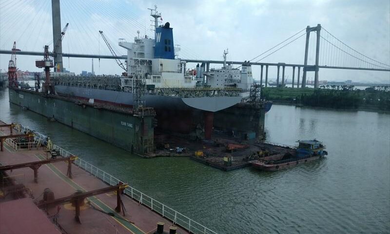
GUANGZHOU is located at South China, South China in China at coordinates N 23° 05′ 07.79″ – E 113° 25′ 30.01″. The official UN/Locode of this port is CNGZG. It is also known as GUANG ZHOU,NEIGANG,SHIGANGAO.
View More GUANGZHOU Port infoANTWERP Port info
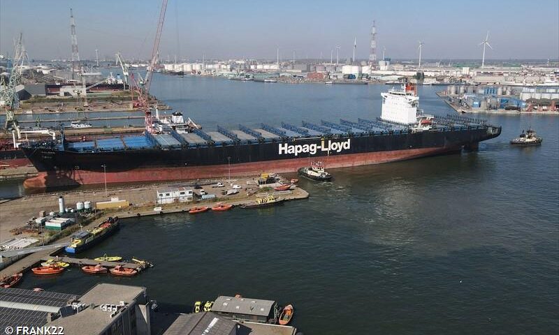
ANTWERP is located at UK Coast & Atlantic, Antwerp Area in Belgium at coordinates N 51° 18′ 08.96″ – E 004° 18′ 41.25″. The official UN/Locode of this port is BEANR. It is also known as ANTWERPEN,BEANT,ANVERS,BEAAA.
View More ANTWERP Port infoAMSTERDAM Port info
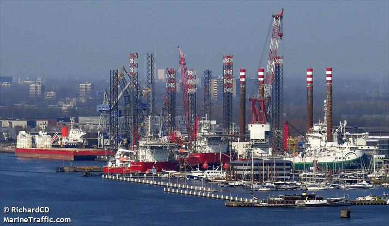
AMSTERDAM is located at UK Coast & Atlantic, North Sea in Netherlands at coordinates N 52° 22′ 14.70″ – E 004° 52′ 44.23″. The official UN/Locode of this port is NLAMS. It is also known as NLAMS.
View More AMSTERDAM Port infoHONG KONG Port info
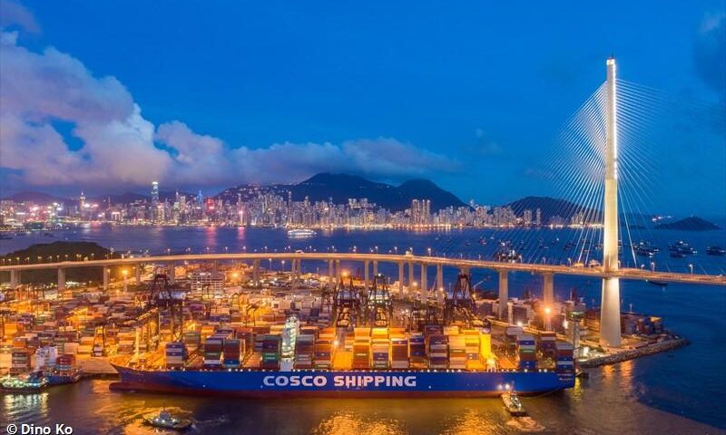
HONG KONG is located at South China, South China in Hong Kong at coordinates N 22° 17′ 16.61″ – E 114° 10′ 52.91″. The official UN/Locode of this port is HKHKG. It is also known as HONGKONG,CN HKG,XIANGGANG,XIANG GANG.
View More HONG KONG Port infoNANTONG Port info
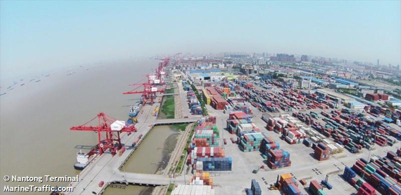
NANTONG is located at Central China, East China Sea in China at coordinates N 31° 58′ 22.94″ – E 120° 51′ 54.01″. The official UN/Locode of this port is CNNTG. It is also known as NAN TONG.
View More NANTONG Port infoSINGAPORE Port info
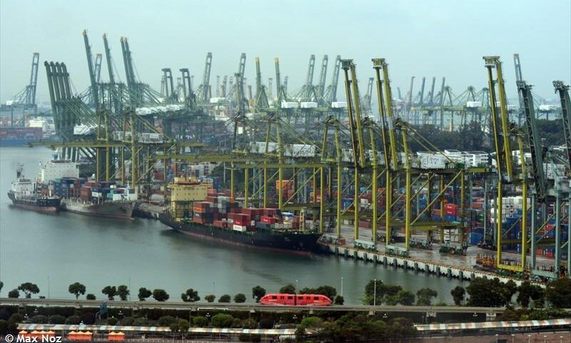
SINGAPORE is located at Indonesia, Singapore Area in Singapore at coordinates N 01° 15′ 33.71″ – E 103° 45′ 16.01″. The official UN/Locode of this port is SGSIN. It is also known as SPORE,SINGPORE,SIN EBGA,SIN PEBGA.
View More SINGAPORE Port infoNANJING Port info
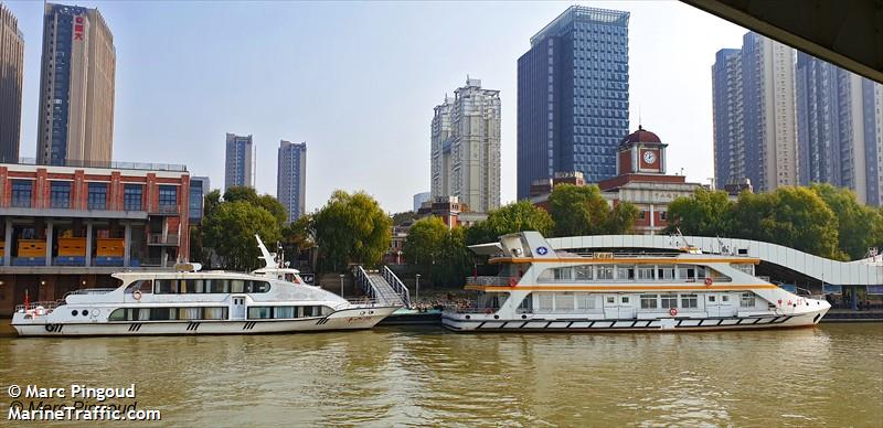
NANJING is located at Central China, East China Sea in China at coordinates N 32° 12′ 45.00″ – E 118° 48′ 43.18″. The official UN/Locode of this port is CNNKG. It is also known as NAN JING,NAN JIN,NANJIN.
View More NANJING Port infoSHANGHAI Port info
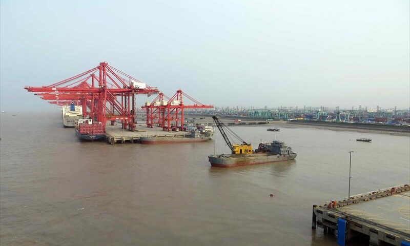
SHANGHAI is located at Central China, East China Sea in China at coordinates N 31° 21′ 58.90″ – E 121° 36′ 53.08″. The official UN/Locode of this port is CNSHG. It is also known as SHANG HAI,YANGSHAN,CNSHA,CNSGH.
View More SHANGHAI Port infoPiracy Map of the world(2019-2020-2021-2022)
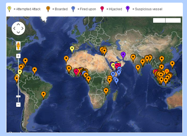
The Piracy & Armed Robbery Map below follows the definition of Piracy as laid down in Article 101 of the 1982 United Nations Convention on the Law of the Sea (UNCLOS) and Armed Robbery as laid down in Resolution A.1025 (26) adopted on 2 December 2009 at the 26th Assembly Session of the International Maritime Organisation (IMO). This maps shows all the piracy and armed robbery incidents reported to the IMB (International Maritime Bureau) Piracy Reporting Centre during 2019- 2022.
View More Piracy Map of the world(2019-2020-2021-2022)
