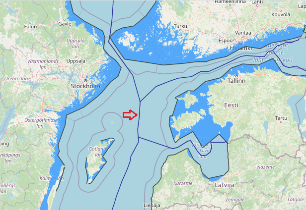
Through an Agreement of 2 November 1998 Estonia and Sweden delimited their entire maritime boundary, except for a short segment extending to the trijunction point with Finland.’ This maritime boundary had been previously delimited between Sweden and the Soviet Union in 1988. The 1998 Agreement between Estonia and Sweden adopts, with some minor technical adjustments, the boundary line established by Sweden and the Soviet Union. However, the 1998 Agreement does not make any reference to this fact. In this way the 1998 Agreement reflects the wish of Estonia not to be considered a successor state to a treaty concluded by the Soviet Union and at the same time reflects the agreement of the parties that the maritime boundary which was in place when Estonia regained its independence also forms the boundary between Estonia and Sweden.
View More maritime boundaries between Sweden and EstoniaTag: Sweden EEZ map
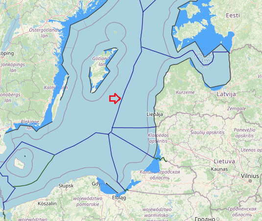
maritime boundaries between Latvia and Sweden
Latvia and Sweden maritime boundaries based on Agreement on the delimitation of the continental shelf and of the Swedish fishery zone and the Soviet economic zone in the Baltic Sea, which it is make the border line by median-equidistance line method. also, agreement between the Government of the Republic of Estonia, the Government of the Republic of Latvia and the Government of the Kingdom of Sweden related to the Common Maritime Boundary Point in the Baltic Sea, 30 April 1997. This agreement entered into force on 20 February 1998.
View More maritime boundaries between Latvia and Swedenmaritime boundaries between Sweden and Lithuania
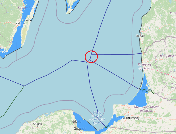
The Agreement between the Government of Lithuania and the Government of Sweden concerning Delimitation of the Maritime Boundary of the Exclusive Economic Zone and the Continental Shelf in the Baltic Sea was initialed at the meeting of delegations of Lithuania and Sweden on 23 December 2014 in Vilnius. The countries plan to sign the agreement in 2014. The Lithuanian-Swedish maritime boundary, which has a length of about 15 kilometers, is being delimited for the first time in history. The agreement establishes a single maritime boundary, dividing the continental shelf and exclusive economic zones (EEZ) between the parties. The boundary extends for a distance of about 8 nautical miles (M) and consists of four turning points, of which one is also a definitive terminal point. The northern terminal point, on the other hand, stops just short of the hypothetical tripoint that will have to be settled by means of direct negotiations between all the parties concerned, including Latvia.
View More maritime boundaries between Sweden and LithuaniaMaritime boundaries between Poland and Sweden
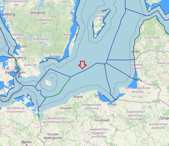
An median line-equidistance-based maritime boundary between Sweden and Poland would extend generally from a Denmark-Poland-Sweden tripoint to Russia-Poland-Sweden. The agreement between the Government of the Kingdom of Sweden, the Government of the Polish People’s Republic and the Government of the USSR concerning the Common Delimitation Point of their Maritime Boundaries in the Baltic Sea several key tripoints in the Baltic have been finalised through agreements between Poland, Sweden and the USSR (1989), Estonia, Latvia and Sweden (1997) and Estonia, Finland and Sweden (2001). The tripoint between Poland, Sweden and the former USSR, was signed on the very day that the last bilateral agreement, i.e. the one between Poland and Sweden, entered into force.
View More Maritime boundaries between Poland and SwedenMaritime boundaries between Finland and Sweden
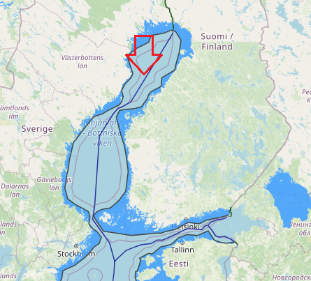
The Finland-Sweden continental shelf agreement is plotted on the attached DMA/HC charts 44030 and 44180. The official Finnish nautical charts cited in Article 6 of the Agreement were used to compute the distances between the boundary points and Finnish straight baselines. Official Swedish charts Nos. 41, 42, 51, 53, and 71 (1:200,000) were used to measure distances to the Swedish baselines.
The shelf boundary extends for a distance of approximately 419.76 nautical miles and has 17 turning or terminal points. The boundary runs the entire length of the Gulf of Bothnia, through the narrow Aland Sea, and into the northernmost part of Baltic Sea.
Maritime boundaries between Norway and Sweden
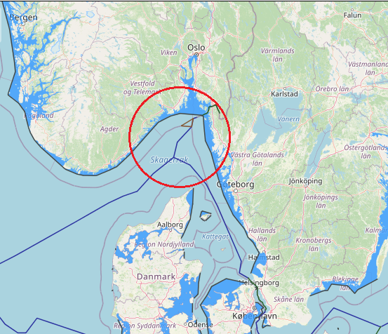
The territorial sea boundary between Norway and Sweden also has a long history having been delimited through an arbitral award of 23 October 1909 following earlier agreements in 1661, 1897 and 1904. By virtue of a compromise signed on March 14, 1908, Norway and Sweden decided to submit to arbitration the question of the maritime boundary between the two countries, insofar as it was not settled by the Resolution royal of March 15, 1904 . The Tribunal constituted for the purposes of this arbitration was called upon to decide whether the frontier line had been fixed either entirely or in part by the Treaty of 1661, and if not, to fix this line taking into account the circumstances of fact and principles of international law. It was composed as follows: Mr. JA Loeff, from the Netherlands; MFVN Beichmann, from Norway, and MK Hj. L. Hammarskjôld, from Sweden. Alone, the latter was a member of the Permanent Court of Arbitration in The Hague. The Tribunal sat from August 28 to October 18, 1909, and meanwhile visited the disputed area. He rendered his award dated October 23, 1909. By this award, the Tribunal determined the maritime boundary between Norway and Sweden, in application of the principles in force in the two countries at the time of the conclusion of the original delimitation treaty. and in view of several long-standing factual circumstances. Settlement of the question of the maritime boundary between Norway and Sweden – Competence of the Tribunal determined by the interpretation of the Compromis – Maritime territory as essential appurtenance of land territory a fundamental principle of International Law – Median line – Thalweg – Historic title. Sweden established an EEZ in 1993 which in the North Sea follows the previously agreed continental shelf boundary with Norway.
View More Maritime boundaries between Norway and Swedenmaritime boundaries between Denmark and Sweden
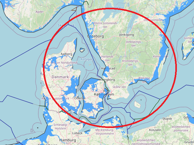
Denmark and Sweden maritime boundaries(in territorial sea and continental shelf) based on equidistance-median line system. on 30 January 1932, Denmark and Sweden concluded a territorial sea boundary stretching 63nm through the Oresund. The territorial waters (12 nautical miles) of Denmark form a border with Sweden along the Øresund, extending to 115 km.
View More maritime boundaries between Denmark and Swedenmaritime boundaries between Germany and Sweden
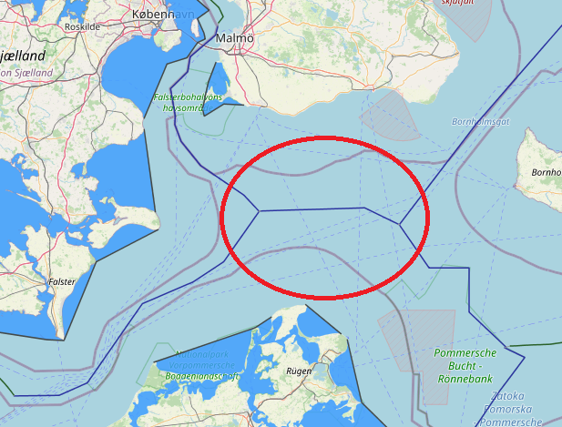
maritime boundaries between Germany and Sweden
View More maritime boundaries between Germany and Sweden
