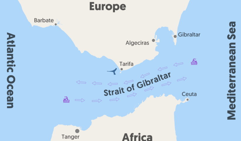
Navigational Regimes of Particular Straits, Gibraltar case study, atlantic ocean, current gibraltar strait, gibraltar strait map, gibraltar strait separates, How deep is the water at the Strait of Gibraltar?, Is the Strait of Gibraltar dangerous?, Strait of Gibraltar, Strait of Gibraltar – Origin and significance, Strait of Gibraltar crossing, strait of gibraltar is controlled by, strait of gibraltar upsc, Traffic Separation Scheme area, What country owns the Strait of Gibraltar?, What separates Spain from Africa?, Who owns Gibraltar?, Why is the Strait of Gibraltar so important?
View More Navigational Regimes of Particular Straits, Gibraltar case studyTag: atlantic ocean
Dispute Concerning Delimitation of the Maritime Boundary between Ghana and Côte d’Ivoire in the Atlantic Ocean (Ghana/Côte d’Ivoire)
During consultations held by the President of the Tribunal with representatives of Ghana and Côte d’Ivoire on 2 and 3 December 2014, a special agreement was concluded between the two States on 3 December 2014 to submit the dispute concerning the delimitation of their maritime boundary in the Atlantic Ocean to a special chamber of the Tribunal to be formed pursuant to article 15, paragraph 2, of the Statute. An original copy of the special agreement was delivered to the Registry on 3 December 2014, which constituted the notification required under article 55 of the Rules. The case was entered in the Tribunal’s list of cases as Case No. 23.
View More Dispute Concerning Delimitation of the Maritime Boundary between Ghana and Côte d’Ivoire in the Atlantic Ocean (Ghana/Côte d’Ivoire)

