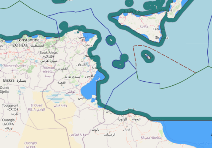
The geography of the area of delimitation in this case is characterized
by a large triangular indentation of the North African coast between Ras
Kaboudia, Tunisia and Ras Tajoura, Libya. The area of the common land
boundary is fairly even and straight in the direction of the coastline.
Further north-west, though, the island of Jerba (Jazirat Jarbah), the
significant concavity of the Gulf of Gabes (Kalij Qabis), the almost
rectangular change of direction of the coast within the Gulf, and finally
the archipelago of the Kerkennah Islands (Juzur Qarquanna) are
prominent features of the area. These constitute the complicating
geographical elements that led to this dispute.
Category: ICJ cases
The 1969 North Sea Continental Shelf cases
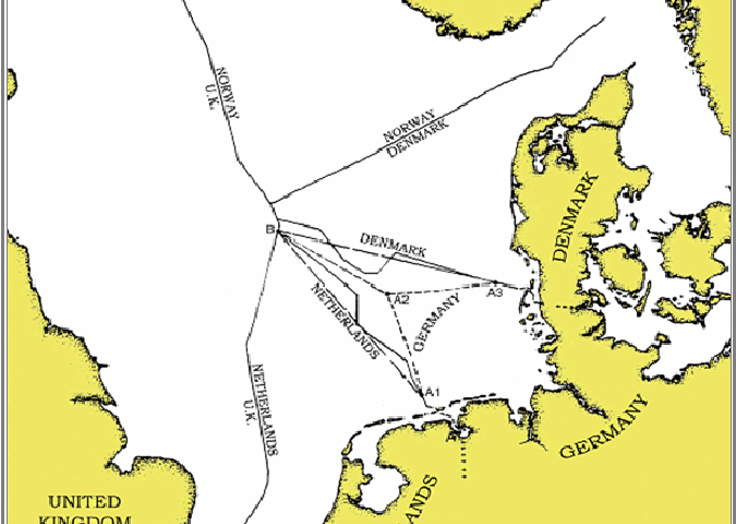
The facts of these founding landmark cases are well known: the coastal
line along Denmark, the Federal Republic of Germany and the
Netherlands is concave with an almost rectangular angle of the German
coast situated between the other countries. It was this particularity that
caused the difficulties in the delimitation of the common and largely
homogeneous continental shelf of the North Sea.
Canada–United States overlapping claims in North Atlantic and surrounding Machias Seal Island and North Rock
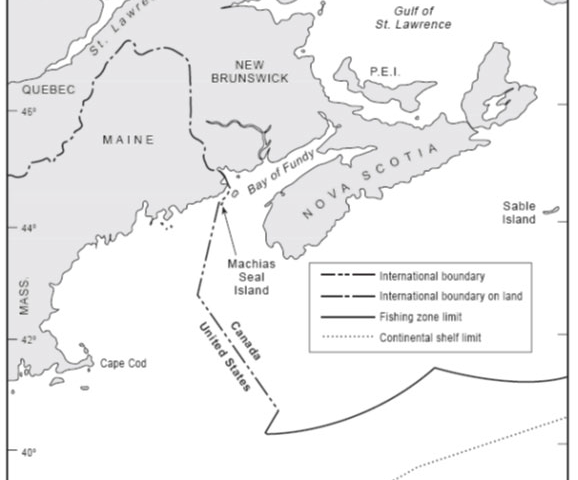
In 1979 the Canada and the United States agreed to empower a Chamber of the ICJ to designate a single seabed and water-column boundary in the Gulf of Maine. The Chamber’s 1984 Judgment establishes a segmented boundary that commences at an offshore point mutually agreed by both States (Point A) and terminates at the point of intersection with the United States’ 200 nautical mile limit. McDorman notes that, prior to the conclusion of the 1979 agreement, Canadian and US negotiators had proposed several options concerning provisional joint management of overlapping claims in the Gulf of Maine. These proposals did not gain traction because delimitation issues proved difficult to set aside. In particular, the location of competing boundary claims influenced political views concerning the fair division of fisheries and potential hydrocarbon resources.
View More Canada–United States overlapping claims in North Atlantic and surrounding Machias Seal Island and North RockFisheries (United Kingdom v. Norway) case on the ICJ
Fisheries (United Kingdom v. Norway) case on the ICJ, Fisheries case, International Court of Justice, United Kingdom v. Norway
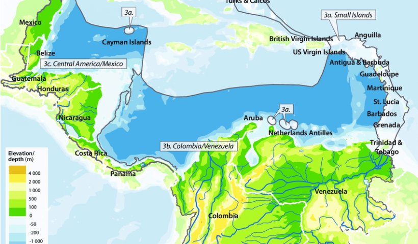
View More Fisheries (United Kingdom v. Norway) case on the ICJTerritorial and Maritime Dispute between Nicaragua and Honduras in the Caribbean Sea (Nicaragua v. Honduras)
Territorial and Maritime Dispute between Nicaragua and Honduras in the Caribbean Sea (Nicaragua v. Honduras), caribbean sea, dispute, honduras, maritime, nicaragua, territorial
View More Territorial and Maritime Dispute between Nicaragua and Honduras in the Caribbean Sea (Nicaragua v. Honduras)Sovereignty over Pedra Branca/Pulau Batu Puteh, Middle Rocks and South Ledge (Malaysia/Singapore)
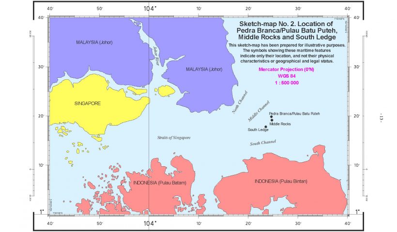
Sovereignty over Pedra Branca/Pulau Batu Puteh, Middle Rocks and South Ledge (Malaysia/Singapore), malaysia, singapore, sovereignty
View More Sovereignty over Pedra Branca/Pulau Batu Puteh, Middle Rocks and South Ledge (Malaysia/Singapore)Dispute regarding Navigational and Related Rights (Costa Rica v. Nicaragua)
Dispute regarding Navigational and Related Rights (Costa Rica v. Nicaragua) OVERVIEW OF THE CASE On 29 September 2005, Costa Rica filed an Application instituting proceedings…
View More Dispute regarding Navigational and Related Rights (Costa Rica v. Nicaragua)Maritime Delimitation in the Black Sea (Romania v. Ukraine)
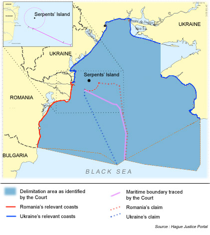
Maritime Delimitation in the Black Sea (Romania v. Ukraine) OVERVIEW OF THE CASE On 16 September 2004, Romania filed an Application instituting proceedings against Ukraine…
View More Maritime Delimitation in the Black Sea (Romania v. Ukraine)
