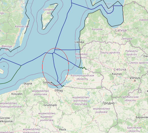
The continental shelf boundary between Poland and the Soviet Union extends for a distance of 77.5 n.m. with an average length of 19.4 n.m. for each segment of the boundary. The entire area covered by the Agreement lies on the continental shelf of the Baltic Sea. The average depth along the CSB is about 50 fathoms.
View More maritime boundaries between Russia(Kaliningrad) and PolandTag: Poland continental shelf map
Maritime boundaries between Poland and Sweden
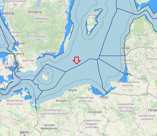
An median line-equidistance-based maritime boundary between Sweden and Poland would extend generally from a Denmark-Poland-Sweden tripoint to Russia-Poland-Sweden. The agreement between the Government of the Kingdom of Sweden, the Government of the Polish People’s Republic and the Government of the USSR concerning the Common Delimitation Point of their Maritime Boundaries in the Baltic Sea several key tripoints in the Baltic have been finalised through agreements between Poland, Sweden and the USSR (1989), Estonia, Latvia and Sweden (1997) and Estonia, Finland and Sweden (2001). The tripoint between Poland, Sweden and the former USSR, was signed on the very day that the last bilateral agreement, i.e. the one between Poland and Sweden, entered into force.
View More Maritime boundaries between Poland and Swedenmaritime boundaries between Denmark and Poland
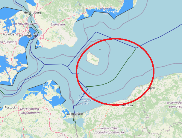
An equidistance-based maritime boundary between Denmark (Bornholm) and Poland would extend generally eastwards then northeast for approximately 70 nm to a Denmark-Poland-Sweden tripoint in the vicinity of the western terminus
of the Poland-Sweden continental shelf and fishing zones boundary of 1989. Article 2 of the 1989 treaty defines the western end of the boundary, Point A, as being located at 55° 21,640’ N, 16° 32,000’ E. West of Point A it is stated that the boundary ‘shall extend as far as the points on which agreement is reached with any third State concerned’. Thus, the western tripoint with Germany appears to be somewhat better defined than that with Sweden, though neither should present the parties with particular difficulties as equidistance is accepted as the basis for the Denmark (Bornholm)-Poland delimitation.
maritime boundaries between Germany and Poland
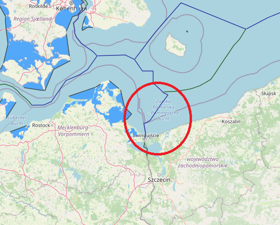
The Agreement between the German Democratic Republic and Poland signed in 1989 provides for a single maritime boundary for both the continental shelf and the fishing zone which is different from the boundary established for the continental shelf under the previous Agreement of 1968.
View More maritime boundaries between Germany and Poland


