Yemen maritime claim about baselines(straight baseline) for measuring the breadth of the territorial sea

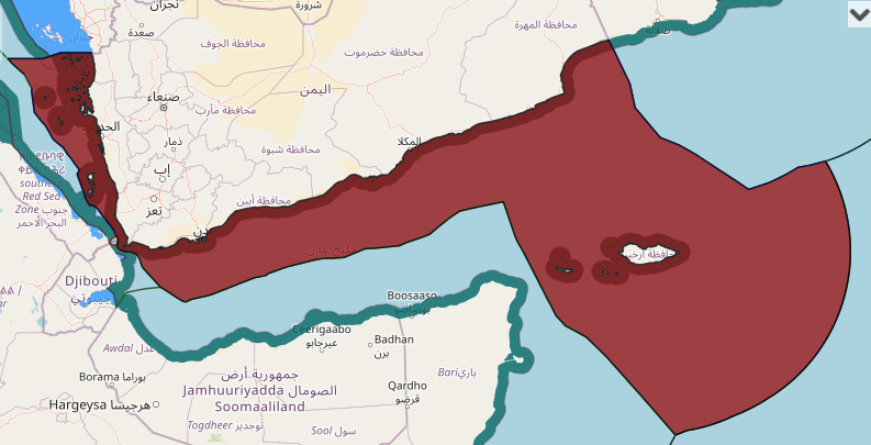
Maritime Claims, yemen, Yemen Arab Republic maritime claim, Yemen continental shelf map, Yemen EEZ map, Yemen exclusive economic zone map, Yemen internal waters map, Yemen maritime boundaries, Yemen maritime claims, Yemen territorial waters map

View More Yemen maritime claim about baselines(straight baseline) for measuring the breadth of the territorial sea

Navigational Regimes of Particular Straits, Bab El Mandeb case study

This strategically important strait links the Red Sea and the Suez Canal with the Gulf of Aden and the Arabian Sea (see Map 29). It is about 14.5 miles wide at its narrowest part of the passage. When it signed the Law of the Sea Convention, the Yemen Arab Republic declared that warships and warplanes must obtain the prior agreement of the Yemen Arab Republic before passing through or over its “territorial waters,” including international straits. The United States Government protested as follows:

View More Navigational Regimes of Particular Straits, Bab El Mandeb case study