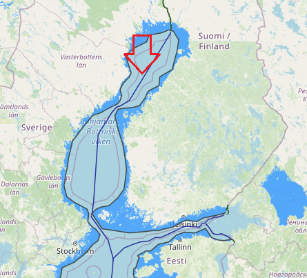
The Finland-Sweden continental shelf agreement is plotted on the attached DMA/HC charts 44030 and 44180. The official Finnish nautical charts cited in Article 6 of the Agreement were used to compute the distances between the boundary points and Finnish straight baselines. Official Swedish charts Nos. 41, 42, 51, 53, and 71 (1:200,000) were used to measure distances to the Swedish baselines.
The shelf boundary extends for a distance of approximately 419.76 nautical miles and has 17 turning or terminal points. The boundary runs the entire length of the Gulf of Bothnia, through the narrow Aland Sea, and into the northernmost part of Baltic Sea.
Tag: Gulf of Bothnia
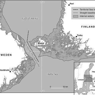
Navigational Regimes of Particular Straits, Aland case study
When it ratified the LOS Convention in 1996, Finland confirmed its declaration on signature in part that:
It is the understanding of the Government of Finland that the exception from the transit passage regime in straits provided for in article 35(c) of the Convention is applicable to the strait between Finland (the Åland Islands) and Sweden. Since in that strait the passage is regulated in part by a longstanding international convention in force, the present legal regime in that strait will remain unchanged after the entry into force of the Convention. Navigational Regimes of Particular Straits, Aland case study, Aland case study, Finland, Gulf of Bothnia, international straits, legal regime in that strait, Particular Straits


