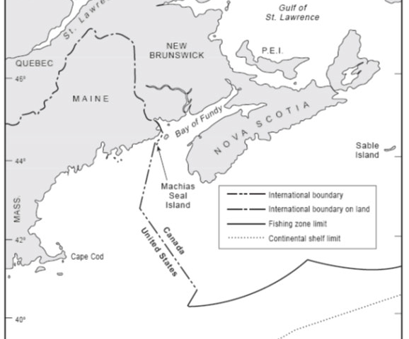
In 1979 the Canada and the United States agreed to empower a Chamber of the ICJ to designate a single seabed and water-column boundary in the Gulf of Maine. The Chamber’s 1984 Judgment establishes a segmented boundary that commences at an offshore point mutually agreed by both States (Point A) and terminates at the point of intersection with the United States’ 200 nautical mile limit. McDorman notes that, prior to the conclusion of the 1979 agreement, Canadian and US negotiators had proposed several options concerning provisional joint management of overlapping claims in the Gulf of Maine. These proposals did not gain traction because delimitation issues proved difficult to set aside. In particular, the location of competing boundary claims influenced political views concerning the fair division of fisheries and potential hydrocarbon resources.
View More Canada–United States overlapping claims in North Atlantic and surrounding Machias Seal Island and North Rock