The maritime boundary with Germany for the Continental Shelf is laid down in 2 treaties: one for the Continental Shelf near the coast, and one…
View More maritime boundaries between Netherlands and Germany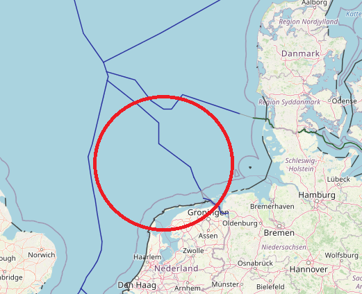
The maritime boundary with Germany for the Continental Shelf is laid down in 2 treaties: one for the Continental Shelf near the coast, and one…
View More maritime boundaries between Netherlands and Germany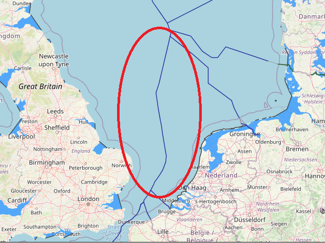
maritime boundaries between Great Britain and Netherlands, Great Britain, Great Britain continental shelf map, Great Britain exclusive economic zone map, Great Britain internal and territorial waters map, Great Britain maritime claims, netherlands, Netherlands boundaries in the North Sea, Netherlands continental shelf map, Netherlands EEZ map, Netherlands exclusive economic zone map, Netherlands internal waters map, Netherlands maritime boundaries, Netherlands maritime claims\, Netherlands straight baseline, Netherlands territorial sea map, Netherlands territorial waters map, UK, UK continental shelf map, UK EEZ map, UK exclusive economic zone map, UK internal waters map, UK maritime boundaries, UK maritime claims, UK territorial waters map
View More maritime boundaries between Great Britain and Netherlands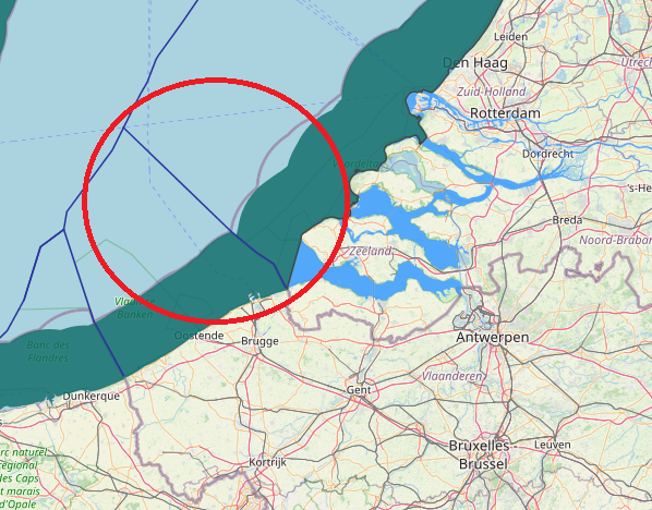
maritime boundaries between Belgium and Netherlands, The Agreement of 1996 between Belgium and the Netherlands delimiting the continental shelf provided that “If one of the Contracting Parties decides to establish an exclusive economic zone, the coordinates, as indicated in Article 1, shall be used for its lateral delimitation.” In the absence of such a provision or a subsequent agreement, it cannot be assumed that a boundary agreed for the continental shelf necessarily applies equally to an EEZ if one has been proclaimed.
View More maritime boundaries between Belgium and Netherlands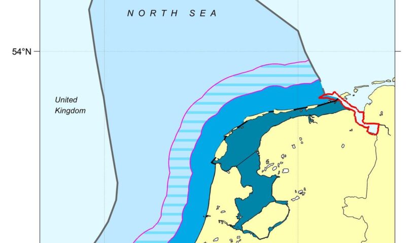
Maritime Claims, netherlands, Netherlands boundaries in the North Sea, Netherlands continental shelf map, Netherlands EEZ map, Netherlands internal waters map, Netherlands maritime boundaries, Netherlands maritime claims, Netherlands straight baseline, Netherlands territorial sea map, Netherlands territorial waters map
View More Netherlands maritime claims about outer limits of the territorial sea
France maritime claims with Jersey, United Kingdom, Crozet archipelago, Saint Paul Island and Amsterdam Island, Kerguelen Islands and Netherlands, Amsterdam Island, Amsterdam Island maritime boundary, Areas of France’s maritime spaces of sovereignty, Crozet archipelago, Crozet archipelago maritime boundary, france, France maritime claims, Kerguelen Islands, Kerguelen Islands maritime boundary, Maritime Claims, netherlands, Saint Paul Island, United kingdom
View More France maritime claims with Jersey, United Kingdom, Crozet archipelago, Saint Paul Island and Amsterdam Island, Kerguelen Islands and Netherlands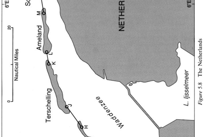
STATE CLAIMS IN SUBSTANTIAL CONFORMITY WITH ARTICLE 4 (LOSC ARTICLE 7), The Netherlands case, netherlands, straight baseline
View More STATE CLAIMS IN SUBSTANTIAL CONFORMITY WITH ARTICLE 4 (LOSC ARTICLE 7), The Netherlands case
On 4 October 2013, the Netherlands instituted arbitral proceedings, under annex VII to the Convention, against the Russian Federation in a dispute concerning the “boarding and detention of the vessel Arctic Sunrise in the exclusive economic zone of the Russian Federation and the detention of the persons on board the vessel by the authorities of the Russian Federation”.
View More The Arctic Sunrise Case (Kingdom of the Netherlands v. Russian Federation), Provisional Measures