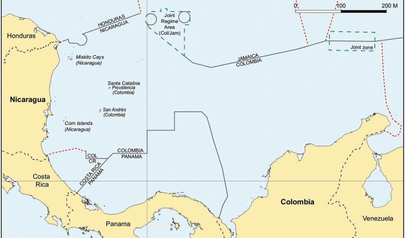
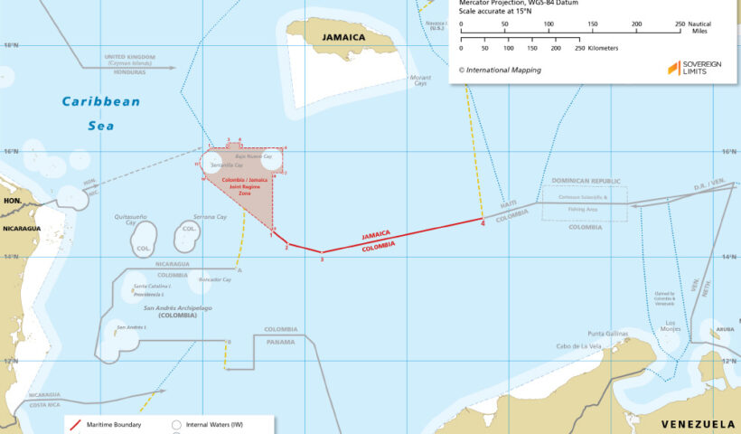
Jamaica is an island country located in the Caribbean Sea, and its maritime domain is an important element of its national security. Jamaican maritime security is subject to the rules of the international law of the seas, which provide a framework for the regulation of maritime activities and security. This article explores the maritime matters of Jamaica in the law of the seas and security, including Jamaica’s legal obligations under the law, its maritime interests, and strategies for enhancing maritime security.
View More Maritime Matters of Jamaica in the Law of the Seas and SecurityMaritime Matters of Jamaica in the Law of the Seas and Security
IILSS 18th September 2023
Challenges for Jamaica's Maritime SecurityColombia–Jamaica Maritime BoundaryJamaicaJamaica and the Law of the Seasjamaica archipelagoJamaica continental shelf mapJamaica EEZ mapJamaica maritime boundariesJamaica maritime claimsJamaica maritime mapJamaica territorial waters mapJamaica's Maritime InterestsJamaica’s Archipelagic ClaimJamaican archipelagic straight baselineLegal Obligations Under Law of the Seaslimits in the seas jamaicaMaritime Matters of Jamaica in the Law of the Seas and SecurityMaritime Security in JamaicaStrategies for Enhancing Maritime Security in JamaicaWhich country have existing delimitation agreement with Jamaica?