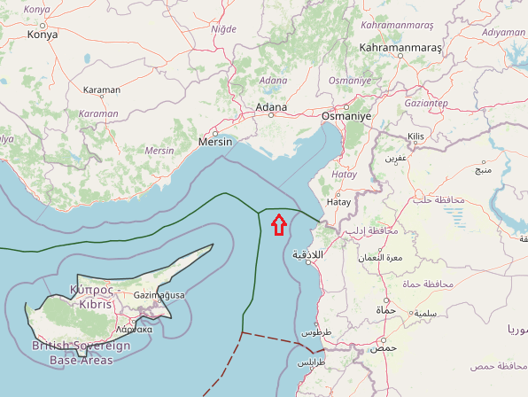
The land boundary between Syria and Turkey reaches the coast in Qasab Bay. The equidistant line is forced northwestwards to Syria’s advantage by Ras el- Basit, a limestone headland. When Turkey’s Ras el-Khanzir comes into range the line of equidistance is directed due west until the trijunction with Cyprus is reached. This trijunction is near 36° 02’ N and 35° 10’ E and the Turco-Syrian boundary extends for about 40 nm. This line appears to be equitable but it will require the question of Hatay Province to be resolved.
View More maritime boundaries between Turkey and Syria
