The establishment of the People’s Republic of China (PRC) was proclaimed by Mao Zedong on October 1, 1949 at Tiananmen Square in Beijing. This followed two decades of almost constant turmoil that took the form of a prolonged civil war between the Nationalist Party, or Kuomintang (KMT), and the Chinese Communist Party (CCP) as well as the Japanese invasion of China, which resulted in the eight year Sino-Japanese War (1937–45). Following Chiang Kai-shek’s split with the CCP after his massacre of thousands of Communists in Shanghai in March 1927, the Nationalists were soon faced with a series of armed insurrections led by the Communists in cities such as Nanchang and Guangzhou. These uprisings ultimately proved unsuccessful. The Communists were driven into the countryside, where the Nationalists proceeded to wage a total of five campaigns of “extermination” between 1930 and 1934, aimed at achieving a comprehensive victory. The success of the fifth campaign in encircling and strangling the Communists led the latter to abandon their base in Jiangxi Province in October 1934 and stage the famous “Long March,” a 4,000-mile journey to establish a new base in Shaanxi in northwest China. China would soon be faced by the even greater threat of external invasion. The Japanese had established a presence in Manchuria by 1931. Growing domestic expansionist pressures led to an undeclared war with China following the “Marco Polo Bridge Incident” on July 7, 1937. Following the outbreak of hostilities, the Communists and Nationalists formed a “United Front” with the goal of defeating the Japanese, although the conflict between the CCP and the KMT was never resolved. Despite its initial success in taking many of the key coastal cities, including Shanghai, and eventually the Nationalist capital of Nanjing, the Japanese advance soon stalled. The Japanese army was never able to penetrate deep into the Chinese countryside. The Japanese surrender on August 14, 1945, following the dropping of atomic bombs on Hiroshima and Nagasaki, plunged China back into civil war. The Communists soon gained the upper hand, eventually driving the KMT out of China and into Taiwan, paving the way for the establishment of the People’s Republic of China.
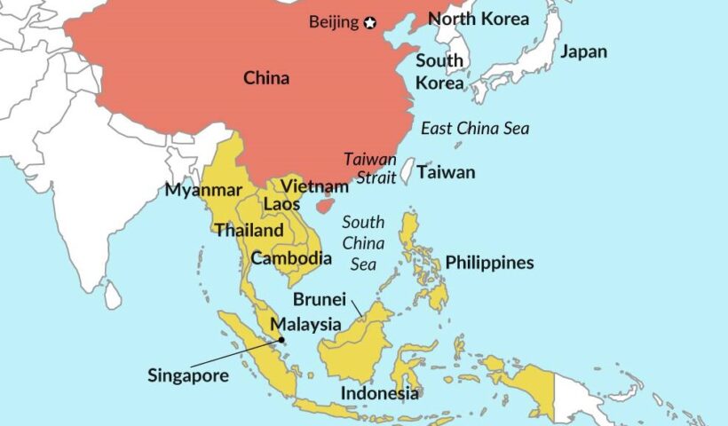
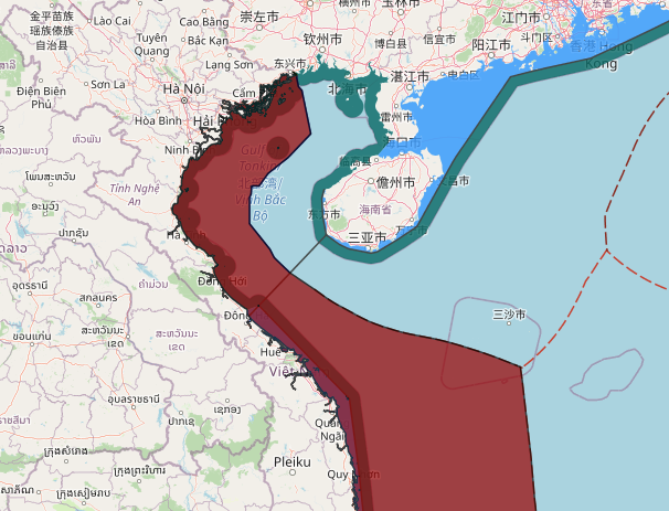
View More China geopolitical interests in eastern Asia and south china sea