Most Beautiful Islands, Maldives, territorial and tourism issues

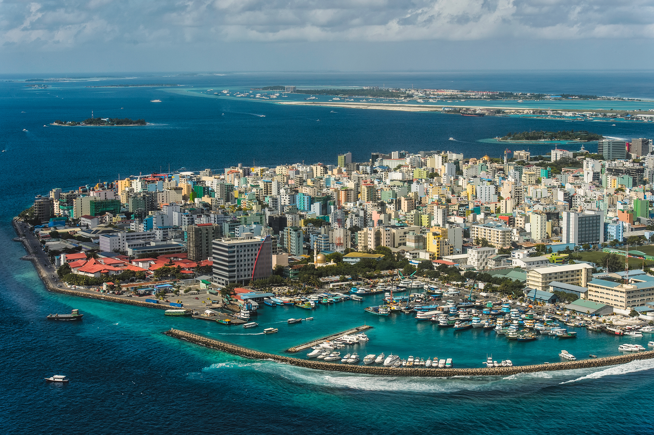
The Republic of Maldives consists of 21 atolls and four reef platforms that straddle the equator in the northern Indian Ocean. Comprising 2041 reefs and 1190 reef islands, the archipelago is globally unique in the reef structures it possesses of a submarine ridge that stretches from the islands of the Lakshadweep (Laccadives) group in the north to the Chagos archipelago in the south.

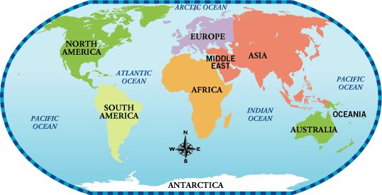
View More Most Beautiful Islands, Maldives, territorial and tourism issues

Most Beautiful Islands, Fiji, territorial and tourism issues

The Fijian archipelago is centrally located amid the island groups of the southwestern Pacifi c. Tonga and Samoa are to the east, Vanuatu and the Solomon Islands to the northwest, New Caledonia to the southwest, more distant New Zealand to the south, and Australia to the west. The group consists of between 300 and 844 islands, depending on the authority and on the defi nition of “island.” There are four major islands: Vitilevu (10,388 km2), Vanualevu (5535 km2), Taveuni (434 km2), and Kadavu (408 km2). Total land area is approximately 18,300 km2, which occupies an ocean area of around 650,000 km2.

View More Most Beautiful Islands, Fiji, territorial and tourism issues

what is the meaning of Flag State in law of the sea

Flag State jurisdiction is the prototype maritime jurisdiction. The flag, as the most potent symbol of State power, demonstrates urbi et orbi the existence of a direct link to the State concerned and, for generations, reflected the power of that State to the world. It is the strength of symbolism that creates the importance attached to the jurisdictional basis employed, that of nationality, and the genuine link between the two. The power connection, however, does not work both ways: as the ship remains a private actor, acts and omissions attached to its presence and operation in the marine environment are not automatically attributable to the State and thus do not necessarily trigger the mechanism of State responsibility; rather the State maintains a general droit de regard on what remains essentially a private enterprise. I will address each problem in turn.

View More what is the meaning of Flag State in law of the sea

the meaning of Lakes and its variants

Surface water usually flows toward the sea, but sometimes it is held back by a depression or dam and forms a lake. Although most lakes are filled with freshwater, others have high salinity due to a high evaporation rate and accumulation of dissolved mineral salts.

View More the meaning of Lakes and its variants

what is the meaning of freshwater and related issues

Barely 2.8% of all water on Earth is freshwater . Most of it is found in glaciers and pack ice (77%) and in groundwater (22%).the rest, only 1%, forms the watercourses that irrigate valleys and plains. Fresh water or freshwater is any naturally occurring liquid/solid water containing low concentrations of dissolved salts and other total dissolved solids. As it flows down from mountaintops to the ocean, freshwater feeds glaciers, lakes , and rivers . the water evaporates and forms clouds, precipitation from which feeds watercourses. For millions of years, this vast water cycle has created landscapes by carving out valleys, eroding mountains, and changing shorelines . It plays an essential role in the redistribution of water around the planet.

View More what is the meaning of freshwater and related issues

THE LARGEST ISLANDS IN THE WORLD

At about 3 million square miles (7.7 million square km), Australia is the smallest continent on Earth, but some of geographer believe that Australia is not an island. Greenland is officially the world’s largest island that is not a continent. Home to 56,000 people, Greenland has its own extensive local government, but it is also part of the Realm of Denmark.

View More THE LARGEST ISLANDS IN THE WORLD

what is the meaning of Littorals in geography and law of the sea?

A littoral is a coastal zone between the low-tide line and the high-tide line. This landscape is constantly changing due to the continuous action of the sea, rivers, and wind, and it may take a variety of forms depending on the geological nature of the coast. also we can say the littoral zone or nearshore is the part of a sea, lake, or river that is close to the shore.

View More what is the meaning of Littorals in geography and law of the sea?

THE WORLD OCEAN

Only 30% of Earth’s surface is exposed land. the rest is covered by a huge body of salt water with a volume of more than 1 billion cubic kilometers: the world ocean. Twice a day, the oceans of the globe rise and fall by several meters. Tides are caused by the gravitational pull of the Moon , and to a certain extent of the Sun , on our planet. the seas and oceans also move in waves —undulations of the surface of the water generated by the wind. Ocean currents , on the other hand, are movements of huge masses of ocean water along very precise routes.

View More THE WORLD OCEAN

THE STRUCTURE OF EARTH

the interior of our planet, with its extreme pressure and temperature conditions, is still a mysterious place. It is where minerals are created and metamorphosed through processes that span millions of years. the immense plates that form Earth’s crust float on the surface of a mass of partially liquid rock. As these plates collide with each other, they build mountains and open up oceans.

View More THE STRUCTURE OF EARTH

what is the meaning of the continents in geography and law

The seven continents that make up the world’s land mass are, from largest to smallest: Asia, Africa, North America, South America, Antarctica, Europe, and Australia. Only 29 percent of the Earth’s surface is land. The percentage area of each continent is shown here.

View More what is the meaning of the continents in geography and law

Denmark(Faroe Islands)–United Kingdom maritime boundary and Special Area

In May 1999 Denmark and the United Kingdom concluded an agreement (1999 Agreement) concerning their overlapping claims to fisheries zones and continental shelf in North Atlantic waters located between the Faroe Islands and Scotland. The 1999 Agreement designates continental shelf and fisheries zone boundaries in addition to a ‘Special Area’ of water column that remains subject to the overlapping jurisdictional claims both States.

View More Denmark(Faroe Islands)–United Kingdom maritime boundary and Special Area

Colombia–Jamaica maritime boundary and the Joint Regime Area

In 1993 Colombia and Jamaica concluded a treaty (1993 Treaty) concerning their overlapping claims to a continental shelf and EEZ in the Caribbean Sea. Article 1 of the 1993 Treaty establishes a maritime boundary between the two States. Immediately to the west of the boundary, the 1993 Treaty also establishes a ‘Joint Regime Area’ in which, ‘pending the determination of the jurisdictional limits of each Party …, the Parties agree to establish … a zone of joint management, control, exploration and exploitation of living and non-living resources’. Article 3(1), sub-paragraphs (b) and (c) of the 1993 Treaty exclude two circular areas of 12 nautical miles radius from the Joint Regime Area. One circular area surrounds the cays of the Seranilla Bank and the other surrounds the cays of Bajo Nuevo. Both of these groups of features are claimed by Colombia – a claim that has been disputed on various occasions by Honduras, Jamaica, Nicaragua and the United States.

View More Colombia–Jamaica maritime boundary and the Joint Regime Area

Canada–United States overlapping claims in North Atlantic and surrounding Machias Seal Island and North Rock

In 1979 the Canada and the United States agreed to empower a Chamber of the ICJ to designate a single seabed and water-column boundary in the Gulf of Maine. The Chamber’s 1984 Judgment establishes a segmented boundary that commences at an offshore point mutually agreed by both States (Point A) and terminates at the point of intersection with the United States’ 200 nautical mile limit. McDorman notes that, prior to the conclusion of the 1979 agreement, Canadian and US negotiators had proposed several options concerning provisional joint management of overlapping claims in the Gulf of Maine. These proposals did not gain traction because delimitation issues proved difficult to set aside. In particular, the location of competing boundary claims influenced political views concerning the fair division of fisheries and potential hydrocarbon resources.

View More Canada–United States overlapping claims in North Atlantic and surrounding Machias Seal Island and North Rock

Barbados–Guyana overlapping claims and Co-operation Zone in Atlantic ocean

Barbados and Guyana assert overlapping EEZ claims and continental shelf entitlements in an OCA located opposite the North East coast of continental South America. As discussed in the following paragraphs, the jurisdictional entitlements of Barbados and Guyana in this area are contested by Venezuela. Design features of provisional joint management frameworks:

View More Barbados–Guyana overlapping claims and Co-operation Zone in Atlantic ocean

Argentina–Uruguay overlapping claims concerning boundary delimitation and the Río de la Plata

In 1973 Argentina and Uruguay concluded an agreement (1973 Agreement) concerning overlapping claims to the Río de la Plata and maritime zones seaward of a closing line at the mouth of the river. Seaward of the closing line, the 1973 Agreement establishes a ‘lateral maritime boundary’ and boundary of the continental shelf, which are both defined by a single equidistance line. The closing line and lateral maritime boundary are depicted in Figure. The lateral maritime boundary delimits several jurisdictional competencies recognized in the Agreement, which relate to: the exploration, conservation, and exploitation of resources; control and supervision of fishing activities; protection and preservation of the environment; scientific research; and construction and emplacement of installations. Viewing this delimitation of competencies in light of LOSC Part V, it is reasonable to regard the lateral maritime boundary as a delimitation of the EEZ and associated coastal state jurisdiction.

View More Argentina–Uruguay overlapping claims concerning boundary delimitation and the Río de la Plata

Argentina–United Kingdom: overlapping claims in the South Atlantic and Southern Oceans(Falkland/Malvinas Islands)

Argentina and the United Kingdom both claim sovereignty over the Falkland/Malvinas Islands, South Georgia and the South Sandwich Islands, and assert a variety of overlapping maritime claims appertaining to these South Atlantic features. Several features currently occupied and administered by the United Kingdom and were the focus of an armed conflict between the two States in 1982. In the immediate aftermath of the conflict the United Kingdom declared a 150 nautical mile ‘Falkland Island Protection Zone’ (FIPZ) designed to restrict and control the navigation of Argentinean vessels in waters surrounding the Islands. In 1986 the United Kingdom supplemented its 3 nautical mile territorial sea claim around the Falkland Islands by (1) declaring an ‘Interim Conservation and Management Zone’ (FICZ) projected 150 nautical miles from a fixed point located in the center of the Islands, and (2) reiterating its claim to the continental shelf surrounding the Islands.The limits of the FIPZ and FICZ are illustrated in Figure. The primary concern influencing the declaration of the FICZ was the rapid and unsustainable escalation of commercial fishing in waters surrounding the Islands between 1982 and 1986. The declaration of the FICZ and reiterated continental shelf claim prompted Argentina to issue a protest note reaffirming its sovereignty claim to the Islands and ‘its rights of sovereignty and jurisdiction over the surrounding maritime waters, sea-bed and marine sub-soil, rights which it will continue to exercise in its capacity as a coastal State in accordance with international law.’ In 1989 both States entered into negotiations with a view to normalizing diplomatic relations after they were broken off during the 1982 conflict. Design features of provisional joint management frameworks:

View More Argentina–United Kingdom: overlapping claims in the South Atlantic and Southern Oceans(Falkland/Malvinas Islands)

The Development of the Case Law of Maritime Delimitation: From Equity to Normativity

In parallel with the codification process in the 1958 Geneva Conventions and the 1982 UNCLOS, the law of maritime delimitation was subject to a progressive development through litigation and arbitration. Both processes were at the same time independent and interrelated. The scope of this part is to provide a broad historical background of the evolution of the case law of maritime delimitation in order to better analyze in the following section the conditions, under which the Equidistance/Relevant Circumstances principle had emerged and developed.

View More The Development of the Case Law of Maritime Delimitation: From Equity to Normativity

Codification of Maritime Delimitation

The first attempt at codification of the customary law of maritime delimitation started with the 1930 Hague Conference under the auspices of the League of Nations. The Hague Conference failed to reach its purpose and the following World War II period was not an appropriate period to deal with issues of maritime delimitation. In the aftermath of World War II, the creation of the United Nations Organization (UN) and the multiple individual claims of States over maritime spaces, such as the Truman Proclamation and the Santiago Declaration raised the need of re-starting the process of codification of the law of maritime delimitation. The adoption of the 1958 Geneva Conventions which followed was a successful initiative, at least to some extent.

View More Codification of Maritime Delimitation

what is the meaning of Thalweg Line

The thalweg line is a concept of river law, defined under customary law either as “the mid-line of the main navigation channel” or as the deepest water line. The purpose of the thalweg line in matters of delimitation is to ensure an equal share of the navigable channel between two sovereign States taking into account the navigation interests. As compared to the median-line, the thalweg line as single rule was less used for maritime delimitation in State practice; one example is the Alaska Boundary Arbitration between Great Britain and the United States in 1903.

View More what is the meaning of Thalweg Line