Iceland: Unveiling the Enchanting Nordic Landscape
View More Iceland: An Insightful Exploration of Nordic Wonders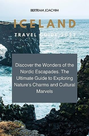
Iceland: Unveiling the Enchanting Nordic Landscape
View More Iceland: An Insightful Exploration of Nordic Wonders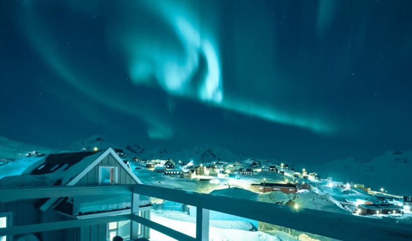
Experience the Arctic’s magical allure in Greenland’s wondrous wonderland – a true enchantment for all adventurers!
View More Greenland: Discover the Arctic’s Enchanted Wonderland!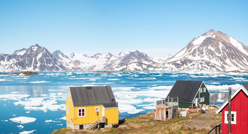
Exploring Greenland: Analyzing its Geography, Climate, and Cultural Significance
View More Exploring Greenland: A Profound Analysis of its Geography, Climate, and Cultural Significance
The Adriatic Sea (/ˌeɪdriˈætɪk/) is a body of water separating the Italian Peninsula from the Balkan Peninsula. The Adriatic is the northernmost arm of the…
View More About Adriatic Sea, facts and maps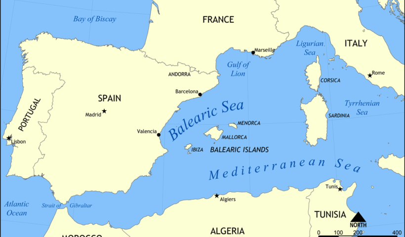
The Balearic Island archipelago is located in the western Mediterranean Sea off Spain’s eastern coast. The Balearic sea is a part of the Mediterranean sea and lies between…
View More About Balearic Sea. facts and maps
The Gulf of California, also known as the Sea of Cortez, is a body of water that separates the Baja California Peninsula from the Mexican mainland. It is a unique and diverse marine ecosystem, home to a wide variety of plant and animal species, many of which are found nowhere else on earth.
View More About Gulf of California, facts and maps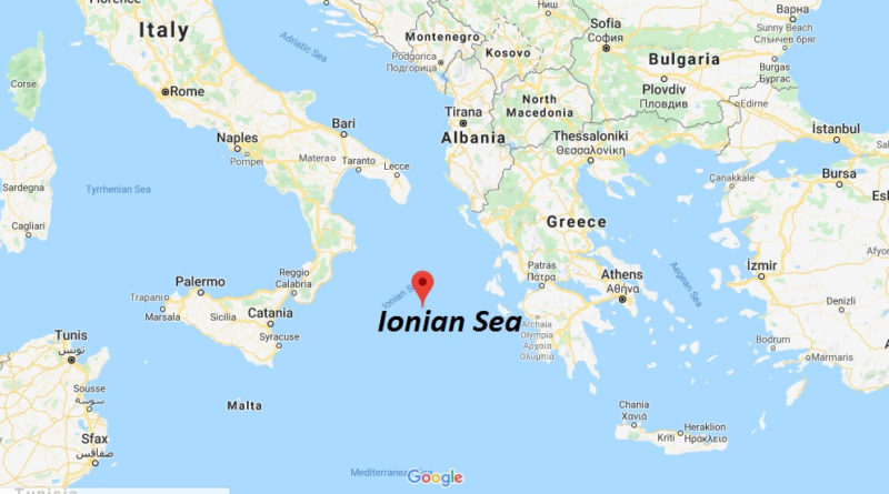
Ionian Sea, Latin Mare Ionium, Italian Mare Ionio, part of the Mediterranean Sea, lying between Albania (northeast), Greece (east), Sicily (southwest), and Italy (west and northwest)..…
View More About Ionian Sea, facts and maps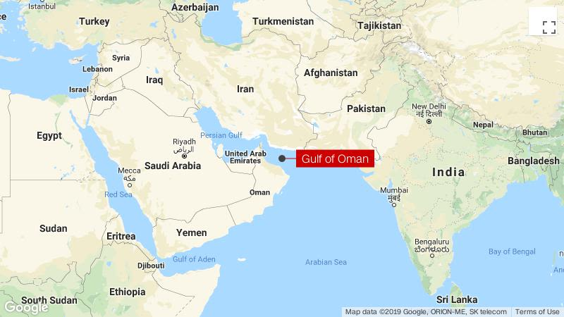
The Gulf of Oman or Sea of Oman (Arabic: خليج عمان khalīj ʿumān; Persian: دریای عمان daryâ-ye omân), also known as Gulf of Makran or…
View More About Gulf of Oman, facts and maps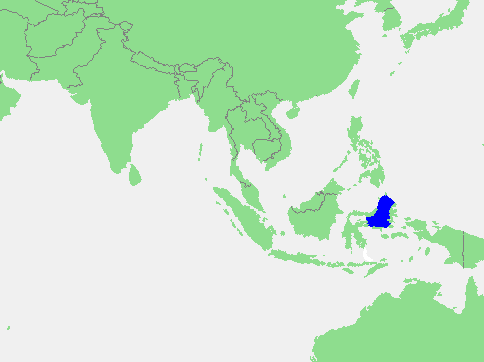
Molucca Sea, Indonesian Laut Maluku, portion of the western Pacific Ocean, bounded by the Indonesian islands of Celebes (west), Halmahera (east), and the Sula group (south).…
View More About Molucca Sea, facts and maps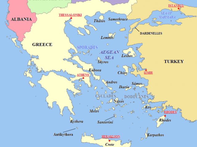
The Aegean Sea has been historically important, especially in regards to the civilization of Ancient Greece, who inhabited the area around the coast of the…
View More About Aegean Sea, facts and maps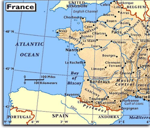
Biscay. / (ˈbɪskeɪ, -kɪ) / noun. Bay of Biscay a large bay of the Atlantic Ocean between W France and N Spain: notorious for storms. Slang.…
View More About Bay of Biscay, facts and maps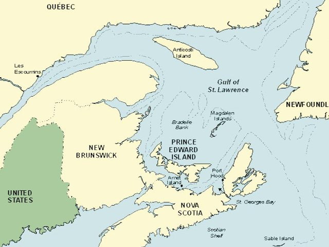
The Gulf of Saint Lawrence (French: golfe du Saint-Laurent) is the outlet of North America’s Great Lakes via the Saint Lawrence River into the Atlantic…
View More About Gulf of St. Lawrence, facts and maps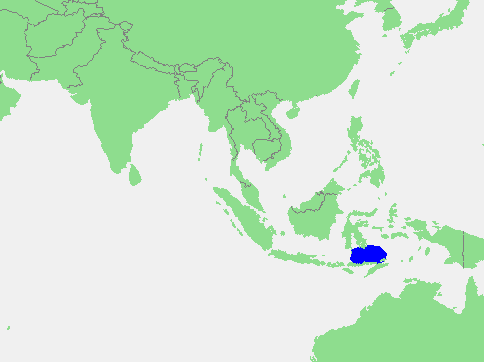
Flores Sea, Bahasa Indonesia Laut Flores, portion of the western South Pacific Ocean, bounded on the north by the island of Celebes (Sulawesi) and on the…
View More About Flores Sea, facts and maps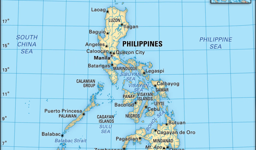
The sea’s surface area is 260,000 square kilometers (100,000 sq mi). The Pacific Ocean flows into Sulu Sea in northern Mindanao and between Sangihe talaud…
View More About Sulu Sea, facts and maps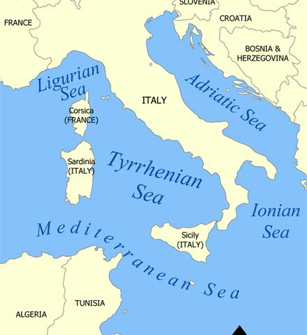
The Tyrrhenian Sea has played an important cultural and social role throughout history, particularly in terms of international trade. Its strategic location allowed ships to connect…
View More About Tyrrhenian Sea, facts and maps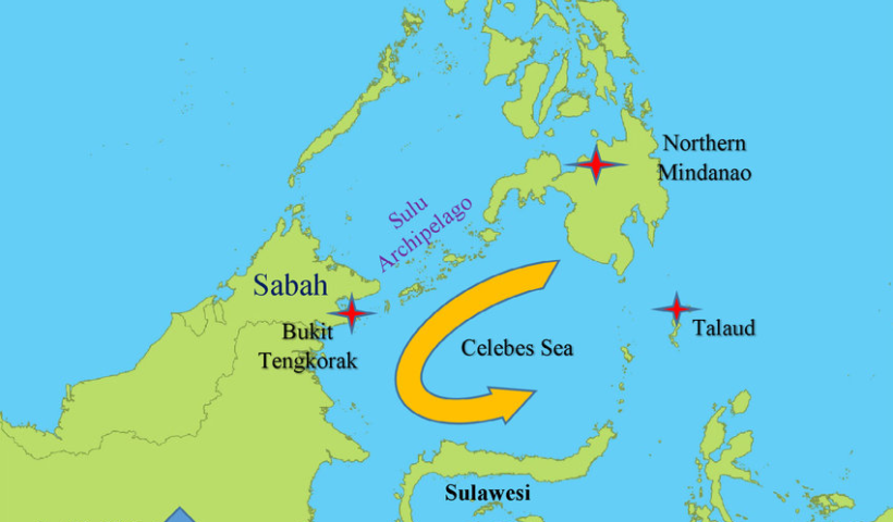
Where is Celebes Sea? western Pacific Ocean The Celebes Sea is located in the western Pacific Ocean north of the Indonesian Island of Celebes and south…
View More About Celebes Sea, facts and maps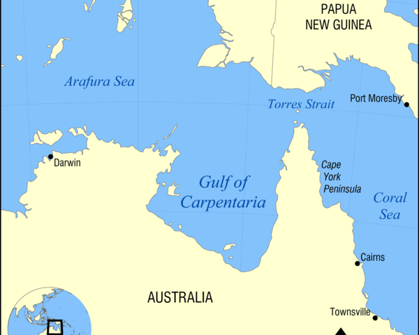
Gulf of Carpentaria, shallow rectangular inlet of the Arafura Sea (part of the Pacific Ocean), indenting the northern coast of Australia. Gulf of Carpentaria a shallow inlet…
View More About Gulf of Carpentaria, facts and maps
The Celtic Sea is the area of the Atlantic Ocean off the southern coast of Ireland bounded to the east by Saint George’s Channel; other…
View More About Celtic Sea, facts and maps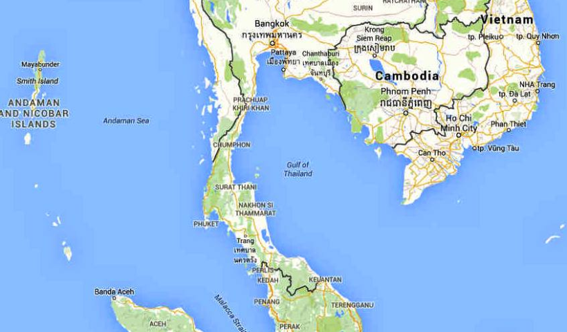
The Gulf of Thailand is a shallow inlet of the South China Sea located in the western part of the Pacific Ocean. It is surrounded by…
View More About Gulf of Thailand, facts and maps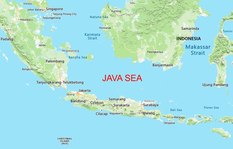
The Java Sea (Indonesian: Laut Jawa, Javanese: Segara Jawa) is an extensive shallow sea on the Sunda Shelf, between the Indonesian islands of Borneo to…
View More About Java Sea, facts and maps
The Levantine Sea is bordered by Turkey in the north and north-east corner, Syria, Lebanon, Israel, and Palestine in the east, Egypt in the south, and…
View More About Levantine Sea, facts and maps
Libya is bounded by the Mediterranean Sea on the north, Egypt on the east, Sudan on the southeast, Niger and Chad on the south, and Tunisia and…
View More About Libyan Sea, facts and maps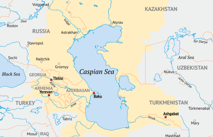
The Caspian Sea is bordered by five countries: Kazakhstan, Turkmenistan, Iran, Azerbaijan, and Russia. The sea is called “dead” because its high salinity prevents macroscopic aquatic organisms,…
View More About Caspian Sea, facts and maps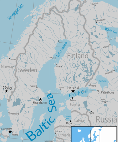
The Baltic Sea is the youngest sea on the planet, almost enclosed, experiencing near-arctic conditions and is one of the world’s largest brackish waters. Water in…
View More About Baltic Sea, facts and maps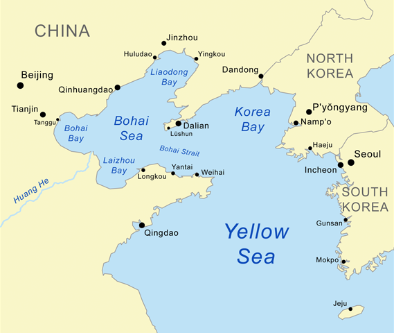
The Yellow Sea is a marginal sea of the Western Pacific Ocean located between mainland China and the Korean Peninsula. The Yellow Sea is 870…
View More About Yellow Sea, facts and maps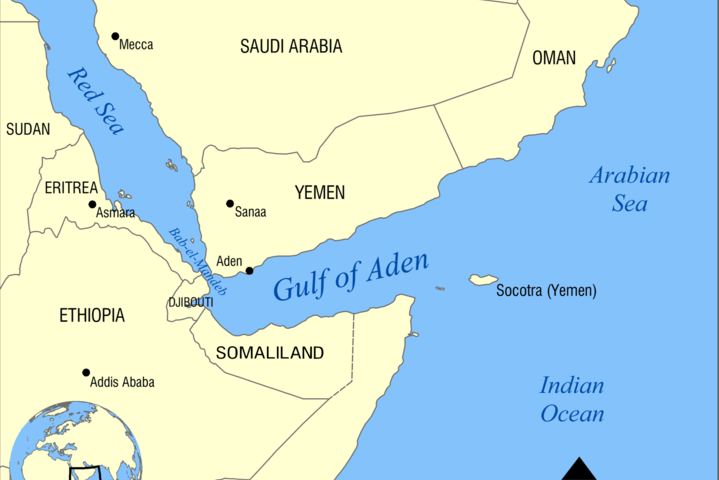
The gulf – roughly 900 kilometres long and 500 kilometres wide – is an important waterway for transporting Persian Gulf oil. Together with the Red Sea,…
View More About Gulf of Aden, facts and maps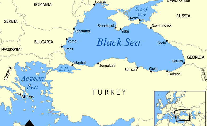
The name ‘Black Sea’ is widely attributed to the Anatolian Turks, due to their habit of referring to the South as ‘white’ and North as ‘black’.…
View More About Black Sea, facts and map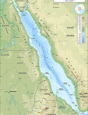
The Red Sea is the saltiest sea of all the seas that connect to the ocean without even one river meeting the sea. A popular…
View More About Red Sea, facts and maps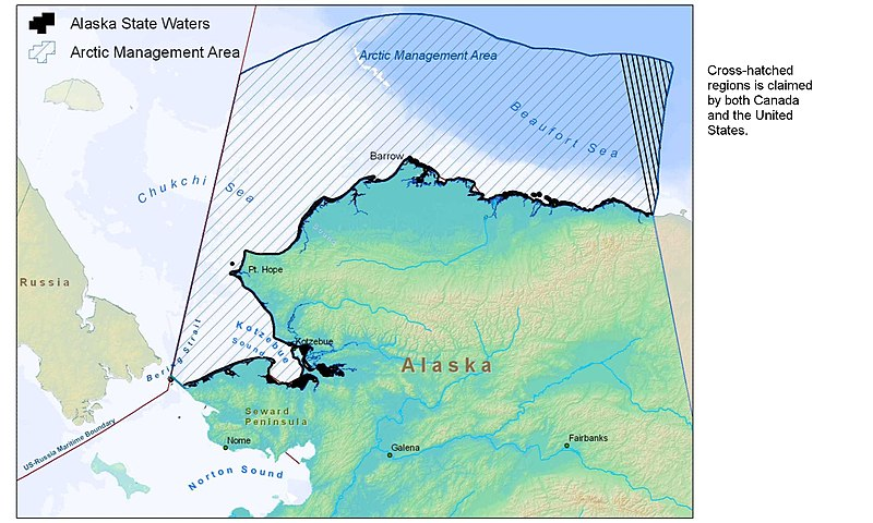
Beaufort Sea, outlying sea of the Arctic Ocean situated north of Canada and Alaska. It extends northeastward from Point Barrow, Alaska, toward Lands End on Prince…
View More About Beaufort Sea, facts and maps
The North Sea (historically also known as the German Ocean) is a part of the Atlantic Ocean, located between Norway and Denmark in the east, Scotland…
View More About North Sea, facts and maps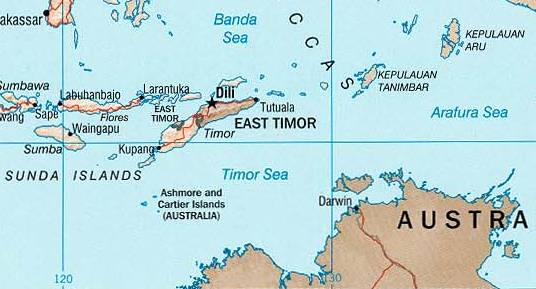
Timor Sea, arm of the Indian Ocean, lying southeast of the island of Timor, Indonesia, and northwest of Australia. Located at latitude 10° S and influenced…
View More About Timor Sea, facts and maps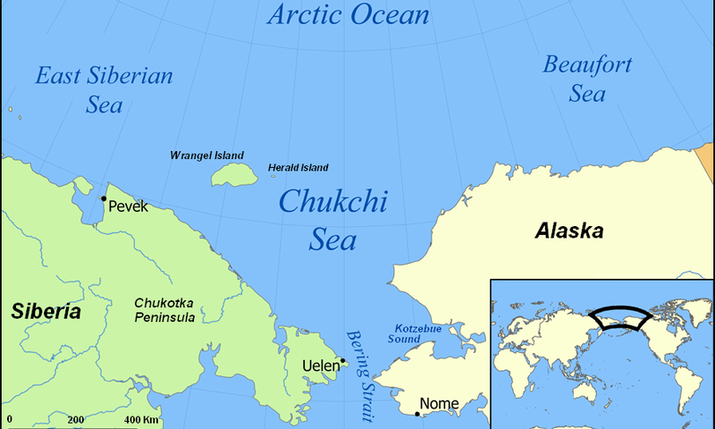
The Chukchi Sea, off the coast of northwest Alaska, is one of the most productive ocean ecosystems in the world. The Chukchi Sea freezes completely during the…
View More About Chukchi Sea, facts and maps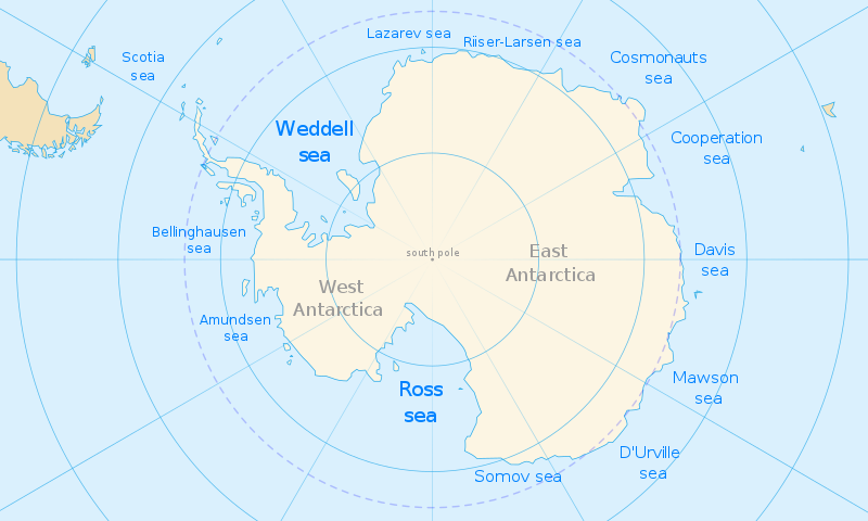
The Ross Sea is a deep bay of the Southern Ocean in Antarctica, between Victoria Land and Marie Byrd Land and within the Ross Embayment,…
View More About Ross Sea, facts and maps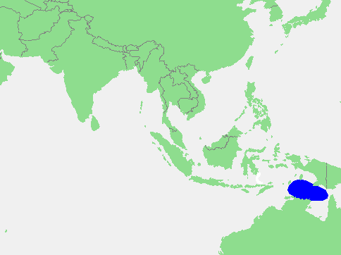
The Arafura Sea name is therefore from the indigenous name for “the people of mountains” in the Moluccas (part of Indonesia) as identified by Dutch…
View More About Arafura Sea, facts and maps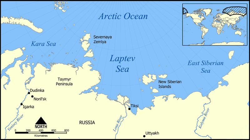
THE LAPTEV SEA, nestled between the north coast of Siberia and Russia’s New Siberian Islands, is known as the birthplace of ice. Every year, ice forms…
View More About Laptev Sea, facts and maps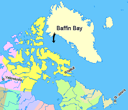
Baffin Bay, arm of the North Atlantic Ocean with an area of 266,000 square miles (689,000 square km), extending southward from the Arctic for 900…
View More About Baffin Bay, facts and maps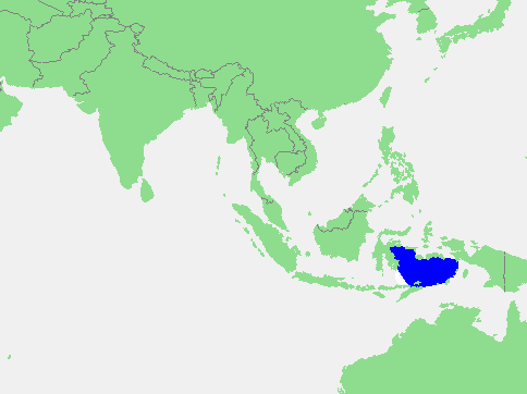
The Banda Sea is one of the most visited water bodies. Known for its clear waters, it is ideal for swimming and scuba-diving. The sea is…
View More About Banda Sea, facts and maps
Who discovered a polynya in the Cosmonaut Sea? Comiso and Gordon (1987) first reported this polynya and named it the western Cosmonaut Sea Polynya (wCSP). The…
View More About Cosmonauts Sea, facts and maps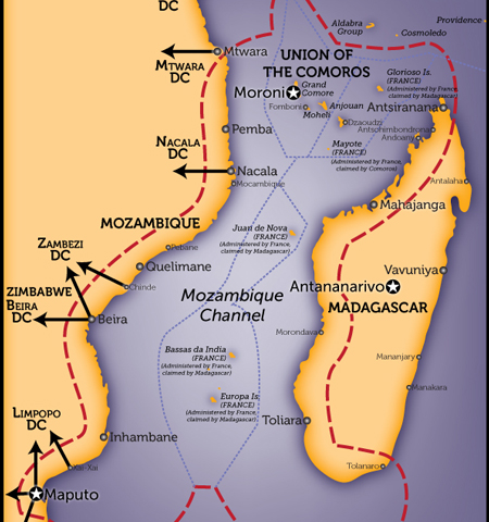
The Mozambique Channel is an integral route for shipping in eastern Africa, linking the Indian Ocean to the rest of the world. This is possible because…
View More About Mozambique Channel, facts and maps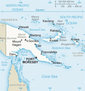
Where is the Solomon Sea? equatorial Southwest Pacific Ocean The Solomon Sea is a semi-enclosed sea located at the western boundary of the equatorial Southwest Pacific…
View More About Solomon Sea, facts and maps