Enchanting British Waters: A Captivating Exploration Dive deep into the mystical wonders of British waters, where breathtaking beauty meets untamed wilderness. Embark on a journey that unveils the secrets hidden beneath the waves, a captivating exploration of marine marvels. Immerse yourself in the ethereal world where mermaids dance amidst vibrant coral reefs and sea creatures whisper legends of the ancient seas. Let the enchantment of British waters bewitch your senses and ignite a profound appreciation for the mesmerizing diversity that lies beneath. Join us as we embark on this extraordinary adventure, where the allure of the unknown beckons you to delve into the depths of the sea.
View More Enchanting British Waters: A Captivating ExplorationCategory: marine(sea) Maps and charts
British Seas: Exploring the Depths and Diversity
The British seas are a rich tapestry of marine life and diverse ecosystems. From the bustling coral reefs of the Channel Islands to the stunning kelp forests of Scotland, these waters offer a fascinating glimpse into the wonders of the underwater world. Join us as we embark on a journey to explore the depths and diversity of the British seas.
View More British Seas: Exploring the Depths and DiversityExploring Australia’s Remarkable Seas: An Informative Article
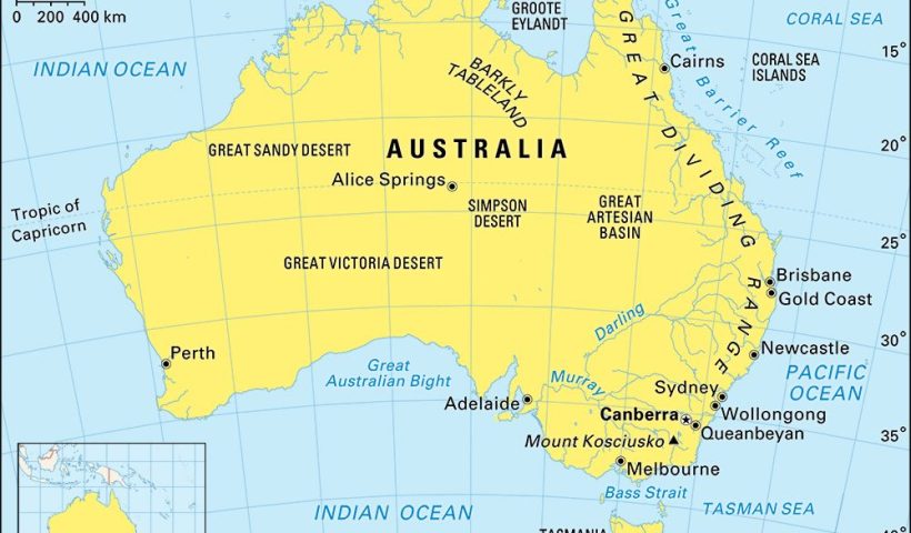
Exploring Australia’s Remarkable Seas: An Informative Article
View More Exploring Australia’s Remarkable Seas: An Informative ArticleIceland: An Insightful Exploration of Nordic Wonders
Iceland: Unveiling the Enchanting Nordic Landscape
View More Iceland: An Insightful Exploration of Nordic WondersExploring the Significance of Hudson Bay: An Analytical Perspective
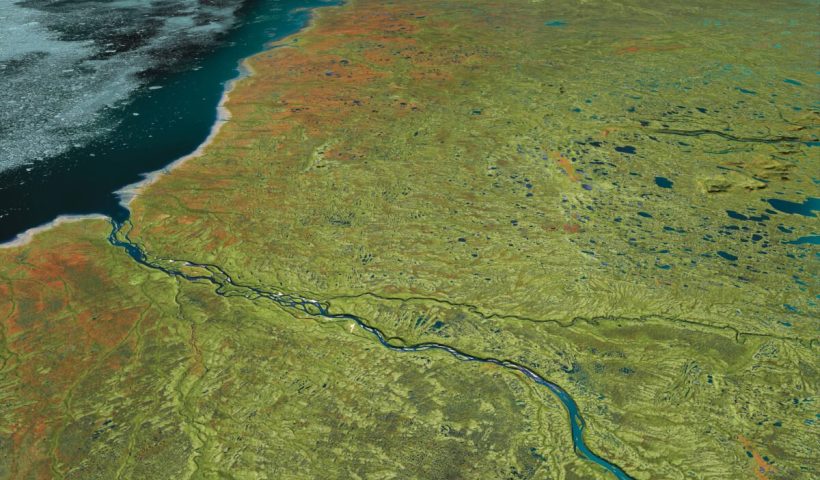
Exploring Hudson Bay: A Comprehensive Analysis
View More Exploring the Significance of Hudson Bay: An Analytical PerspectivePiracy Map of the world(2019-2020-2021-2022)
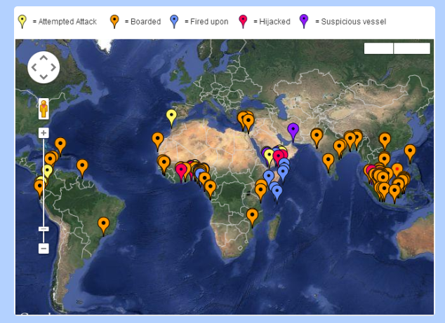
The Piracy & Armed Robbery Map below follows the definition of Piracy as laid down in Article 101 of the 1982 United Nations Convention on the Law of the Sea (UNCLOS) and Armed Robbery as laid down in Resolution A.1025 (26) adopted on 2 December 2009 at the 26th Assembly Session of the International Maritime Organisation (IMO). This maps shows all the piracy and armed robbery incidents reported to the IMB (International Maritime Bureau) Piracy Reporting Centre during 2019- 2022.
View More Piracy Map of the world(2019-2020-2021-2022)exclusive economic zone(EEZ) map of the world
Extending beyond this point and reaching up to 200 nautical miles (370.4 km) from a country’s coast lies its Exclusive Economic Zone. Within this region, a country owns the natural resources at the seafloor but has no say on what happens at the surface. Any ships in an Exclusive Economic Zone are essentially in international waters. This map of the week features the Exclusive Economic Zones of EU Countries for which a regulatory text exists in UN’s Convention on the Law of the Sea1. Note that such a text does not exist for the EEZ of some EU countries (e.g. UK, Italy, and Greece) and these are currently not shown on the map.
View More exclusive economic zone(EEZ) map of the worldBorder of seas and oceans in the earth(sea and oceans boundaries)
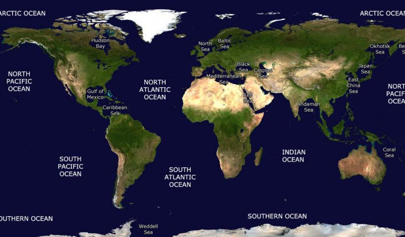
This dataset represents the boundaries of the major oceans and seas of the world. The source for the boundaries is the publication ‘Limits of Oceans & Seas, Special Publication No. 23’ published by the IHO in 1953. The dataset was composed by the Flanders Marine Data and Information Centre.
View More Border of seas and oceans in the earth(sea and oceans boundaries)International Bathymetric Chart of the Southern Ocean (IBCSO)
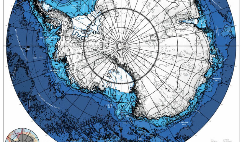
International Bathymetric Chart of the Southern Ocean (IBCSO), Bathymetric Chart, Southern Ocean
View More International Bathymetric Chart of the Southern Ocean (IBCSO)International Bathymetric Chart of the Arctic Ocean (IBCAO)
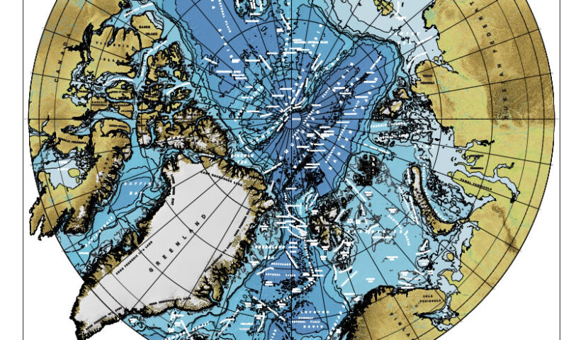
International Bathymetric Chart of the Arctic Ocean (IBCAO), Arctic Ocean, Bathymetric Chart
View More International Bathymetric Chart of the Arctic Ocean (IBCAO)GEBCO world map via superzoom capability and world’s ocean floor
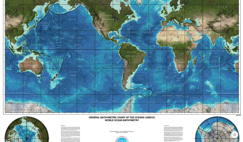
GEBCO world map via superzoom capability and world’s ocean floor, colour map, map, ocean floor, world map
View More GEBCO world map via superzoom capability and world’s ocean floorTypology of Marine Spaces
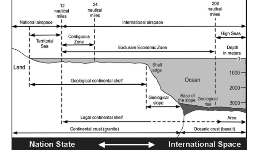
In summary, spatial jurisdiction comprises both complete spatial jurisdiction (= territorial sovereignty) and limited spatial jurisdiction (= sovereign rights). In either case, it must be stressed that coastal State jurisdiction over marine spaces is spatial by nature. It follows from the above discussion that marine spaces in the law of the sea can be categorised as follows :
(i) Marine spaces under national jurisdiction
(a) Marine spaces under territorial sovereignty (or complete spatial jurisdiction): internal waters, the territorial sea, international straits, and archipelagic waters.
(b) Marine spaces under sovereign rights (or limited spatial jurisdiction): the contiguous zone (where the EEZ is established), the EEZ and the continental shelf.
(ii) Marine spaces beyond national jurisdiction the high seas and the Area., Typology of Marine Spaces, archipelagic waters, beyond national jurisdiction, contiguous zone, High seas, internal waters, international straits, jurisdictional zones, national jurisdiction, territorial seas, Typology of Marine Spaces
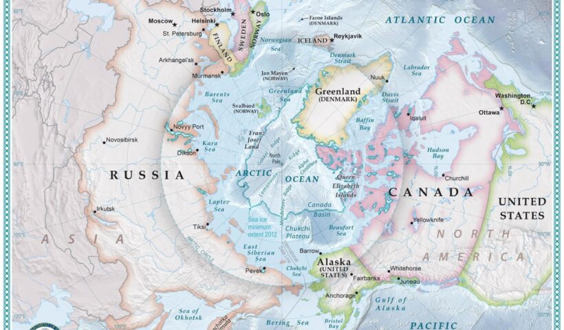
Physical Geography of arctic and its land
Physical Geography of arctic and its land, Angaran Shield, arctic, Baltic, Hercynian elements, land, northern Urals, Queen Elizabeth Islands, Severnaya Zemlya, Taymyr Peninsula
View More Physical Geography of arctic and its land


