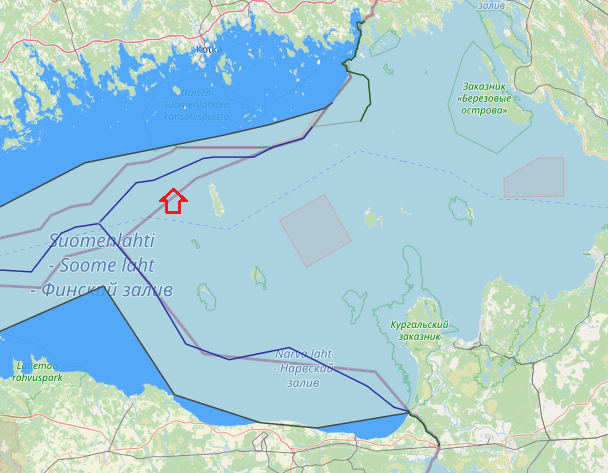
between Russia and Finland, the boundary is on the shore of Gulf of Finland, in which there is a maritime boundary between the respective territorial waters, terminating in a narrow strip of international waters between Finnish and Estonian territorial waters. In 2014, Estonia and the Russian Federation signed their land and maritime boundary agreements that are currently awaiting ratification. This study reconstructs the maritime boundary delimitation between the two States. In particular, the role of islands and pre-existing agreements for the delimitation of the territorial sea boundary in the south-eastern part of the Gulf of Finland are critically examined. It is established that the agreed maritime boundary line is a median line which was influenced by the use of the special circumstances method in the delimitation process. in relation to the first part of the Finland-USSR maritime boundary, military, strategic and related navigational considerations have had a powerful influence on the course of maritime boundaries and it had not based on equidistance method alone.
View More maritime boundaries between Finland and RussiaTag: Finland fishery zones map
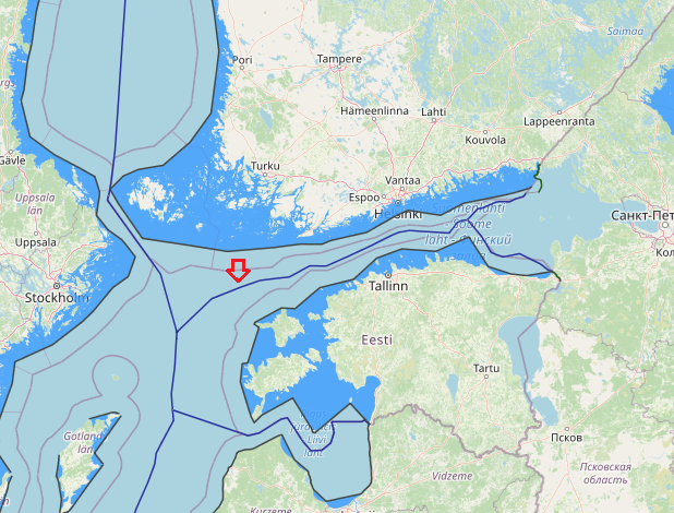
maritime boundaries between Finland and Estonia
Agreement between the Republic of Estonia and the Republic of Finland on the Boundary of the Maritime Zones in the Gulf of Finland and the Northern Baltic Sea was signed in 18 October 1996. In principle, the main aim of the negotiations was not to try to establish a maritime boundary in areas· where no such boundary existed before. In fact, only a very minor part of this agreement could fit such a description. What the Estonia-Finland Agreement did rather was to provide an answer to the much more subtle question about the ·exact legal value to be attributed under international law to the previously concluded maritime boundary agreements, in casu by the former Soviet Union.
View More maritime boundaries between Finland and EstoniaMaritime boundaries between Finland and Sweden
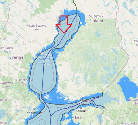
The Finland-Sweden continental shelf agreement is plotted on the attached DMA/HC charts 44030 and 44180. The official Finnish nautical charts cited in Article 6 of the Agreement were used to compute the distances between the boundary points and Finnish straight baselines. Official Swedish charts Nos. 41, 42, 51, 53, and 71 (1:200,000) were used to measure distances to the Swedish baselines.
The shelf boundary extends for a distance of approximately 419.76 nautical miles and has 17 turning or terminal points. The boundary runs the entire length of the Gulf of Bothnia, through the narrow Aland Sea, and into the northernmost part of Baltic Sea.


