lists of geographical coordinates of points, pursuant to article 16, paragraph 2, of the Convention concerning the baselines of Saudi Arabia “in the Red Sea, the Gulf of Aqaba and the Persian Gulf”, as contained in Council of Ministers Resolution No. 15 dated 11 January 2010 and Royal Decree No. M/4 dated 12 January 2010


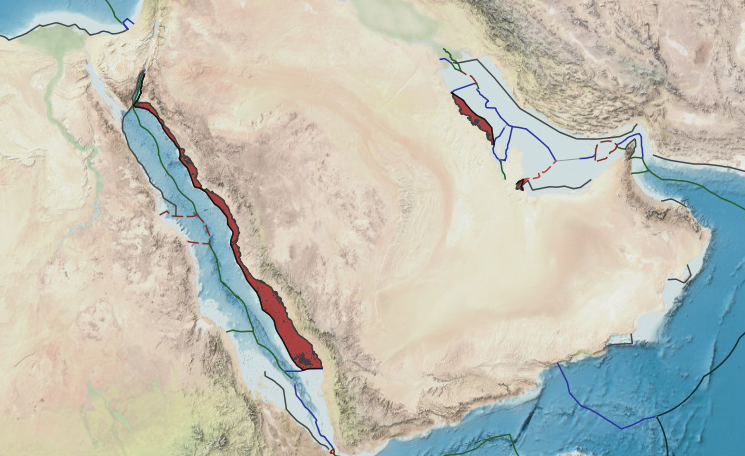
Saudi Arabia was the first Arab country to claim offshore jurisdiction and the first Middle Eastern state to define its offshore waters. This study examines the principal geographical factors which have resulted in the present Saudi maritime boundary. The semi-enclosed sea, islands, reefs, natural resources of the continental shelf, exclusive economic zone and coastline, can all be considered principal geographical factors that have influenced Saudi territorial waters policy.
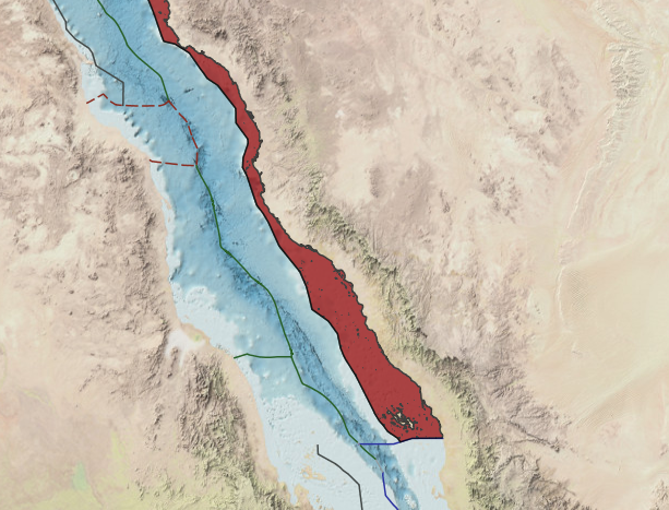
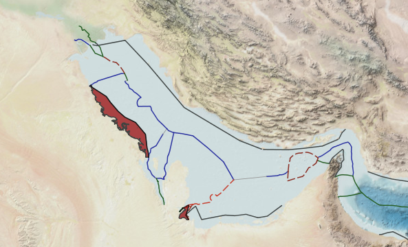
Islands, for example, play an effective role in increasing the area of Saudi internal waters, increasing the breadth of the territorial sea, straight baseline and the delimitation of maritime boundary in the Red Sea and the Arabian Gulf with
opposite and adjacent states. Natural resources demanded the swift implementation of unique agreements, used later as an example worldwide.
The author has drawn the 1958 Saudi straight baseline and a theoretical straight baseline based on the 1982 Convention and states practice. The territorial sea which is drawn on this basis along the Red Sea and the. Arabian Gulf coasts,
is affected by the presence of islands and reefs. The Saudi Exclusive Fishing Zone claimed by the 1974 decree gave the Kingdom the same right as the 1982 Exclusive Economic Zone (EEZ), but the Kingdom had to adapt the latter in order to gain more control over its resources and non-mineral activities. The importance of the 1949 Saudi decree can be found in the contribution made by Saudi Arabia to the development of the law of the sea, and to safeguarding the national hydrocarbon resources (natural gas and oil) on and below its seabed.
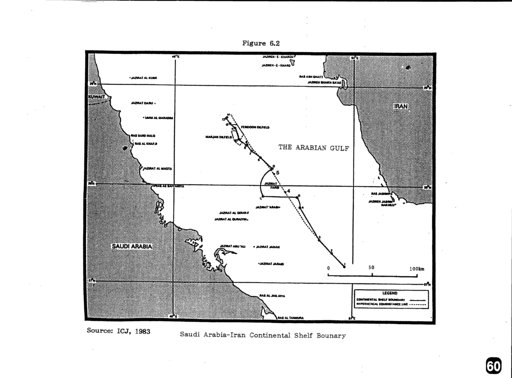
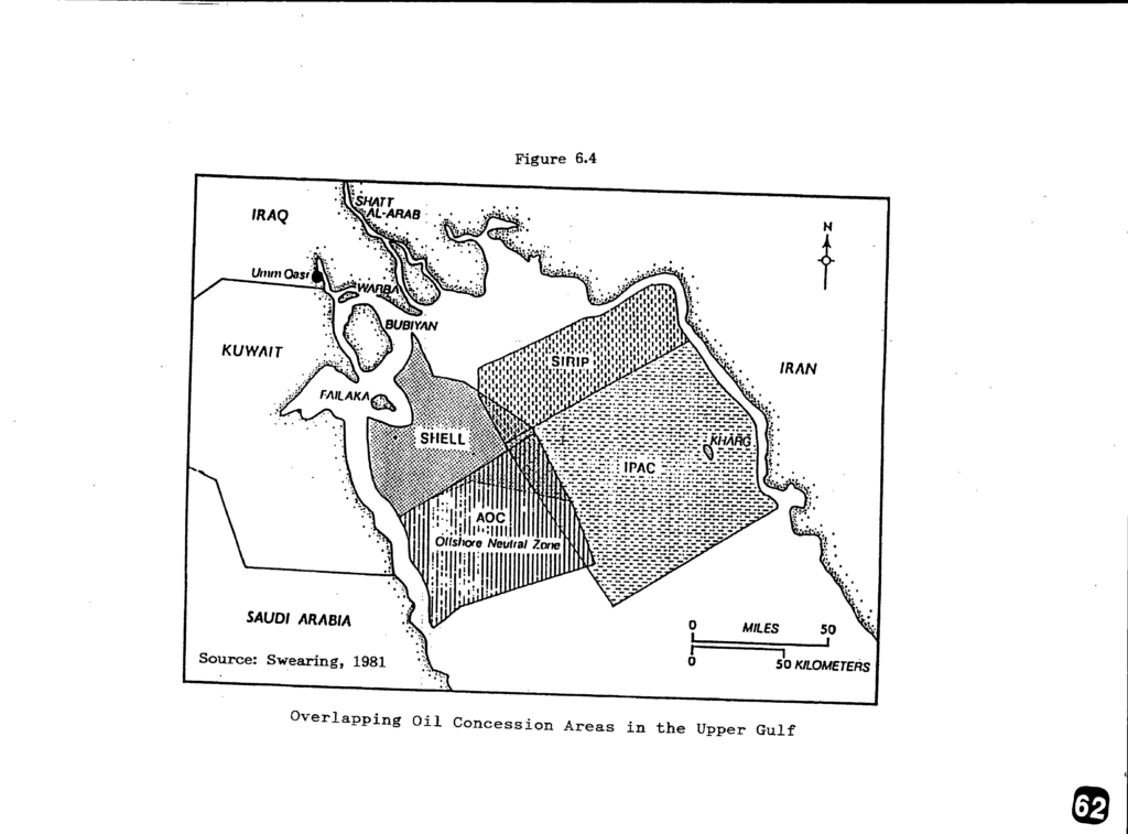
Saudi Arabia engaged in several agreements, mainly in the Persian Gulf, in order to define its boundary. This study has highlighted these agreements as a model which can be used in different parts of the world to solve similar disputes, and can be adopted as methods of maritime delimitation between opposite and adjacent states. The importance of the economic factor has been shown, along with security, as the main factor influencing the successful conclusion of such agreements, but where there is no such importance, the boundary may become less significant and by the absence of such motivation the boundary may not be defined.
Saudi waters are a rich and highly important maritime area. This is based on the facts that Saudi Arabia has 30 percent of the world seawater desalination plants; that the sea represents food, fuel and wealth to Saudi Arabia; and that the existence of huge deserts emphasizes the importance of the sea.