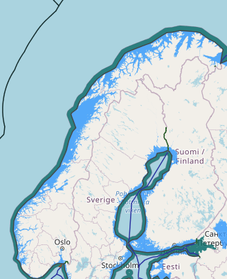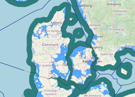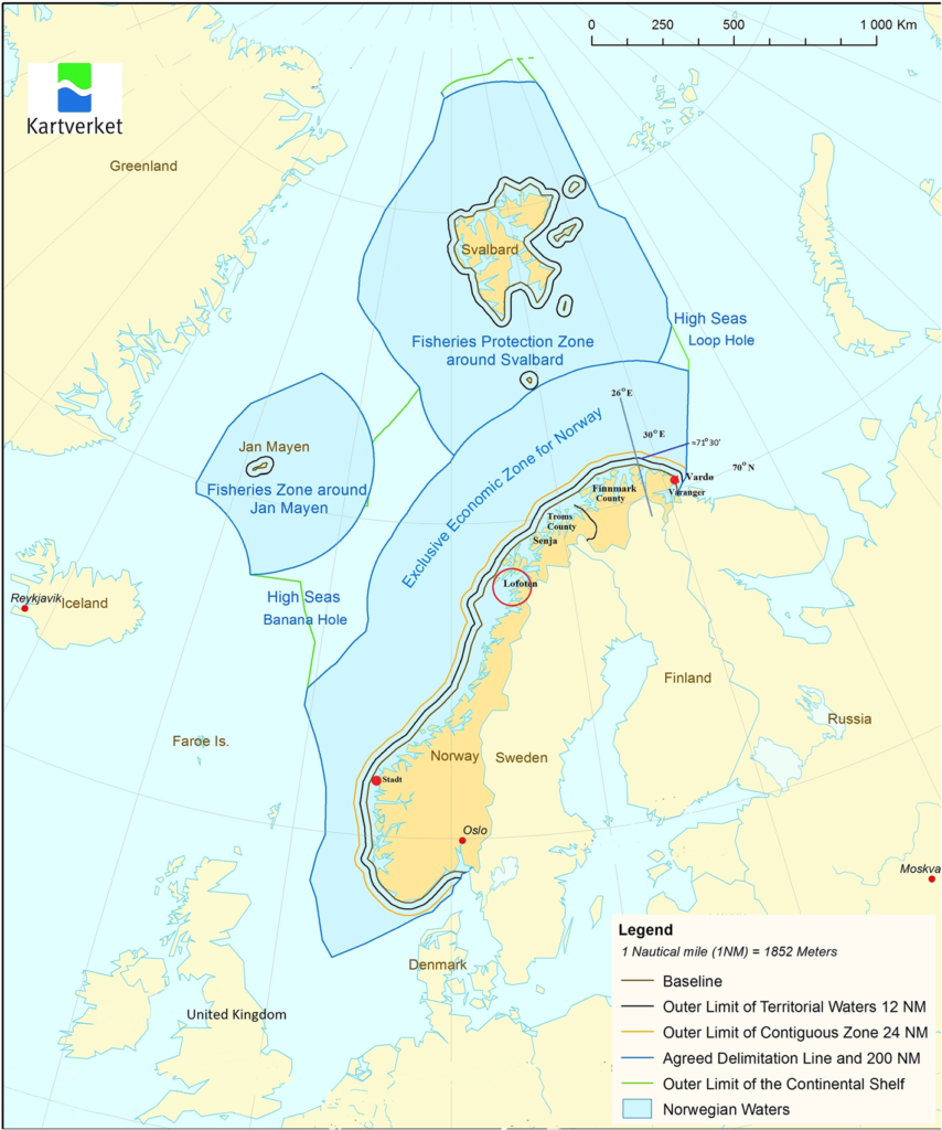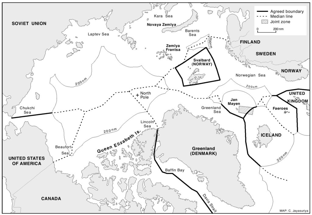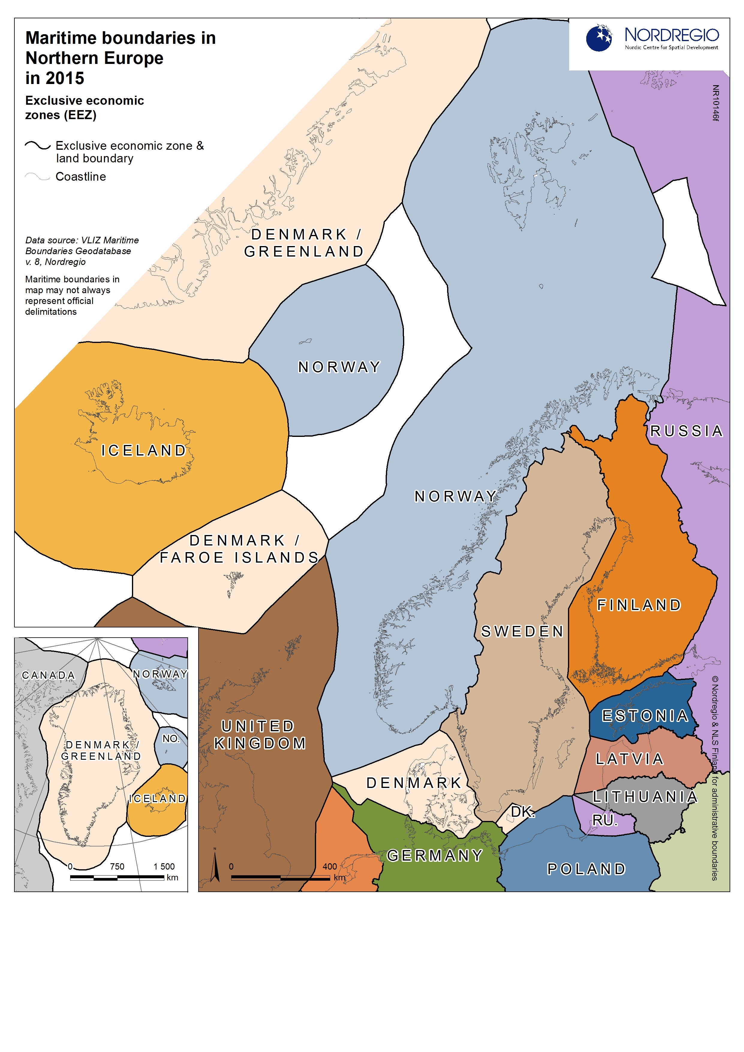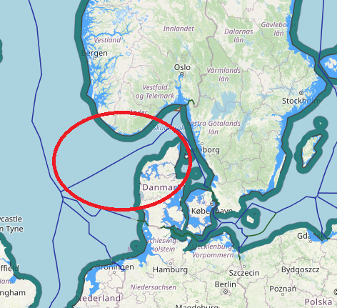
the common principle for delimitation of maritime boundaries between Norway and Denmark based on median and equidistance line. they have many faced place against together which many of them solved via agreements and one of them solved by ICJ decision. The border between the Danish and Norwegian EEZ runs along the Skagerrak, between Faroer and Norway in the North Sea and between Greenland and Norwegian Svalbard in the Arctic. in below see their agreements and ICJ judgement in Jan Mayen and green land case.
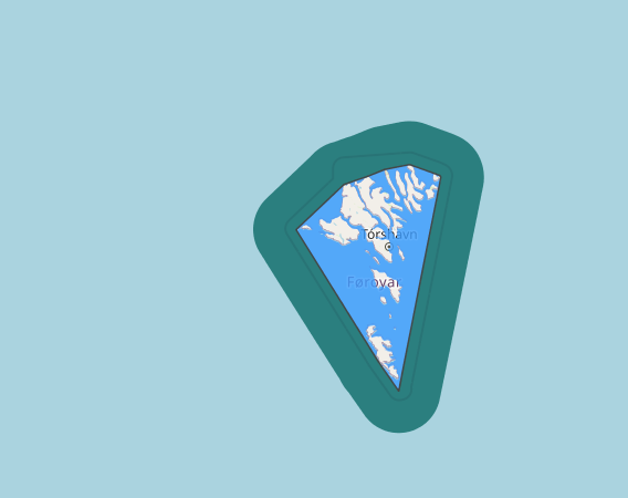
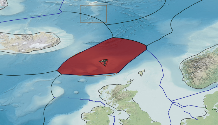
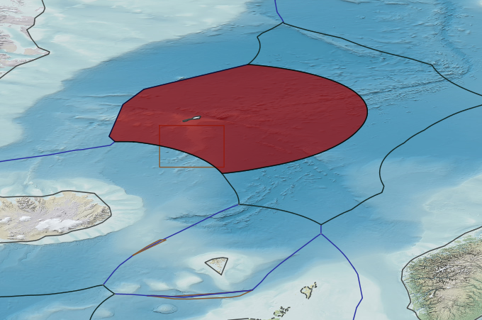
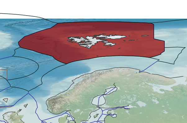
In 1979 Denmark and Norway drew an equidistant seabed and fisheries boundary measuring 32 nm in length from the terminus of the Anglo-Norwegian seabed boundary to the intersection of the 200 nm zone from the coasts of Norway and the Faeroes. The northern terminus is located in latitude 64° 25’ N. The Norwegian Sea, in the area enclosed by the 200 nm limits of Norway, Iceland and Denmark with the Faroe Islands and Greenland, also referred to as the ‘Banana Hole’. in the southern part of the Banana Hole there would be a potential overlap with the continental shelf of Iceland and Denmark with the Faroe Islands. From the start, there was communication between the three states on both diplomatic and technical level.
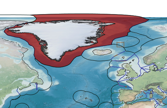
In other side, The Arctic Ocean is enclosed by the shallow shelf areas of the five Arctic states: Canada, United States of America (USA), Russia, Norway, and Denmark with Greenland. A central topographic element of the Arctic Ocean is the submerged Lomonosov Ridge that extends right across the ocean between the Greenland and Siberian shelves. This ridge divides the ocean into two parts, the complex Amerasian Basin on the American side and the oceanic Eurasian Basin on the other. The Eurasian Basin in turn, is subdivided into the Amundsen Basin to the north and the Nansen Basin to the south. The submission that Norway made in respect of the Arctic Ocean, the Barents Sea and the Norwegian Seas implied actual and potential overlaps with the continental shelf limits of the neighbour states, Russia, Iceland and Denmark with Greenland and the Faroe Islands.
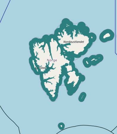
Before the First World War the Arctic archipelago of Svalbard was a terra nullius. Under a treaty of 1920 Norway’s sovereignty over Svalbard was recognised, while the other States parties to the Treaty were accorded equal rights to carry on certain economic activities, including fishing and mining, in Svalbard’s territorial waters. By virtue of its sovereignty, Norway is entitled to establish the full range of maritime zones in respect of Svalbard. It has established a 12-mile territorial sea and a 200-mile fishery protection zone (rather than an Exclusive Economic Zone) around Svalbard. Svalbard also has a continental shelf, extending beyond 200 miles in places. The Norwegian government argues that the equal rights of fishing and mining do not apply beyond the territorial sea, whereas a number of other States parties take the opposite view. This paper examines both sets of arguments, and reaches the conclusion that there is no clear-cut answer to the question. The final part of the paper suggests various ways in which the dispute between Norway and other States parties over the geographical application of the Treaty could be resolved.
Norway, Iceland and Denmark with the Faroe Islands developed the shared view that the whole area concerned consists of continuous continental shelf. It also became clear that there would be potential overlaps of continental shelf areas of the three states in this region, and that Norway would be the first state in position to make its submission to the Commission, while the two others would submit some years later. On this basis, Iceland and Denmark with the Faroe Islands approached Norway and proposed to discuss a possible future delimitation in the area before Norway lodged its submission. The Agreed Minutes that came out of these discussions were published on 21 September 2006. These minutes include a Model Agreement and the coordinates for the points on which the future delimitations would be based. The final delimitation would be concluded at the time when all three states had received their recommendations from the Commission.
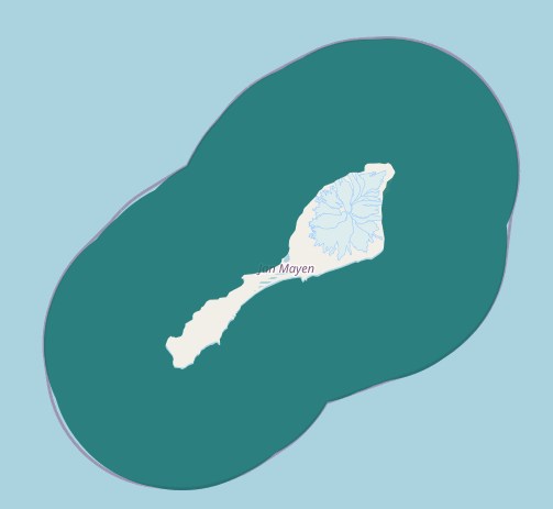
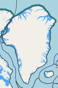
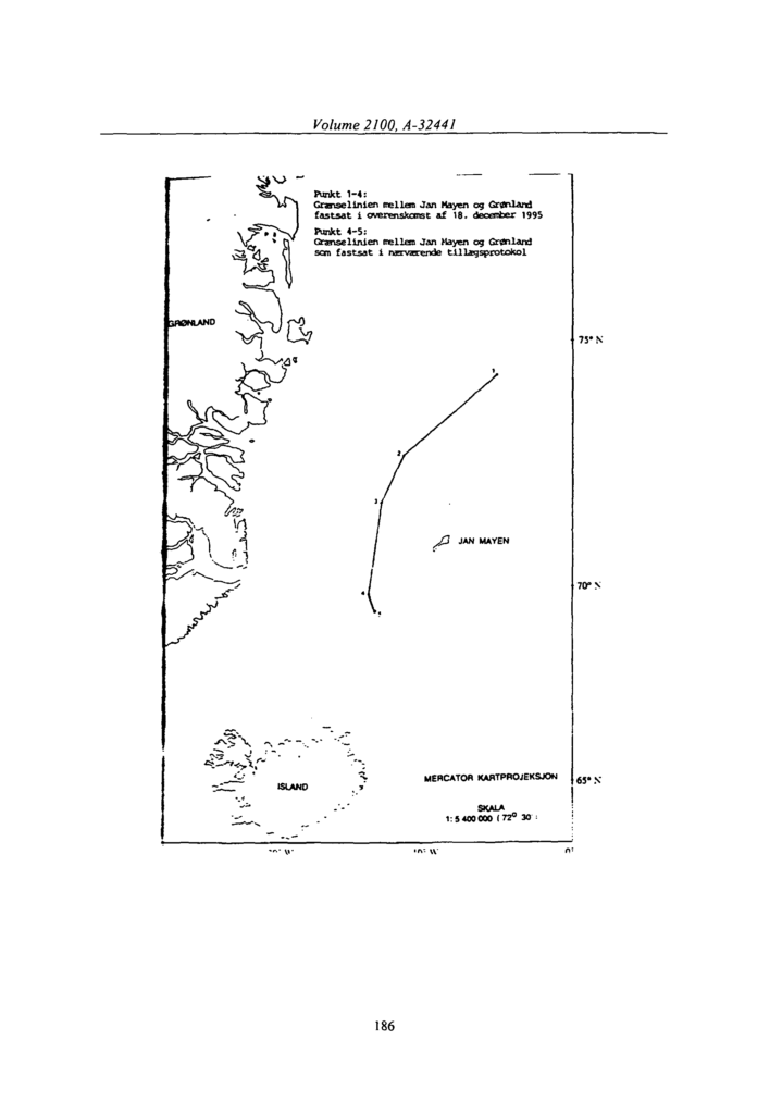
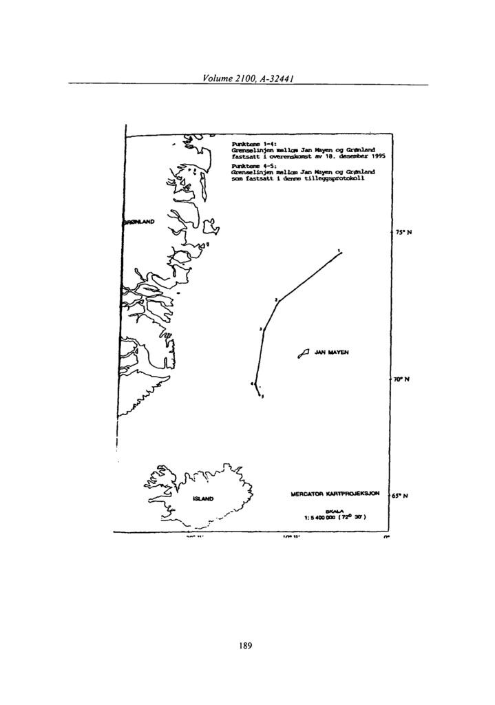
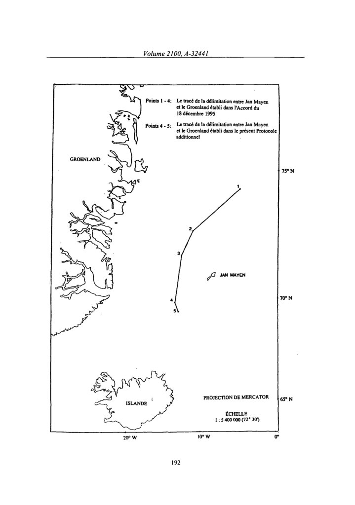
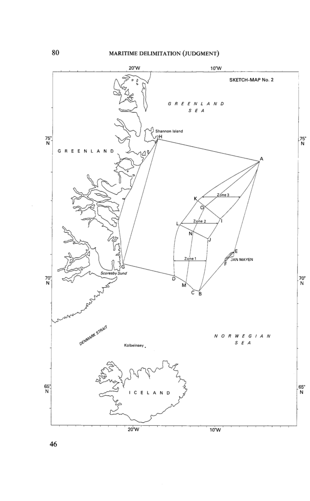
The maritime boundary between Greenland and Jan Mayen, belonging respectively to Denmark and Norway was settled by the International Court of Justice in June 1993. After drawing a provisional line of equidistance the Court decided that it should be adjusted in Denmark’s favour because of the great disparity between the lengths of the coasts of the two territories that constituted special circumstances.