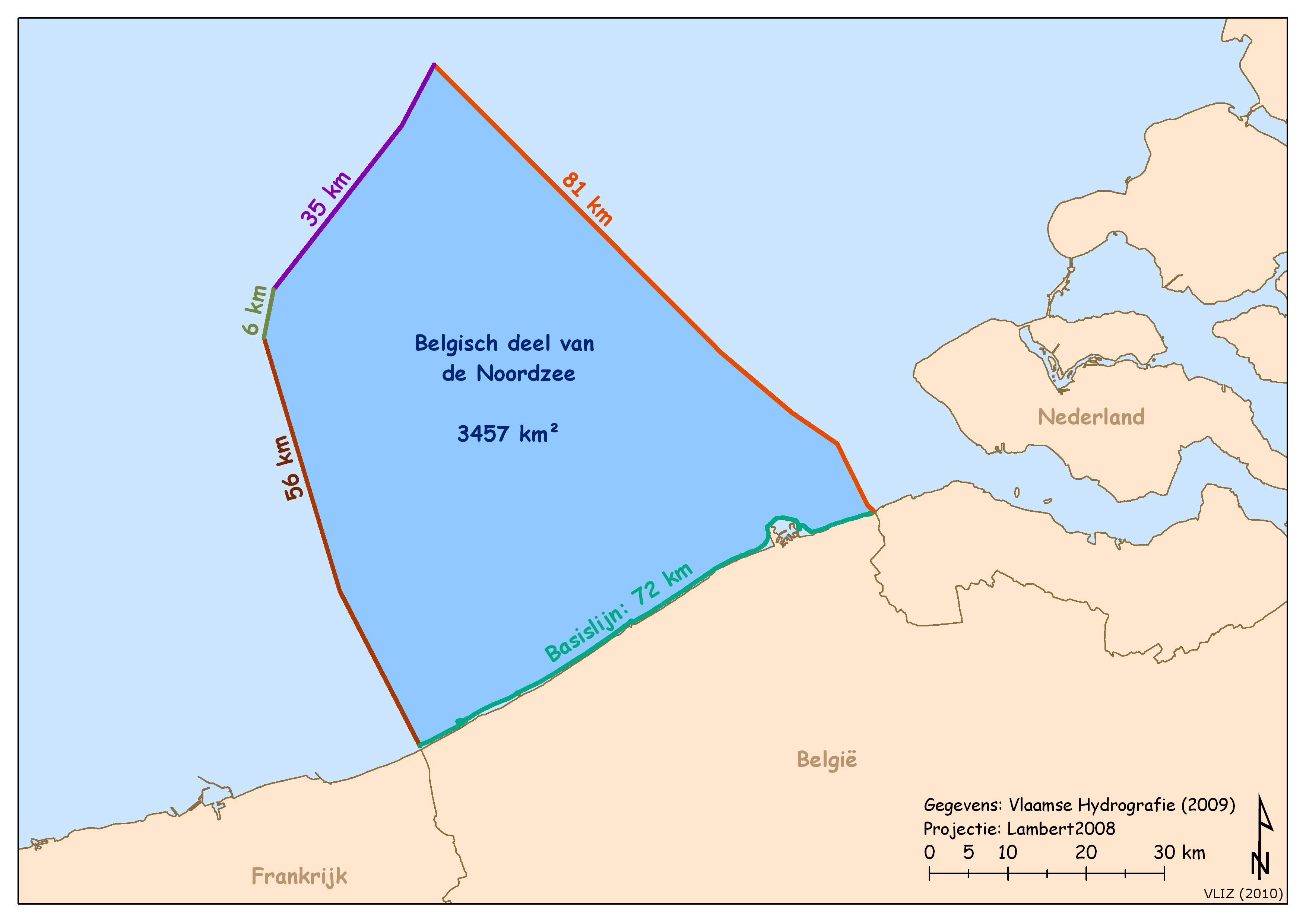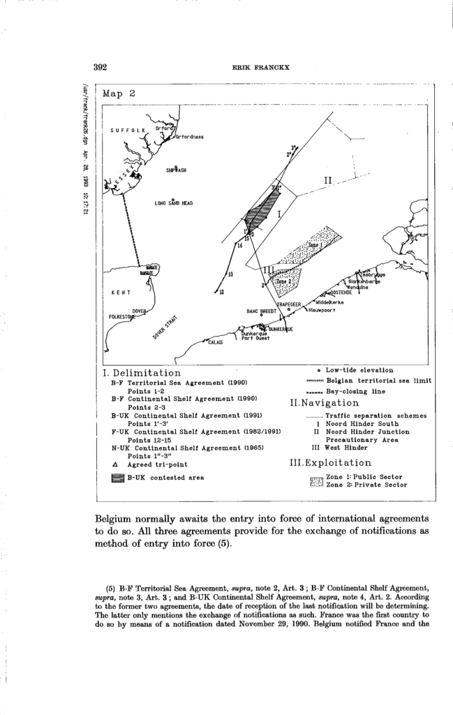
agreements in the eastern part of the Channel and extending into the southern North Sea have subsequently been achieved between Belgium and France in 1990, despite a dispute over a low-tide elevation called the Banc Breedt, and between Belgium and the UK (1991) on the basis of equidistance.
In semi-enclosed seas, a semi-complete pattern of existing boundaries may provide a framework for the negotiation of the remaining boundaries. For instance, the existence in the southern North Sea of agreed boundaries between the Netherlands and the United Kingdom (UK) and between France and the UK provided the framework for the negotiation
of the boundary between Belgium and the UK. The latter’s negotiating stance was based on the consideration that the UK was legally bound by agreements in force with its other two neighbours and the new boundary had somehow to join together the two existing boundaries, thereby filling the “gap”.
Desiring to establish the common boundary between their respective parts of the continental shelf, taking full account
of the current rules of international law on international boundaries in order to achieve an equitable solution,
Have agreed as follows:
Article 1The boundary between that part of the continental shelf which appertains to the United Kingdom of Great Britain and Northern Ireland and that part which appertains to the Kingdom of Belgium shall be a line composed of loxodromes joining in the sequence given the points defined as follows by their coordinates:
51° 33′ 28″ N 02° 14′ 18″ E
51° 36′ 47″ N 02° 15′ 12″ E
51° 48′ 18″ N 02° 28′ 54″ E
The positions of the points in this article are defined by latitude and longitude on European Datum (1st Adjustment 1950).