a list of geographical coordinates of points describing the maritime boundaries of its exclusive economic zone and continental shelf with Costa Rica, as contained in theAgreementon Maritime Delimitation Between the Republic of Ecuador and the Republic of Costa Rica, of 21 April 2014.
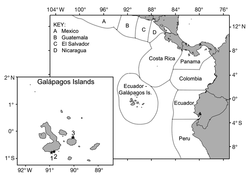
In 1985, Ecuador and Costa Rica concluded a maritime boundary treaty delimiting the maritime
zones of the two States generated by the Galapagos Islands (Ecuador) and Isla del Coco (Costa
Rica).
This agreement provided for an equidistance line to be drawn using the basepoints for
each State specified in the treaty. However, the treaty did not contain geographic coordinates
establishing an actual boundary, and it did not enter into force.
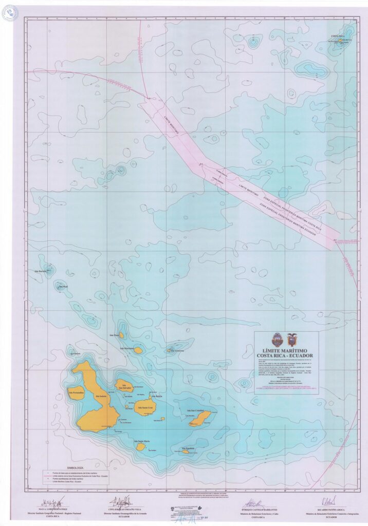
In 2014, Ecuador and Costa Rica concluded a new maritime boundary treaty.
This treaty establishes an EEZ and continental shelf boundary, on the basis of equidistance, composed of two
geodesic lines connecting three points. As with Ecuador’s other maritime boundaries, its boundary
with Costa Rica has a 10 M “special zone” on each side of the boundary within which each State
will tolerate the small fishing vessels of the other State.