GUANGZHOU is located at South China, South China in China at coordinates N 23° 05′ 07.79″ – E 113° 25′ 30.01″. The official UN/Locode of this port is CNGZG. It is also known as GUANG ZHOU,NEIGANG,SHIGANGAO.
View More GUANGZHOU Port info
GUANGZHOU is located at South China, South China in China at coordinates N 23° 05′ 07.79″ – E 113° 25′ 30.01″. The official UN/Locode of this port is CNGZG. It is also known as GUANG ZHOU,NEIGANG,SHIGANGAO.
View More GUANGZHOU Port info
ANTWERP is located at UK Coast & Atlantic, Antwerp Area in Belgium at coordinates N 51° 18′ 08.96″ – E 004° 18′ 41.25″. The official UN/Locode of this port is BEANR. It is also known as ANTWERPEN,BEANT,ANVERS,BEAAA.
View More ANTWERP Port info
AMSTERDAM is located at UK Coast & Atlantic, North Sea in Netherlands at coordinates N 52° 22′ 14.70″ – E 004° 52′ 44.23″. The official UN/Locode of this port is NLAMS. It is also known as NLAMS.
View More AMSTERDAM Port info
HONG KONG is located at South China, South China in Hong Kong at coordinates N 22° 17′ 16.61″ – E 114° 10′ 52.91″. The official UN/Locode of this port is HKHKG. It is also known as HONGKONG,CN HKG,XIANGGANG,XIANG GANG.
View More HONG KONG Port info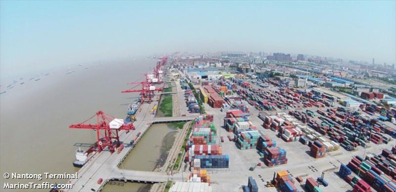
NANTONG is located at Central China, East China Sea in China at coordinates N 31° 58′ 22.94″ – E 120° 51′ 54.01″. The official UN/Locode of this port is CNNTG. It is also known as NAN TONG.
View More NANTONG Port info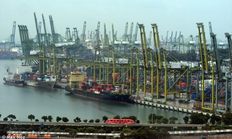
SINGAPORE is located at Indonesia, Singapore Area in Singapore at coordinates N 01° 15′ 33.71″ – E 103° 45′ 16.01″. The official UN/Locode of this port is SGSIN. It is also known as SPORE,SINGPORE,SIN EBGA,SIN PEBGA.
View More SINGAPORE Port info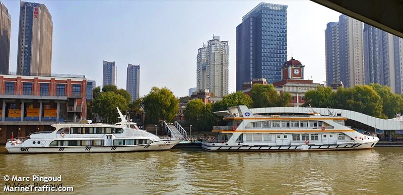
NANJING is located at Central China, East China Sea in China at coordinates N 32° 12′ 45.00″ – E 118° 48′ 43.18″. The official UN/Locode of this port is CNNKG. It is also known as NAN JING,NAN JIN,NANJIN.
View More NANJING Port info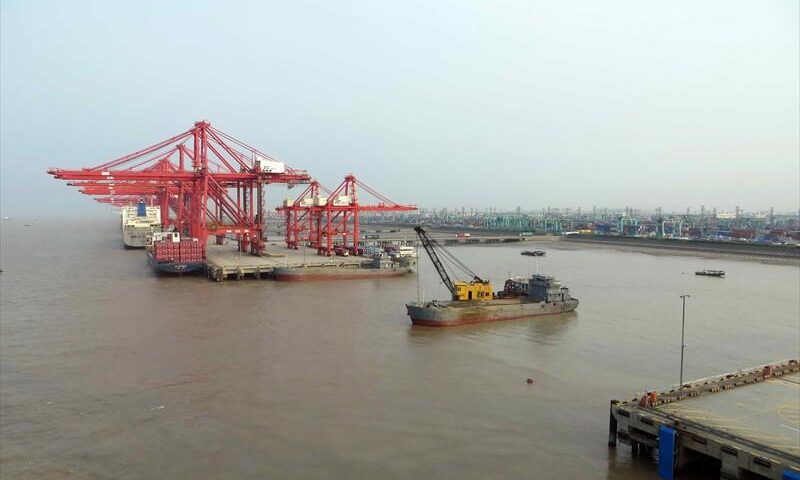
SHANGHAI is located at Central China, East China Sea in China at coordinates N 31° 21′ 58.90″ – E 121° 36′ 53.08″. The official UN/Locode of this port is CNSHG. It is also known as SHANG HAI,YANGSHAN,CNSHA,CNSGH.
View More SHANGHAI Port info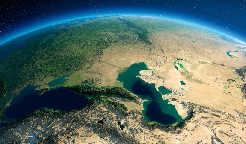
Surface water usually flows toward the sea, but sometimes it is held back by a depression or dam and forms a lake. Although most lakes are filled with freshwater, others have high salinity due to a high evaporation rate and accumulation of dissolved mineral salts.
View More the meaning of Lakes and its variants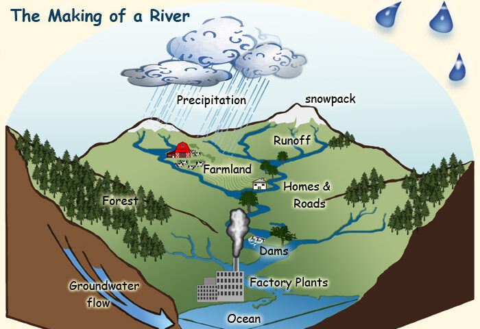
Barely 2.8% of all water on Earth is freshwater . Most of it is found in glaciers and pack ice (77%) and in groundwater (22%).the rest, only 1%, forms the watercourses that irrigate valleys and plains. Fresh water or freshwater is any naturally occurring liquid/solid water containing low concentrations of dissolved salts and other total dissolved solids. As it flows down from mountaintops to the ocean, freshwater feeds glaciers, lakes , and rivers . the water evaporates and forms clouds, precipitation from which feeds watercourses. For millions of years, this vast water cycle has created landscapes by carving out valleys, eroding mountains, and changing shorelines . It plays an essential role in the redistribution of water around the planet.
View More what is the meaning of freshwater and related issues
At about 3 million square miles (7.7 million square km), Australia is the smallest continent on Earth, but some of geographer believe that Australia is not an island. Greenland is officially the world’s largest island that is not a continent. Home to 56,000 people, Greenland has its own extensive local government, but it is also part of the Realm of Denmark.
View More THE LARGEST ISLANDS IN THE WORLD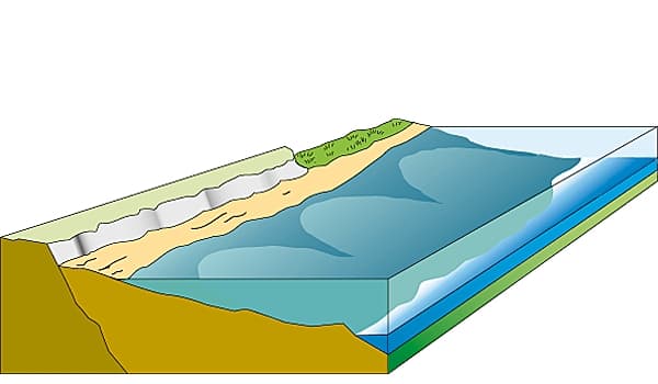
A littoral is a coastal zone between the low-tide line and the high-tide line. This landscape is constantly changing due to the continuous action of the sea, rivers, and wind, and it may take a variety of forms depending on the geological nature of the coast. also we can say the littoral zone or nearshore is the part of a sea, lake, or river that is close to the shore.
View More what is the meaning of Littorals in geography and law of the sea?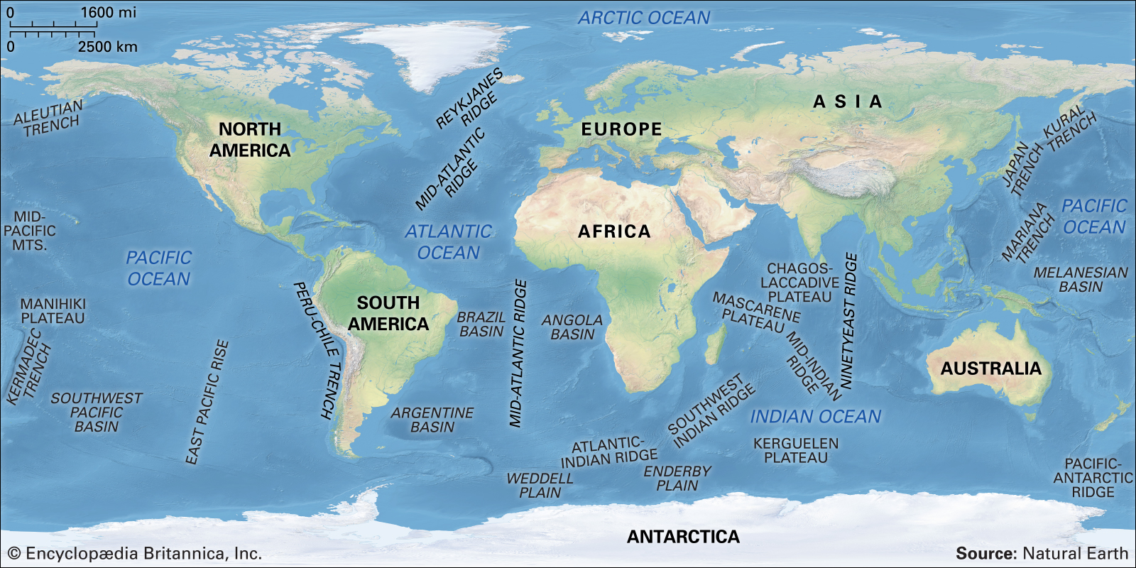
Only 30% of Earth’s surface is exposed land. the rest is covered by a huge body of salt water with a volume of more than 1 billion cubic kilometers: the world ocean. Twice a day, the oceans of the globe rise and fall by several meters. Tides are caused by the gravitational pull of the Moon , and to a certain extent of the Sun , on our planet. the seas and oceans also move in waves —undulations of the surface of the water generated by the wind. Ocean currents , on the other hand, are movements of huge masses of ocean water along very precise routes.
View More THE WORLD OCEAN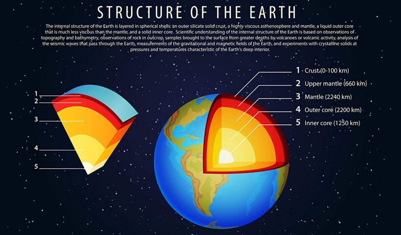
the interior of our planet, with its extreme pressure and temperature conditions, is still a mysterious place. It is where minerals are created and metamorphosed through processes that span millions of years. the immense plates that form Earth’s crust float on the surface of a mass of partially liquid rock. As these plates collide with each other, they build mountains and open up oceans.
View More THE STRUCTURE OF EARTH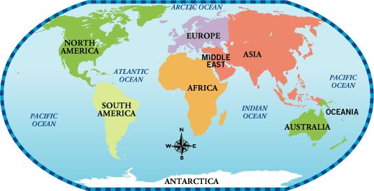
The seven continents that make up the world’s land mass are, from largest to smallest: Asia, Africa, North America, South America, Antarctica, Europe, and Australia. Only 29 percent of the Earth’s surface is land. The percentage area of each continent is shown here.
View More what is the meaning of the continents in geography and law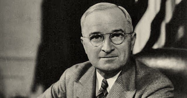
U.S. President Harry S. Truman’s executive order on September 28, 1945, proclaiming that the resources on the continental shelf contiguous to the United States belonged to the United States. This was a radical departure from the existing approach, under which the two basic principles of the law of the sea had been a narrow strip of coastal waters under the exclusive sovereignty of the coastal state and an unregulated area beyond that known as the high seas. The speed at which Truman’s continental shelf concept was recognized through emulation or acquiescence led Sir Hersch Lauterpacht to declare in 1950 that it represented virtually “instant custom.”
View More The Truman Proclamation, 1945 (Proclamation 2667—Policy of the United States With Respect to the Natural Resources of the Subsoil and Sea Bed of the Continental Shelf)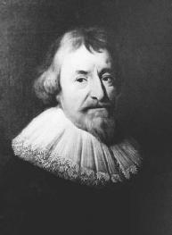
Mare Liberum (or The Freedom of the Seas) is a book in Latin on international law written by the Dutch jurist and philosopher Hugo Grotius, first published in 1609. In The Free Sea, Grotius formulated the new principle that the sea was international territory and all nations were free to use it for seafaring trade. The disputation was directed towards the Portuguese Mare clausum policy and their claim of monopoly on the East Indian Trade. Grotius wrote the treatise while being a counsel to the Dutch East India Company over the seizing of the Santa Catarina Portuguese carrack issue. The work was assigned to Grotius by the Zeeland Chamber of the Dutch East India Company in 1608.
View More Mare Liberum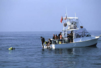
Oceans are of enormous value to the world economy. They provide us with food, water, raw materials and
energy. The combined value of ocean resources and uses is estimated to be about $7 trillion per year. Fish and
minerals, including oil and gas, are among the most important marine resources, while the major uses of the
oceans include the recreation industry, transportation, communications and waste disposal.

Table of claims to maritime jurisdiction (as at 15 July 2011)/maritime spaces of countries, How are maritime boundaries defined?, How are maritime boundaries determined?, Maritime borders map, Maritime Claims, Maritime Claims and Boundaries, Maritime Space, Maritime Zones and Maritime Delimitation, SUMMARY OF NATIONAL CLAIMS, What are the stages of maritime boundary?, What is delimited boundary?, What is international maritime boundary line?, What is maritime dispute?, What is maritime space?, Where is international waters boundaries?, Which country has the longest maritime boundary?, World Maritime Boundaries
View More Table of claims to maritime jurisdiction (as at 15 July 2011)/maritime spaces of countries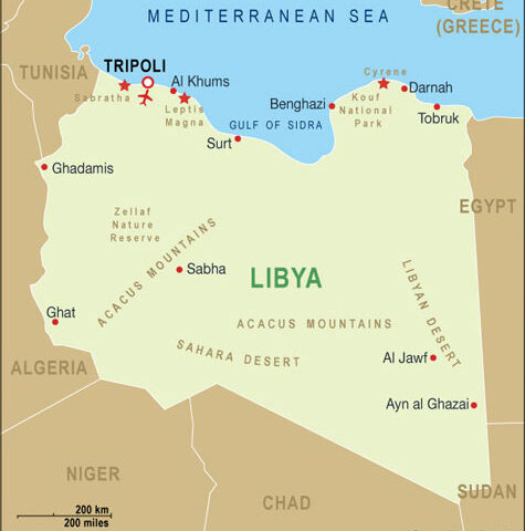
History of Maritime Interception Operations, Libya (2011–Present), Libya, Libyan leader Qaddafi, Libyan port of Es Sidra, Maritime Interception Operations, NATO, UNSC
View More History of Maritime Interception Operations, Libya (2011–Present)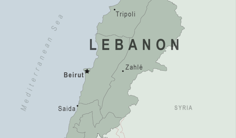
History of Maritime Interception Operations, Lebanon (2006–Present), Israel and Hezbollah, lebanon, maritime dimension: Maritime Taskforce, Maritime Interception Operations, UNSC
View More History of Maritime Interception Operations, Lebanon (2006–Present)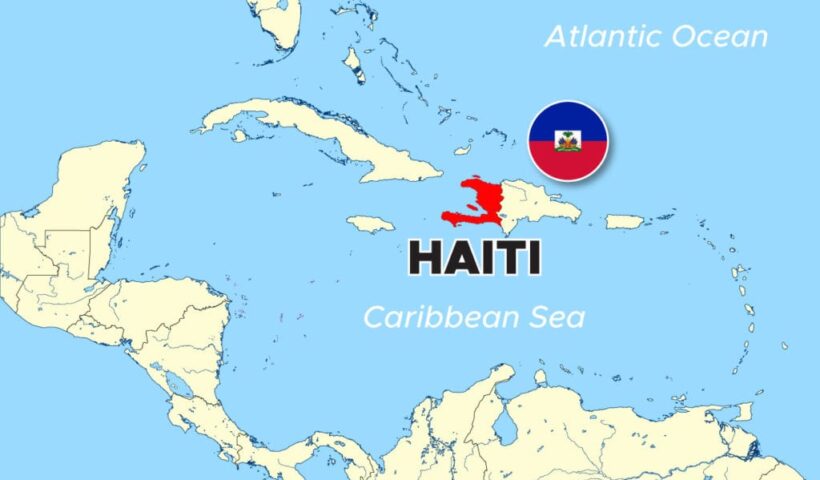
History of Maritime Interception Operations, Haiti (1993–1996), Haiti, Maritime Interception Operations, multinational force (MNF), OAS, Organization of American States, UNSC
View More History of Maritime Interception Operations, Haiti (1993–1996)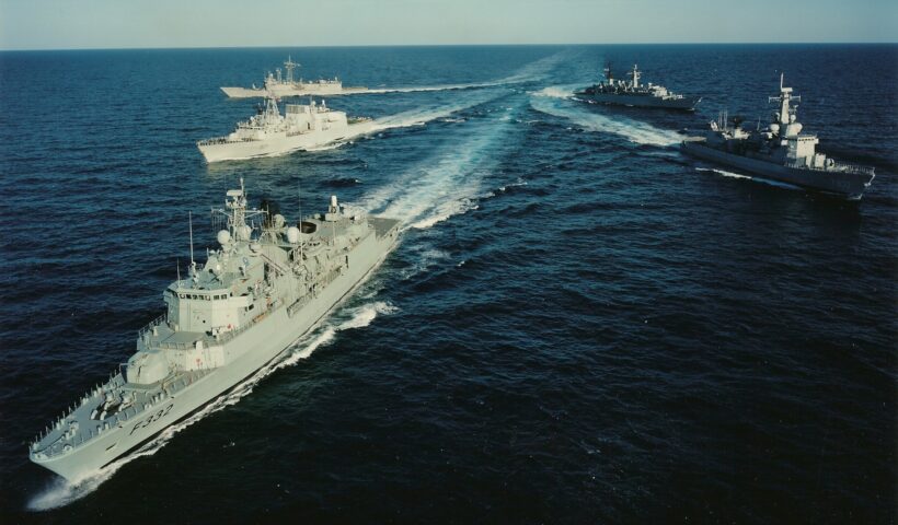
History of Maritime Interception Operations, The Former Yugoslavia (1992–1996), Adriatic Sea, Maritime Interception Operations, NATO, The Former Yugoslavia, UNSC, WEU
View More History of Maritime Interception Operations, The Former Yugoslavia (1992–1996)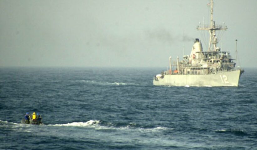
History of Maritime Interception Operations, Iraq (1990–2003), Iraq, Maritime Interception Force (MIF), Maritime Interception Operations, UN Charter, UNSC
View More History of Maritime Interception Operations, Iraq (1990–2003)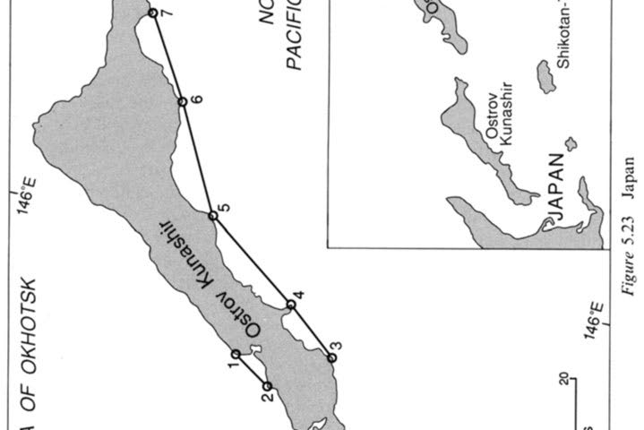
Baselines Drawn under Article 4 ( LOSC Article 7) which Subvert Other Convention Provisions, USSR(now Russia)case, extensive coastline, Kamchatka Peninsula, Kara Sea, North Pacific, russia, Sea of Japan, Sea of Okhotsk, Tartar Strait, USSR, Vrangelya Island
View More Baselines Drawn under Article 4 ( LOSC Article 7) which Subvert Other Convention Provisions, USSR(now Russia)case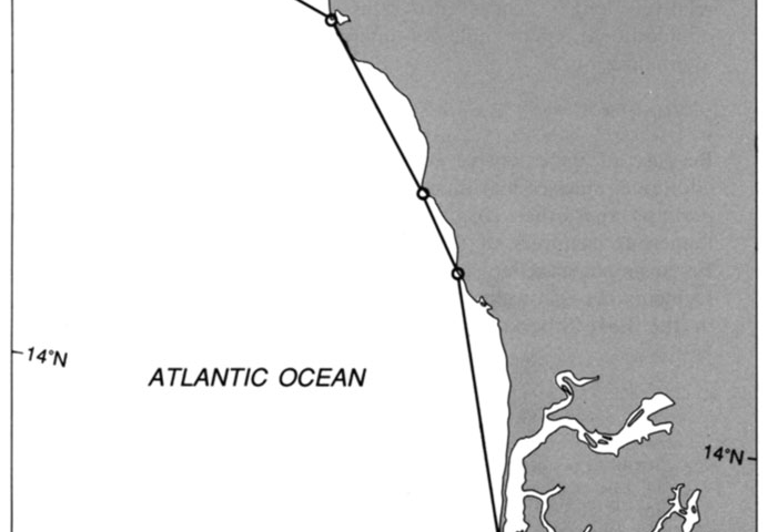
Baselines Drawn under Article 4 ( LOSC Article 7) which Subvert Other Convention Provisions, Senegal case, de Sangomar and the Gambian border, Senegal, straight baseline, straight baseline system
View More Baselines Drawn under Article 4 ( LOSC Article 7) which Subvert Other Convention Provisions, Senegal case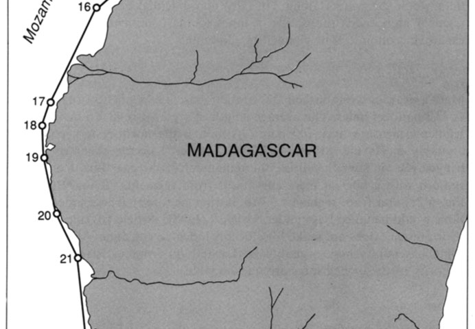
Baselines Drawn under Article 4 ( LOSC Article 7) which Subvert Other Convention Provisions, Madagascar case, fringing islands, Madagascar, straight baseline
View More Baselines Drawn under Article 4 ( LOSC Article 7) which Subvert Other Convention Provisions, Madagascar case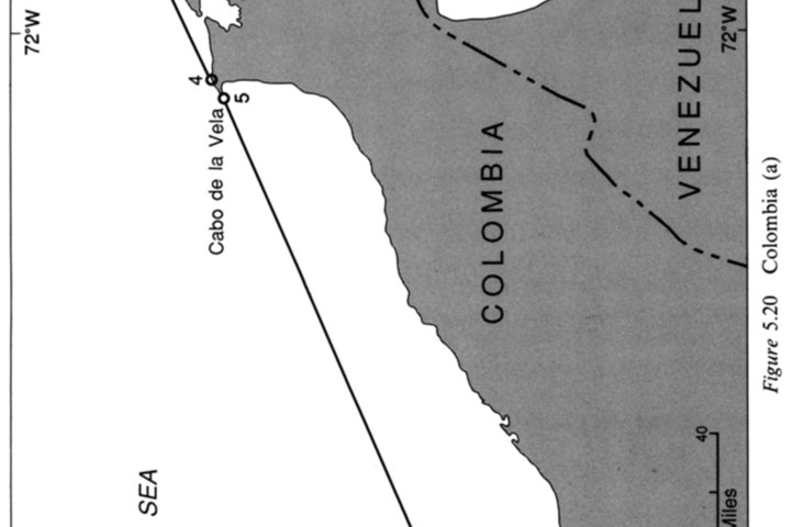
Baselines Drawn under Article 4 ( LOSC Article 7) which Subvert Other Convention Provisions, Colombia (Caribbean Coast) case, Cabo de Ia Vela, Caribbean Coast, Colombia, Golfo de Venezuela, Juridical Bays, Punta de Gallinas, Straight Baselines
View More Baselines Drawn under Article 4 ( LOSC Article 7) which Subvert Other Convention Provisions, Colombia (Caribbean Coast) case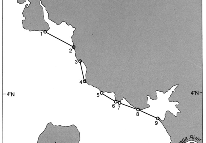
Baselines Drawn under Article 4 ( LOSC Article 7) which Subvert Other Convention Provisions, Cameroon case, Cameroon, enclose juridical bays, low-water mark, River Bimbia, straight baseline
View More Baselines Drawn under Article 4 ( LOSC Article 7) which Subvert Other Convention Provisions, Cameroon case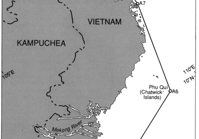
STATE CLAIMS IN VIOLATION OF ARTICLE 4 (LOSC ARTICLE 7), Vietnam case, Con Dao, Dao Tho Chu, Hon Khoai, Mekong delta, Phu Qui group (Chatwick Islands), straight baseline, Vietnam
View More STATE CLAIMS IN VIOLATION OF ARTICLE 4 (LOSC ARTICLE 7), Vietnam case
STATE CLAIMS IN VIOLATION OF ARTICLE 4 (LOSC ARTICLE 7), Italy case, Gulf of Taranto, internal waters, italy, juridical bay, Juridical Bays, Ligurian Sea, straight baseline
View More STATE CLAIMS IN VIOLATION OF ARTICLE 4 (LOSC ARTICLE 7), Italy case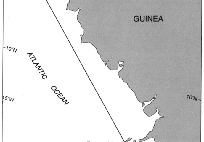
An egregious breach was committed by Guinea in its Decree of 1964 which purported to establish a single straight baseline of 120 n.m. enclosing its entire coastline (see Fig. 5.14). The Guinean coastline is somewhat indented in localities, but it certainly does not pass muster under any interpretation of the “deeply indented and cut into” language of Article 4 (LOSC Article 7). To view Sene Island in the north and Tamara Island in the south as together constituting an island fringe is also to misapprehend that requirement as it is used in the Convention. The islands have no spatial relationship to one another nor are they within 12 n.m. of the coast. Having failed to meet either geographical test under Article 4(1) (LOSC Article 7(1)), it hardly mattered that the baseline followed the general direction of the coast.
STATE CLAIMS IN VIOLATION OF ARTICLE 4 (LOSC ARTICLE 7), Guinea case, Guinea, Guinea-Bissau, Guinean coastline, maritime boundary, north and Tamara Island, straight baseline
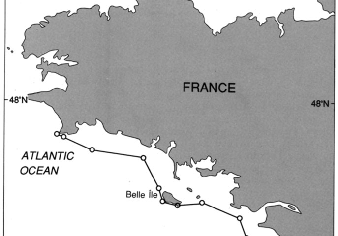
STATE CLAIMS IN VIOLATION OF ARTICLE 4 (LOSC ARTICLE 7), France case, france, straight baseline
View More STATE CLAIMS IN VIOLATION OF ARTICLE 4 (LOSC ARTICLE 7), France case
STATE CLAIMS IN VIOLATION OF ARTICLE 4 (LOSC ARTICLE 7), Senegal case, Riviere Casamance, Senegal, straight baseline
View More STATE CLAIMS IN VIOLATION OF ARTICLE 4 (LOSC ARTICLE 7), Senegal case
STATE CLAIMS IN VIOLATION OF ARTICLE 4 (LOSC ARTICLE 7), lceland case, lceland, straight baseline
View More STATE CLAIMS IN VIOLATION OF ARTICLE 4 (LOSC ARTICLE 7), lceland case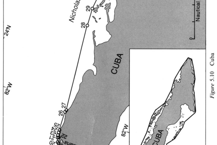
STATE CLAIMS IN VIOLATION OF ARTICLE 4 (LOSC ARTICLE 7), Cuba case, Common Heritage, cuba, Nicholas Channel, straight baseline
View More STATE CLAIMS IN VIOLATION OF ARTICLE 4 (LOSC ARTICLE 7), Cuba case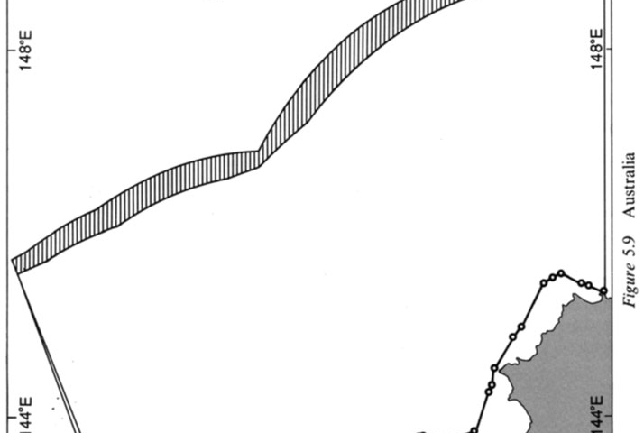
STATE CLAIMS IN VIOLATION OF ARTICLE 4 (LOSC ARTICLE 7), Australia case, Australia, Cape York Peninsula, Coral Sea, straight baseline
View More STATE CLAIMS IN VIOLATION OF ARTICLE 4 (LOSC ARTICLE 7), Australia case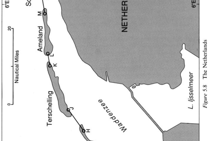
STATE CLAIMS IN SUBSTANTIAL CONFORMITY WITH ARTICLE 4 (LOSC ARTICLE 7), The Netherlands case, netherlands, straight baseline
View More STATE CLAIMS IN SUBSTANTIAL CONFORMITY WITH ARTICLE 4 (LOSC ARTICLE 7), The Netherlands case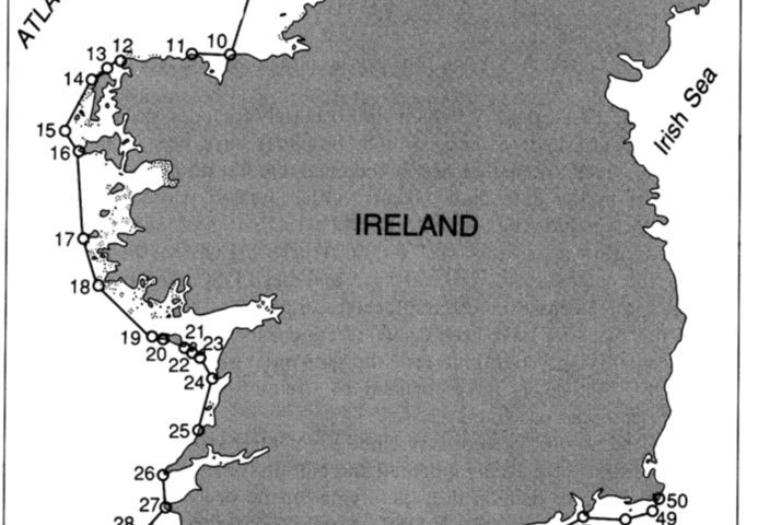
STATE CLAIMS IN SUBSTANTIAL CONFORMITY WITH ARTICLE 4 (LOSC ARTICLE 7), lreland case, internal waters, lreland, straight baseline
View More STATE CLAIMS IN SUBSTANTIAL CONFORMITY WITH ARTICLE 4 (LOSC ARTICLE 7), lreland case
STATE CLAIMS IN SUBSTANTIAL CONFORMITY WITH ARTICLE 4 (LOSC ARTICLE 7), Canada case, Canada, Canadian straight baseline, Scandinavian coasts
View More STATE CLAIMS IN SUBSTANTIAL CONFORMITY WITH ARTICLE 4 (LOSC ARTICLE 7), Canada case