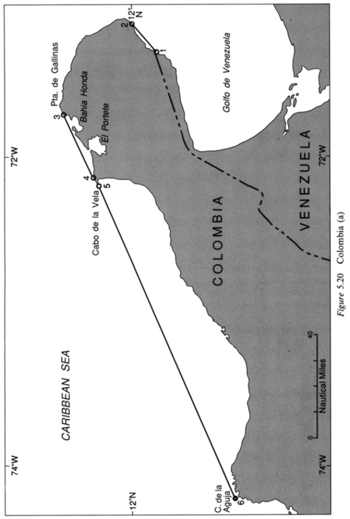
Many of the Colombian straight baselines on the Caribbean Sea purport to enclose illegal bays (see Fig. 5.20). Segment 1-2 encloses a mere curvature on the Golfo de Venezuela. Segment 3-4 internalizes waters seaward of the natural entrance points to Bahia Honda and El Portete, both of which by themselves appear to be legitimate juridical bays under Article 7. Applying the semi-circle test using the entrance points selected by Colombia near Punta de Gallinas and Cabo de Ia Vela, however, the total area of water enclosed does not equal or exceed the area of a semi-circle drawn between those points. By drawing the baseline in this fashion, Colombia has managed to carve out a few more miles of maritime territory than could have been obtained by the enclosure of the two juridical bays alone. Repeated continuously along a coastline, this practice can add thousands of miles to a state’s claim and significantly affect the claims of third states.
One of the most egregious examples of this pathology can be seen at segment 5-6, which encloses the large but shallow curvature between Cabo de Ia Vela and Cabo de Ia Aguja. The waters of this mere curvature are no more worthy of internalization by the coastal state than would be waters along a totally non-indented coast. This one segment alone adds thousands of miles to the continental shelf and exclusive economic zone claimed by Colombia.