The concept of proportionality holds an important position in the case law as the concept has been taken into account in almost every judgment on maritime delimitation. In the context of maritime delimitation, the concept of proportionality was originally formulated by the Federal Republic of Germany in the North Sea Continental Shelf cases. The Federal Republic of Germany contended that each State concerned should receive a ‘just and equitable share’ of the available continental shelf, proportionate to the length of its coastline or sea frontage. Although the ICJ rejected the idea of a ‘just and equitable share’, it held:
In the present case there are three States whose North Sea coastlines are in fact comparable in length and which, therefore, have been given broadly equal treatment by nature except that the configuration of one of the coastlines would, if the equidistance method is used, deny to one of these States treatment equal or comparable to that given the other two . . . What is unacceptable in this instance is that a state should enjoy continental shelf rights considerably different from those of its neighbours merely because in the one case the coastline is roughly convex in form and in the other it is markedly concave, although those coastlines are comparable in length.
Thus, the Court did accept the concept of proportionality as a final factor to be taken into account in the course of the negotiations between the Parties concerned. In the words of the Court:
A final factor to be taken account of is the element of a reasonable degree of proportionality which a delimitation effected according to equitable principles ought to bring about between the extent of the continental shelf appertaining to the States concerned and the lengths of their respective coastlines – these being measured according to their general direction in order to establish the necessary balance between States with straight, and those with markedly concave or convex coasts, or to reduce very irregular coastlines to their truer proportions.
The above statements suggest three geographical features which justified the recourse to proportionality: (i) adjacent coasts, (ii) existence of particular coastal configurations, such as concavity and convexity, and (iii) quasi-equal length of the relevant coasts. In cases where concavity or convexity exists in adjacent coasts that are comparable in length, a distorting effect would be produced by the application of the equidistance method. For the Court, such a result was unacceptable. As Higgins rightly observed, it was in this particular geographical situation that proportionality came into play. It must also be noted that the Court regarded proportionality not as a distinct principle of delimitation, but as one of the factors – a ‘final’ factor – ensuring delimitation in accordance with equitable principles. In light of the geographical limitations and the relatively minor position of proportionality, as Judge Oda observed, some doubts might be expressed whether the Court was of the view that the theory of proportionality would be universally applicable to maritime delimitations.
The above observations are confirmed by the Anglo-French Continental Shelf case. With regard to the geographical circumstances which would justify recourse to proportionality, the Court of Arbitration stated:
In particular, this Court does not consider that the adoption in the North Sea Continental Shelf cases of the criterion of a reasonable degree of proportionality between the areas of continental shelf and the lengths of the coastlines means that this criterion is one for application in all cases. On the contrary, it was the particular geographical situation of three adjoining States situated on a concave coast which gave relevance to that criterion in those cases.
In subsequent cases, however, international courts and tribunals began to resort to proportionality in completely different geographical situations. It thus appears that currently international courts and tribunals are ready to apply proportionality to every geographical situation.
Before the Black Sea case, the concept of proportionality had not been applied consistently in the jurisprudence concerning maritime delimitation. While, in some cases, the ICJ and Arbitral Tribunals applied proportionality as an ex post facto test, in other cases, the ICJ did not do so. However, the ICJ, in the Black Sea case, formulated disproportionality as an ex post facto test to verify the equitableness of the delimitation line at the third and final stage of maritime delimitation. Here the disproportionality test was explicitly given an independent status as the third and final stage of maritime delimitation. In subsequent cases, the disproportionality test was applied not only by the ICJ itself but also by ITLOS and an Annex VII Arbitral Tribunal. The principal elements of the disproportionality test specified by the ICJ in the Black Sea case can be summarized in four points.
First, ‘it is disproportion rather than any general principle of proportionality which is the relevant criterion or factor’. Here the ICJ used the negative formula of disproportionality.
Second, the continental shelf and EEZ allocations are not to be assigned in proportion to the length of respective coastlines. Disproportionality comes in to play an ex post facto test of equitableness of the delimitation line.
Third, the disproportionality test is not in itself a method of delimitation. In the words of the ICJ:
It is rather a means of checking whether the delimitation line arrived at by other means needs adjustment because of a significant disproportionality in the ratios between the maritime areas which would fall to one party or other by virtue of the delimitation line arrived at by other means, and the lengths of their respective coasts.
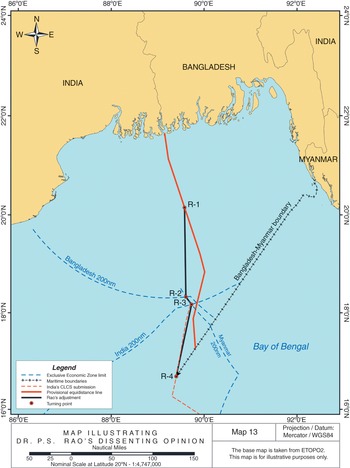
Fourth, the checking of the equitableness of the delimitation line by the disproportionality test can only be approximate. This point was echoed by the ICJ in the Nicaragua/Colombia case and the Costa Rica/Nicaragua case. The Arbitral Tribunal in the Bangladesh/India case also stressed that ‘proportionality is not a mathematical exercise that results in the attribution of maritime areas as a function of the length of the coasts of the Parties or other such ratio calculations’. Nevertheless, the disproportionality test is not free from difficulty. In this regard, four obstacles must be noted.
The first problem is the lack of any objective criterion for calculating the coastal lengths and surfaces. In order to calculate the lengths of relevant coasts, it is necessary to define the coasts to be evaluated. However, in many, if not most, cases the definition of relevant coasts is itself a disputable point; international courts and tribunals have failed to come up with any objective criterion. Nor is there any criterion for calculating the lengths of the relevant coasts. That calculation may be complicated by the presence of islands. It is also difficult to define relevant areas, especially where legal titles of third States may be at issue.
The second difficulty pertains to the lack of an objective criterion for evaluating the reasonable relation between coastal lengths and the maritime areas attributed to the Parties. In all cases, the international courts concluded that there was no disproportion between the ratio of coastal lengths and the ratio of maritime areas appertaining to the Parties.
Nonetheless, it is impossible, or at least highly difficult, to extrapolate any objective criterion for judging whether there is reasonable relation between the coastal length and maritime area appertaining to each party. In the Nicaragua v Colombia case, for instance, the Court considered that there was no disproportionality between the ratio for the coastal lengths, which was approximately 1:8.2 in Nicaragua’s favour, and the ratio of the relevant area, approximately 1:3.44 in Nicaragua’s favour. Given that the ratio of coastal length is more than twice as great as that of maritime areas, however, some doubts can be expressed on whether the ratio in question is truly proportionate. Furthermore, in some cases, the ICJ ruled that the disproportionality test had been met, without presenting any specific figures of the relevant coastal lengths and maritime areas accorded to each party. The disproportionality test without calculation of the ratio of the coastal length and the maritime area is merely legal impressionism. Related to this, the striking fact is that, to date, there is no single case where courts and tribunals admitted the existence of disproportion between the ratio of coastal lengths and the ratio for maritime areas appertaining to the Parties. This can hardly be a mere coincidence. Here it is difficult to resist the temptation to submit that, at the second stage of maritime delimitation, the maritime boundary had already been drawn in such a way as to pass the disproportionality test.
The third obstacle is that since the number of lines capable of producing the same proportion is limitless, proportionality will not determine a concrete delimitation line. Accordingly, it cannot objectively constrain the discretion of judges in the adjustment of the provisional equidistance line. It is open to debate whether the disproportionality test can contribute to enhancing the transparency and objectiveness of the process of maritime delimitation.
Finally, it may have to be accepted that the concept of proportionality necessarily includes some aspects of apportionment, although the ICJ clearly distinguished between delimitation and apportionment. In this regard, the concept of proportionality contradicts the rejection of the idea of apportionment in maritime delimitation.