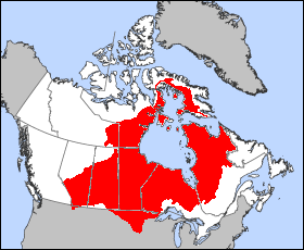
Where is Labrador Sea? Situated between Greenland and Canada’s Labrador Peninsula, the sea is part of the North Atlantic Ocean and connects to the Arctic Ocean…
View More About Labrador Sea, facts and maps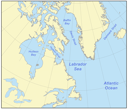
About Labrador Sea, facts and maps
IILSS 12th February 2023
Are Labradors the best swimmers?Are there icebergs in the Labrador Sea?Are there sharks in the Labrador Sea?Can you swim in Labrador?Can you swim in the Sea of Labrador?Does the Sea of Labrador get tsunamis?Has any human touched the bottom of the ocean?How big is the Sea of Labrador?How deep is the Sea of Labrador?How was Labrador Sea formed?Is it Sea of Labrador or Labrador Sea?Is Labrador a cold ocean current?Is Labrador Sea freshwater or saltwater?Is the Sea of Labrador warm?What is special about Sea of Labrador?What is the importance of Labrador Current?What is the Labrador Sea famous for?What is the Sea of Labrador called?What lives in the Labrador Sea?What lives in the Sea of Labrador?where is sea of LabradorWhere was the Sea of Labrador?Who has touched the bottom of the ocean?Who named the Sea of Labrador?Who owns the Sea of Labrador?Why is it called a Labrador Sea?Why is it called Sea of Labrador?Why is Labrador Sea not navigable during winters?Why is the Labrador Sea called the lung of the ocean?