The United Kingdom has asserted the legal regimes applicable in some of the international straits in its waters. The transit passage regime is considered to be applicable in the Dover Strait, the North Channel between Scotland and
Northern Ireland, and the Fair Isle Gap between the Shetlands and Orkneys.
The “transit passage” regime was used in a Declaration issued by France and Great Britain setting out the governing regime of navigation in the Dover Straits in conjunction with signature on November 2, 1988, of an Agreement
establishing a territorial sea boundary in the Strait of Dover. In 1987, the United Kingdom recognized the right of foreign aircraft to exercise the right of transit passage over the Strait of Dover, the North Channel and the Fair Isle Channel between the Shetland and Orkney islands.
The regime of non‑suspendable innocent passage is said to apply in other United Kingdom straits used for international navigation, such as the Pentland Firth south of Orkney and the passage between the Scilly Isles and the mainland of Cornwall. The United Kingdom has long recognized the right of innocent passage applies in the Minch, an area of internal waters within the straight baselines around the Hebrides.
North Channel, strait linking the Irish Sea with the North Atlantic Ocean and reaching a minimum width of 13 miles (21 km) between the Mull of Kintyre (Scotland) and Torr Head (Northern Ireland). It runs northwest-southeast between Scotland and Northern Ireland and includes the larger Arran and Gigha islands and the smaller Ailsa Craig, on each of which a lighthouse is located. The Scottish coast of the channel is deeply indented by the Sound of Jura, Kibrannan Sound, and the Firth of Clyde, and the Irish coast by the Belfast Lough.
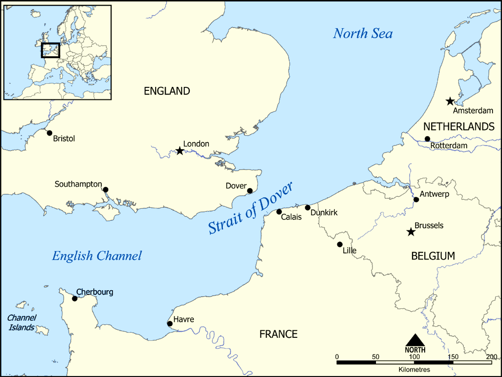
Strait of Dover, French Pas de Calais, Latin Gallicum Fretum, narrow water passage separating England (northwest) from France (southeast) and connecting the English Channel (southwest) with the North Sea (northeast). The strait is 18 to 25 miles (30 to 40 km) wide, and its depth ranges from 120 to 180 feet (35 to 55 metres). Until the comparatively recent geologic past (c. 5000 BCE), the strait was an exposed river valley, thus making England an extension of the European continent. Because of the prevailing winds, the main flow of water through the strait is from the southwest, but a persistent northeast wind can reverse the current. The white cliffs on the British side, composed of soft chalk, are receding because of erosion. Although the strait is one of the world’s busiest seaways, a strict system of traffic lanes and navigation information became mandatory only in 1977. The chief ports along the strait include Dover and Folkestone (England) and Calais and Boulogne (France). The idea of a rail tunnel across the bottom of the strait was first proposed in 1856. However, such a project was not undertaken for another 130 years. Constructed between 1987 and 1991 and officially opened in 1994, the Channel Tunnel is now a major transportation link between the two countries. High-speed ferries also operate across the strait. The Strait of Dover was the scene of several historic naval battles, notably the first major repulse by the English of the Spanish Armada (1588). During World War I, Boulogne was a major army base, and Dover was the headquarters for the “Dover patrol,” which protected shipping in the strait. In 1940 the Allied troops evacuating from Dunkirk (Dunkerque, France) crossed the strait to Dover. The name Dover originally meant “the waters” or “the stream.”