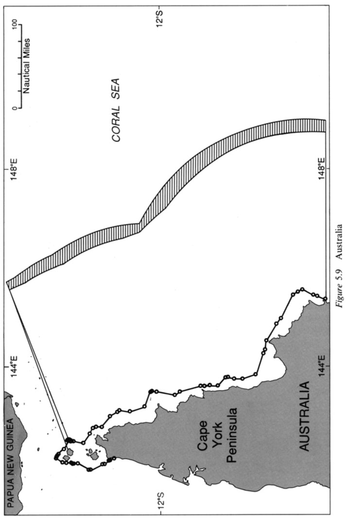
Australia’s straight baseline system is one of the most striking
examples of this particular pathology. Termed a “comprehensive”
system by Australia, straight baselines have been established on all
coasts of the mainland and Tasmania, the islands off the coasts of the
states and the Northern Territory, and other islands off the coast of
Queensland. In some areas, the coastline meets the deeply indented or
island fringe tests; in the majority of areas, it does not. For example,
the northwest coast of the Cape York Peninsula fronting the Coral Sea
presents a series of undulations in a relatively smooth coastline (see
Fig. 5.9). Under a strict interpretation of the deeply indented test, a
coast like this cannot be characterized as deeply indented or cut-into.
None of the indentations are deep in the absolute sense nor do they
occur so frequently that the coast has a “cut into” appearance. Nor is
this area of coastline “fringed” with islands in the immediate vicinity.
Yet, baselines have been used in this locality to internalize large areas
of previously territorial waters and to territor-ialize theretofore high
seas. Even if the coast met the geographic tests in this area, the basepoints selected enclose waters not “sufficiently closely linked to the land domain to be subject to the regime of internal waters,” as
required under Article 4(2) (LOSC Article 7(3)). Although the length
of baseline segments is relatively short, Australia nonetheless
increases the area of continental shelf and exclusive economic zone it
claims by approximately 7700 square nautical miles because of the
location of these baselines, as illustrated in the striated area in Fig. 5.9.
