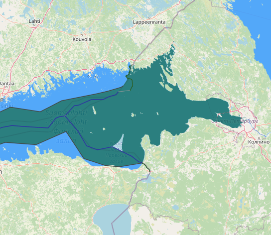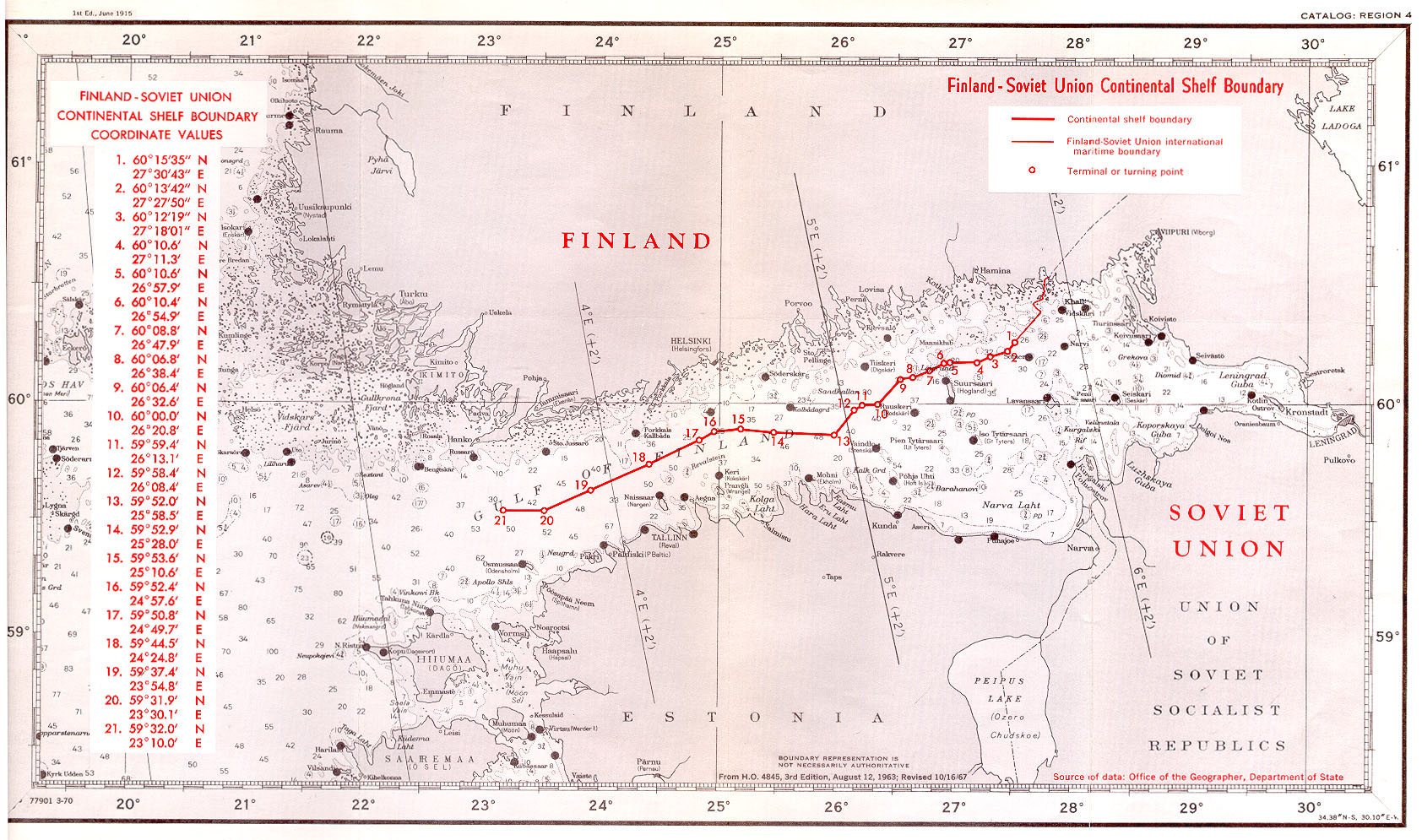
between Russia and Finland, the boundary is on the shore of Gulf of Finland, in which there is a maritime boundary between the respective territorial waters, terminating in a narrow strip of international waters between Finnish and Estonian territorial waters. In 2014, Estonia and the Russian Federation signed their land and maritime boundary agreements that are currently awaiting ratification. This study reconstructs the maritime boundary delimitation between the two States. In particular, the role of islands and pre-existing agreements for the delimitation of the territorial sea boundary in the south-eastern part of the Gulf of Finland are critically examined. It is established that the agreed maritime boundary line is a median line which was influenced by the use of the special circumstances method in the delimitation process. in relation to the first part of the Finland-USSR maritime boundary, military, strategic and related navigational considerations have had a powerful influence on the course of maritime boundaries and it had not based on equidistance method alone.
In the modern period maritime delimitation was, at least initially, conducted among the communist states, together with Finland. However, from the early 1970s, and particularly in the wake of the conclusion of the Treaty on the Basis of Intra-German Relations between the two Germanys, a number of agreements were concluded between Western and Soviet bloc states, despite the profound ideological and economic divides between the littoral states. This remarkable situation has been attributed, not only to small size (the average width being about 120 miles) and semi-enclosed characteristics of the Baltic but to its shallowness (average depth being 55 m), the large number of rivers flowing into it, high coastal populations and a high degree of industrialization among the littoral states. This combination of factors dictated a clear need for cooperation’. considered chronologically, maritime boundaries in the Baltic Sea have therefore been concluded between Denmark and Germany (1965 and 1988), Finland and the USSR (1965, 1967, 1980 and 1985) and more..
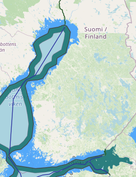
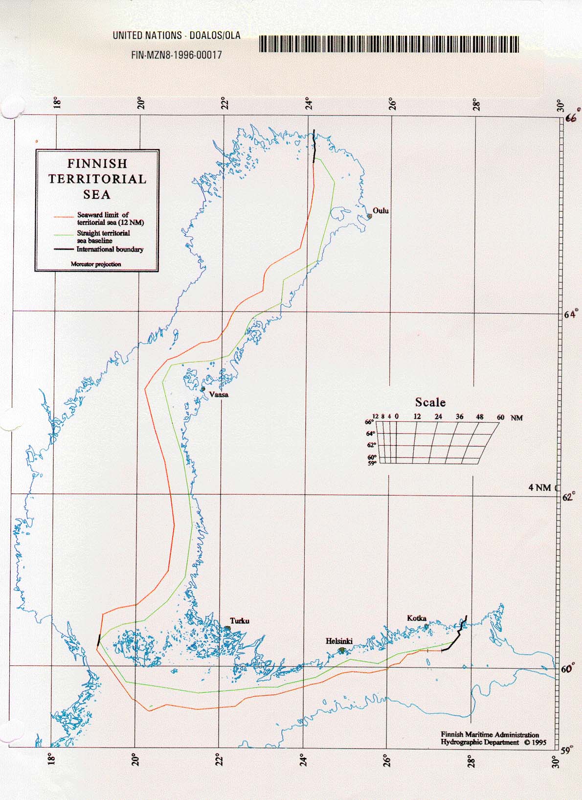
Finland was the first, in 1956, when it placed the termini of its model straight baselines in the sea to link with subsequent baselines drawn by Sweden and Russia. Finland For most of length straight baselines cross water but their termini are on land and are defined by the coordinates on or near the normal baseline. It would be prudent for countries to review the coordinates defining their straight baselines at set intervals. This would ensure that any changes in the configuration of the low-water line can be recorded and the coordinates of basepoints adjusted. Finland seems to be the only country that specified in its declaration of its straight baselines that they would be reviewed every 30 years.
in 1995 Finland reviewed the 1965 definition of its baselines. Finland took the opportunity to abandon its requirement that no segment of its baselines should be longer than 8 nm. The length of baselines in the previous system averaged 4.4 nm. The previous system ensured that the Finnish straight baselines conformed to the coast to a greater degree than those of any other country. The new arrangements allow the Finns to use fewer basepoints which will reduce the costs of future measurements. The 1995 definition will cover the period 1995-2024.